VK Stadium — как клуб становится цифровым организмом

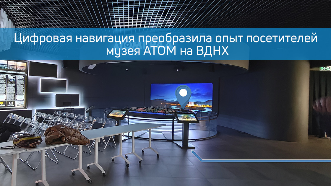
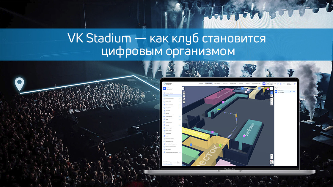
Представьте себе момент, когда пятнадцать тысяч человек одновременно пытаются найти бар, туалет или выход с многоуровневой концертной площадки — это зрелище напоминает хаотичное движение частиц, где каждый решает свою навигационную задачу в одиночку, тратя драгоценные минуты шоу на поиск пути сквозь толпу. Именно с этой проблемой столкнулся VK Stadium, одна из крупнейших концертных площадок Москвы, где традиционные указатели и информационные стойки переставали работать в условиях пиковой нагрузки. Администрация же сталкивалась с не менее сложной дилеммой — как в реальном времени управлять двумя сотнями сотрудников, разбросанных по территории в двенадцать тысяч квадратных метров, чтобы обеспечить безупречное обслуживание и безопасность. Ответом стала полномасштабная цифровая трансформация пространства с помощью платформы Indoors Navigation, превратившая физический концертный зал в управляемый цифровой организм.

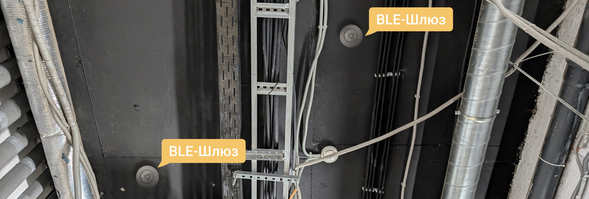
Техническая реализация проекта напоминала создание нервной системы для огромного сооружения — семьдесят два Bluetooth-локатора образовали невидимую сеть, покрывающую каждый угол стадиона, а более полутора сотен персональных меток превратили униформы сотрудников в цифровые маячки, чье движение отслеживалось с хирургической точностью. Проложенные четыре с половиной километра кабельной инфраструктуры стали цифровыми артериями, питающими серверный кластер, способный обрабатывать тысячи запросов в секунду без единого сбоя даже в момент кульминации концерта. Эта техническая основа позволила создать то, что мы называем цифровым двойником стадиона — живой, дышащей трехмерной моделью, где каждый объект и каждое движение имеют свое цифровое отражение.

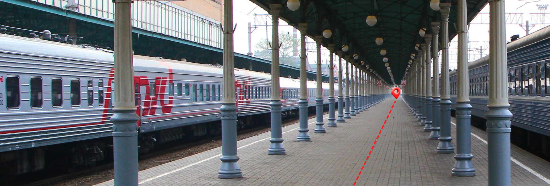
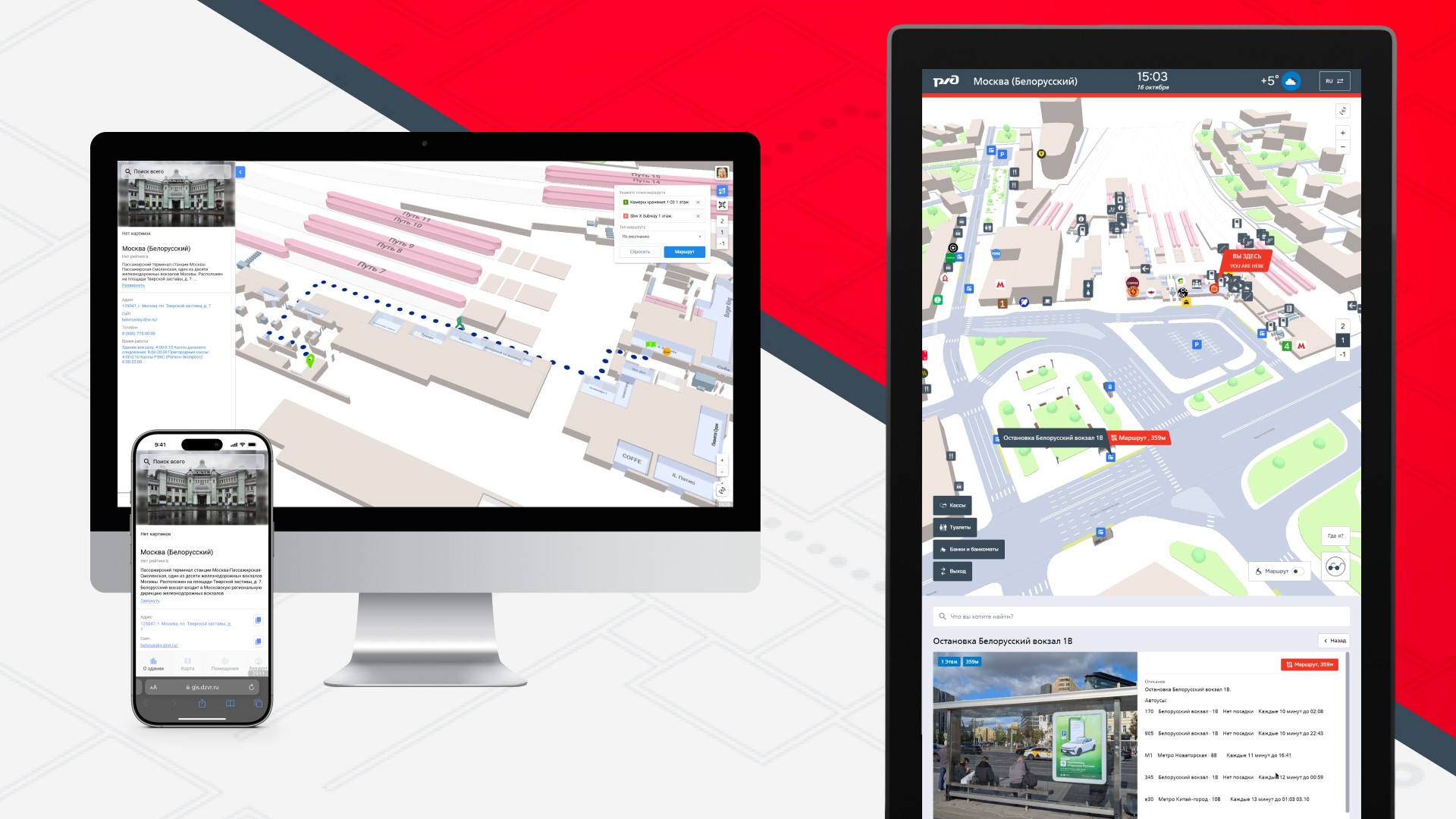
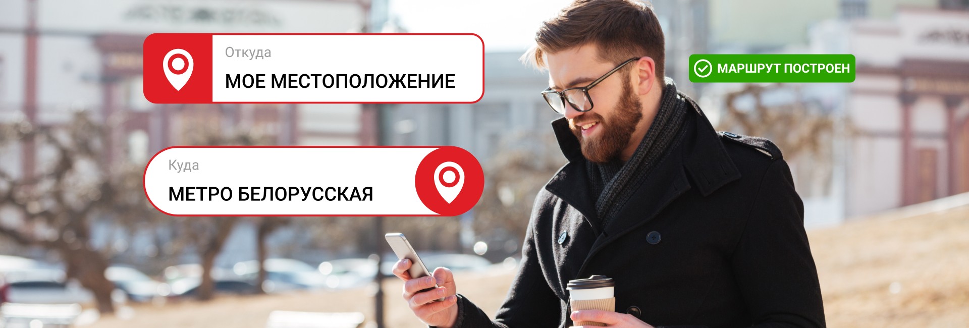
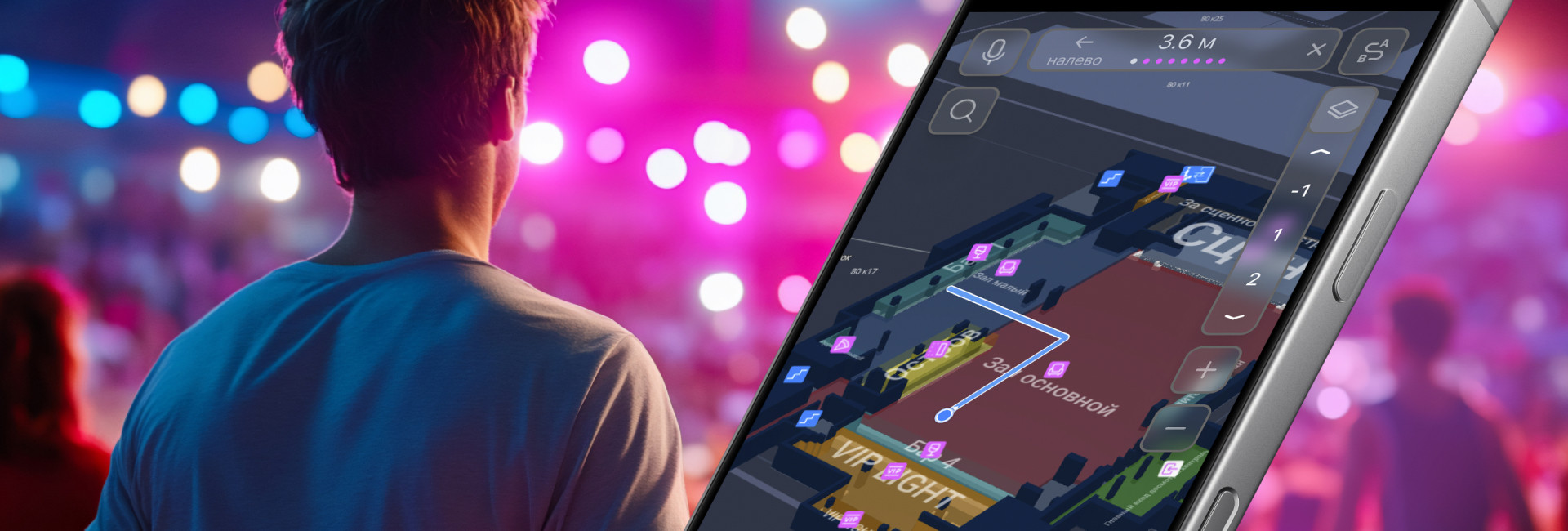
Для гостя стадиона вся эта сложная технология обернулась удивительной простотой — достаточно было навести камеру смартфона на один из множества QR-кодов, чтобы в браузере мгновенно открылась интерактивная карта с точным указанием его местоположения. Система, не требуя установки специального приложения, позволяла строить маршруты к любой точке интереса, будь то ближайший бар, где очередь только начинала формироваться, или конкретный выход к парковке, экономя те самые драгоценные минуты, ради которых люди и пришли на шоу. Эта кажущаяся простота скрывала за собой сложные алгоритмы, которые не просто показывали статичную карту, а анализировали текущую ситуацию — загруженность зон, работающие выходы, открытые точки обслуживания — предлагая каждому гостю оптимальный путь в реальном времени, превращая навигацию из проблемы в незаметный, но безупречный сервис.

Истинная же революция произошла в помещениях администрации, где на больших экранах разворачивалась цифровая картина всего происходящего на стадионе. Руководитель мероприятия мог одним взглядом оценить расстановку сил — видеть, где находятся все двести сотрудников, как движутся потоки гостей, какие зоны требуют дополнительного внимания. Система позволяла не просто наблюдать, а активно управлять — отправить мгновенное сообщение группе официантов в перегруженный сектор, проверить, все ли посты охраны укомплектованы, получить автоматическое предупреждение о формировании очереди у определенного бара. Это был переход от реактивного управления, основанного на поступающих жалобах и запросах, к проактивному контролю, где проблемы решались до того, как они становились заметны гостям.

После окончания каждого мероприятия начинался этап глубокого анализа — система предоставляла не просто отчеты, а детальную картину произошедшего в цифрах и графиках. Тепловые карты показывали, где скапливались основные потоки людей, выявляя узкие места архитектуры. Маршруты сотрудников анализировались на предмет эффективности, показывая, сколько времени тратилось на перемещения и где возникали неоправданные простои. Статистика посещаемости разных зон помогала оптимизировать расстановку точек обслуживания на будущих мероприятиях. Эти данные превращались в конкретные бизнес-решения — где открыть дополнительный бар, как изменить логистику обслуживания, какой персонал работает наиболее эффективно, создавая постоянно совершенствующуюся систему управления большими событиями.

Результаты внедрения говорили сами за себя — время поиска гостями нужных точек сократилось в среднем с семи до полутора минут, что в масштабах пятнадцатитысячной аудитории сэкономило сотни человеко-часов, которые вместо блужданий по коридорам были потрачены на наслаждение концертом. Обращаемость к информационным стойкам снизилась почти наполовину, освобождая персонал для решения действительно важных задач. В операционном управлении эффективность работы сотрудников выросла на тридцать процентов за счет оптимизации маршрутов и оперативного перераспределения сил в реальном времени, а безопасность мероприятия достигла нового уровня благодаря постоянному контролю за критическими зонами и мгновенному реагированию на любые отклонения от нормы.

Этот проект стал для нас не просто успешным внедрением, а доказательством концепции — современные технологии навигации и позиционирования перестали быть просто инструментом ориентации в пространстве, превратившись в комплексные системы управления сложными объектами. От концертных площадок и стадионов до торговых центров и аэропортов — везде, где есть большие потоки людей и необходимость координации многих сотрудников, цифровой двойник пространства становится тем самым недостающим звеном, которое соединяет физическую инфраструктуру с интеллектуальным управлением. VK Stadium показал, что будущее больших мероприятий — за бесшовным слиянием реального и цифрового, где каждый гость чувствует себя уверенно, а каждый руководитель имеет полный контроль над ситуацией, создавая идеальную среду для незабываемых впечатлений и безупречного сервиса.

Leave a request for: https://indoorsnavi.pro/

👇 Subscribe and keep up to date with innovations! 👇

Цифровая навигация преобразила опыт посетителей музея АТОМ на ВДНХ

Представьте, что вы входите в современный музей, посвященный одной из самых сложных и фундаментальных тем — атомной энергии. Пространство наполнено интерактивными экспонатами, макетами, информационными стендами. Возникает естественный вопрос: с чего начать? Как найти ту самую симуляцию ядерной реакции или детскую зону, если вы пришли с ребенком? Где ближайшее кафе? В музее АТОМ на ВДНХ эти вопросы остались в прошлом благодаря внедрению передовой системы цифровой навигации от компании Indoors Navigation.

Мы превратили физическое пространство музея в его точный, интерактивный и понятный цифровой двойник. Результат — не просто электронная схема, а живая 3D-карта, которая стала личным гидом каждого посетителя, делая путешествие по миру атомной науки осознанным, удобным и увлекательным.

Ваш личный цифровой гид в кармане

Главный принцип, который мы заложили, — максимальная простота и доступность. Нам было важно, чтобы технология служила людям, а не требовала от них специальных знаний.

  1. Никаких приложений: Не нужно искать нас в App Store или Google Play, тратить время на скачивание и регистрацию.
  2. Просто сканируйте: По всему маршруту музея — у входа, в начале каждой экспозиционной зоны, у лифтов — размещены QR-коды.
  3. Мгновенный доступ: Наведите камеру смартфона на код, и в вашем браузере моментально откроется полная 3D-карта музея. Система автоматически определит, где вы находитесь, и отметит вашу позицию на плане.

В один клик пространство музея становится прозрачным и понятным. Вы больше не «гость», который может заблудиться, а «исследователь», уверенно прокладывающий свой собственный маршрут.

Что видит и что может посетитель на цифровой карте?

Трехмерная модель музея АТОМ — это детализированная копия, где учтено все, что может заинтересовать гостя:

  • Экспозиции и экспонаты. Выберите на карте интересующий вас зал или конкретный интерактивный стенд. Система не только покажет, куда идти, но и поможет построить самый оптимальный путь.
  • Инфраструктура и сервисы. Вам нужен гардероб, туалет, лифт или комната матери и ребенка? Все эти точки отмечены на карте и доступны для поиска.
  • Зоны отдыха и питания. Устали и хотите кофе? Найдите на карте кафе и постройте маршрут, не спрашивая у смотрителей.
  • Входы и выходы. Легко сориентироваться при входе и спланировать, через какой выход вам будет удобнее уйти после экскурсии.

Это решение кардинально меняет опыт. Посетители тратят время на изучение науки, а не на поиск пути. Они чувствуют себя увереннее, могут планировать свой визит и глубже погружаться в контент, следуя индивидуальному сценарию. При этом существенно снижается нагрузка на персонал музея, который может сосредоточиться на содержательной работе с гостями, а не на постоянных повторениях: «Пройдите налево, затем направо».

Цифровой двойник как основа будущего развития

Созданная нами 3D-карта — это не разовый проект, а фундамент для будущего развития музея. Цифровой двойник позволяет:

  • Легко обновлять информацию. При изменении экспозиции или перемещении зон карта оперативно корректируется.
  • Интегрировать новый контент. В будущем к точкам на карте можно привязать аудиогиды, дополнительные материалы, видео или AR-эффекты, усиливая immersion (эффект погружения).
  • Анализировать потоки. Анонимизированные данные о популярности маршрутов помогают администрации понимать поведение посетителей и оптимизировать пространство.

В итоге навигация как часть экспозиции

Внедрение системы в музее АТОМ доказало, что современная навигация — это уже не утилитарный сервис, а полноценная часть культурного и образовательного опыта. Она работает на три ключевые цели:

  1. Комфорт посетителя. Самостоятельность, экономия времени, отсутствие стресса от незнакомого пространства.
  2. Эффективность музея. Разгрузка персонала, улучшение логистики потоков, создание современного технологичного имиджа.
  3. База для инноваций. Готовая цифровая платформа для будущих образовательных и интерактивных решений.

Музей атомной энергии, символ прогресса и высоких технологий, теперь обладает и цифровой инфраструктурой, соответствующей его духу. Проект в музее АТОМ — это наш ответ на вопрос, как сделать сложное пространство простым и дружелюбным. Мы создаем решения, где технологии не усложняют, а обогащают реальность, делая ее понятной и доступной для каждого.

Оставьте заявку на: https://indoorsnavi.pro/

👇 Subscribe and keep up to date with innovations! 👇

Pavilion Smart City of VDNH: How we turned the museum into the digital space of the future.

What happens if you combine the museum with smart city technologies? The Smart City pavilion at VDNH will turn out to be a living laboratory of the future, where we, the company Indoors Navigation, have implemented one of the most comprehensive projects of digital transformation of the exhibition space.

In this video, we will show how modern navigation and positioning technologies create a fundamentally new experience for visitors and provide powerful management tools for the administration.

You will see how it works.:

🗺️ A single geographic information system based on the digital twin of the entire pavilion.
📱 A mobile application with intelligent navigation and AR routes.
🎧 A "smart" audio guide that automatically turns on at the desired exhibit.
👁️ A video tracking and analytics system for managing visitor flows.
🌐 A virtual 360° tour that allows you to plan a visit from home.

Our project is not just a map in your phone. It is a complex ecosystem that makes visiting a museum a fascinating journey, and its management is efficient and data-oriented.

Leave a request for: https://indoorsnavi.pro/

👇 Subscribe and keep up to date with innovations! 👇

Seamless navigation in the building and on the street: how we digitized the Belarusian TPU

In the heart of any megalopolis, where the flows of people, trains and cars intersect, the main challenge of modern urbanism arises — the problem of orientation. The Belorussky transport hub in Moscow is not just a point on the map, it is a complex organism that unites the metro and railway stations of the same name, ground transport stops, underpasses and a well-developed infrastructure of services. Hundreds of thousands of people pass through it every day, and for many, this experience is associated with stress, loss of time, and the need to constantly switch between maps, signs, and questions from passersby. Indoors Navigation has taken on the ambitious task of turning this maze into a transparent, intuitive digital environment where navigation becomes seamless, continuous and completely natural.

From an architectural maze to a digital twin

The first and most difficult stage of the project was to create a high-precision digital copy of the entire TPU. Our engineers and cartographers have carried out extensive work on laser scanning and photogrammetry in order to digitalize not only the room plans, but also all their spatial characteristics. We have digitized the multi-level metro lobbies with their complex passageways, waiting rooms and platforms of the railway station, underground pedestrian galleries, exits to city streets and even the location of turnstiles, elevators and escalators. The most important part of the work was the inclusion of all significant points of interest in the general map — from cafes and shops to ATMs, storage rooms and toilets, because for a person the ultimate goal of the route is often not an abstract geo-coordinate, but a specific place where you can satisfy your need.

The result of this painstaking work is not just a map, but a complete digital model that understands the logic of human movement. The system knows that to switch from the Kazan direction to the Tagansko-Krasnopresnenskaya metro line, you need to go up to the second floor and go through an underpass, and it can calculate the time of this route taking into account the workload of the halls and the speed of the escalators. It takes into account which exits are open at different hours, and can warn the user that the lobby closest to his destination is closed for renovation, suggesting the best alternative way.

Three faces of one system: application, terminal and web

The key philosophy of the project was versatility and accessibility. We understood that different users prefer different channels of information in different situations, so the navigation system was implemented in three complementary formats synchronized with each other in real time.

The mobile app It has become a personal guide for regular TPU users. Integrated with urban transport applications, it allows you to build a door—to-door route, for example, from a house in the Moscow region to a specific office on Leningradsky Prospekt, taking into account all transfers. The uniqueness of the solution is that at the moment when a person goes down to the subway or enters the station building, the application does not lose it, as happens with GPS navigators, but smoothly switches to using indoor positioning technologies, continuing to guide him through the same interface, with the same voice, with the same accuracy..

Information terminalslocated at key points of the hub — at the entrances to the subway, in the central halls of the station, at the exits to the platforms — have become a salvation for tourists, people without smartphones or those who just want to quickly navigate the place. Touch kiosks with large screens allow you to find the right service in a few taps or set a route to any point of the TPU. The terminal system forms its own network, where each kiosk knows its location, which allows it to offer the most relevant routes from exactly the point where the person is located.

Web version Navigation, accessible from any browser, has become a trip planner for those who like to prepare in advance. A potential passenger can study the TPU circuit from home or office, understand where to get off the train in order to get to the right metro lobby faster, and even "walk" along the future route in 3D mode in order to feel confident in reality.

Use cases: from daily routes to emergency situations

The real value of seamless navigation is revealed in the specific scenarios that are played out daily within the walls of the Belarusian TPU.

For a hurrying passenger, the system becomes a time-saving tool. An office worker who is late for morning planning can still set a route to the exit to Butyrsky Val Street in the aeroexpress carriage, and the application will take him the shortest way, bypassing the crowds of tourists at the main entrance to the metro, warning that there is increased traffic at the junction between stations today and it is better to go up to the floor above. According to our data, using optimized routes allows you to save an average of 5-7 minutes per transfer, which adds up to several saved hours per month.

For the tourist , navigation becomes a guarantee of peace of mind. A foreigner who finds himself at the Belorussky railway station for the first time no longer feels lost. He can find on the map not only a storage room for his suitcase, but also a currency exchange point with the best exchange rate, and from there he can be guided to the bus stop he needs. Integration with the machine translation system in terminals makes navigation available in dozens of languages, erasing the language barrier.

For people with limited mobility, the system provides an accessible route function. When building a path, it takes into account the presence and working condition of elevators, ramps and lifts, allowing a person in a wheelchair or with an injury to the musculoskeletal system to reach the goal without unforeseen obstacles.

For the TPU administration, the collected anonymized data on human flows is an invaluable tool for managing infrastructure. Analytics shows where traffic jams occur regularly, which exits are being used inefficiently, and how flows can be reallocated to increase the overall throughput of the node. This allows not only to increase security, but also to place commercial outlets — kiosks, advertising structures — more efficiently, increasing their passability and, as a result, profitability.

Technologies that make this possible

The seemingly simple user interface hides a complex technology stack. The seamless transition between outdoor and indoor navigation is provided by a hybrid algorithm that switches in real time between GPS, GLONASS, data from cell towers, Wi-Fi triangulation and the signal from Bluetooth beacons installed indoors. The positioning accuracy inside buildings reaches 1-3 meters, which is enough to identify a specific door or escalator.

A dynamic routing system based on graph databases constantly recalculates optimal paths, taking into account not only the static geometry of space, but also operational information about the closure of an exit, repairs, or an emergency situation. Integration with the API of urban transport systems allows you to show up-to-date schedules of commuter trains and buses, making navigation truly lively and useful.

Conclusion: seamless as a new standard of urban life

The project at TPU Belorussky clearly demonstrates that the future of urban mobility lies in integration and seamless operation. The urban environment is no longer a set of disparate zones with different navigation rules and is turning into a single, understandable and friendly digital space.

The successful implementation of this project is only the first step. The technologies developed in one of Moscow's most complex transportation hubs are ready to scale to other urban infrastructure facilities: airports, large business centers, university campuses, stadiums, and shopping galleries.

The company Indoors Navigation continues to develop this area, working on the integration of navigation systems with smart urban services such as e-tickets, carsharing and delivery services. Our goal is for people in the city of the future to be able to solve their problems without thinking about logistical barriers, trusting technology to play the role of an invisible but reliable guide.

Leave a request for: https://indoorsnavi.pro/

👇 Subscribe and keep up to date with innovations! 👇

Navigation at the Rostov-on-Don bus station

The Indoors Navigation team has implemented smart navigation in the Central Bus Station of Rostov-on-Don!

Now passengers can easily find their bus or the desired area using:

  • ✅ A mobile application with a 3D map and turn-by-turn navigation
  • ✅ Interactive terminals (infomats)
  • ✅ QR codes (works without installing the app)
  • ✅ Augmented reality (AR pointers through the camera) The system is powered by 400 BLE sensors, providing accurate positioning.

Benefit for passengers:

  • ➜ Saving time
  • ➜ Ease of use
  • ➜ Accessibility without downloading the app

Benefits for the bus station:

  • 📊 Movement analytics (heat maps, route history)
  • 📉 Reducing staff workload
  • 🔄 Improving the quality of service

Modern technology is for everyone's comfort!  Indoors Navigation is not just a navigation system, but a powerful building management platform that helps make your business more transparent, secure, and efficient.

Discover the future of geographic information systems with the Indoors Navigation Platform. 🌐

📍 What will you see?

The digital twin of the enterprise in action

Indoor geolocation services

Interactive navigation with QR codes and AR

🛠 How to integrate it?

We create personalized solutions for each client. Contact us for a demo.

👇 Subscribe and keep up to date with innovations! 👇

Learn more about new developments and the geographic information system of the Indoors Navigation Platform: https://indoorsnavi.pro/

Digital navigation in YAROD: modern solutions for medicine

The company Indoors Navigation has implemented a patient navigation and tracking system in the Yakutsk Regional Oncological Dispensary (YAROD), solving the key problems of the medical facility.:

  • The difficulty of orientation in the hospital building
  • Search for doctors' offices and medical equipment
  • Control of patient movements

Implemented solutions:

  • Hardware search for medical staff
  • Accurate 3D map buildings with furniture detailing
  • The mobile app navigator with:
    — Поиском кабинетов и врачей
    — Маршрутизацией и позиционированием (+ AR-режимы)
    — 360° панорамами помещений
  • QR navigation for guests without an app
  • Tracking system patients through BLE Navitag bracelets

Implementation results:

✔ Reducing the search time for cabinets
✔ Simplification of patient monitoring
✔ Optimization of visitor flows
✔ Reducing the burden on staff

The technology is available:

  • In the mobile app

  • On interactive terminals

  • Via the web version

To learn more about new developments and the geographic information system of the Indoors Navigation Platform for medical institutions, follow the link: https://indoorsnavi.pro/

👇 Subscribe and keep up to date with innovations! 👇

Control over the movement of personnel and assets in buildings

Managing large facilities such as office buildings, warehouses, production facilities or shopping malls involves a number of difficulties. One of the key tasks is to control the movement of employees and material assets. The lack of effective monitoring can lead to work disruptions, discipline violations, and in some cases, damage or theft of property.

The company Indoors Navigation offers a modern solution that minimizes these risks and improves the efficiency of facility management.

Problems faced by building administrators:

1. Lack of control over staff movement.
Employees may be in the wrong places or spend their working hours inefficiently. A violation of discipline can lead to a decrease in productivity.

2. Risks associated with tangible assets:
The lack of tracking of the movement of equipment or goods increases the likelihood of damage or theft.
Difficulties in finding assets inside the building.

3. Inefficient use of resources:
The inability to optimize work processes due to the lack of data on the movements of employees and equipment.

A solution from Indoors Navigation

The Indoors Navigation platform is a universal building management tool that allows you to solve these problems.

How does it work?

  • For employees:
    A special mobile application is installed, or badges or bracelets with BLE (Bluetooth Low Energy) technology are issued.
    Каждый сотрудник становится «видимым» в системе, что позволяет отслеживать его местоположение в режиме реального времени.
  • For tangible assets:
    Electronic BLE tags are attached to equipment, goods, or other valuables.
    The administrator can track their movement inside the building and on the territory.
  • For the administrator:
    Information about the location of employees and assets is displayed in real time.
    The ability to control the time employees stay in certain areas. Receiving notifications about unauthorized movements or violations.

The integration of geomarketing with the Indoors Navigation platform allows businesses not only to receive data, but also to optimize processes based on it.

Advantages of the Indoors Navigation Platform:

  • Контроль дисциплины — администратор может отслеживать, где находятся сотрудники и как они используют рабочее время, а это помогает предотвратить нарушения и повысить производительность.
  • Защита активов — система позволяет минимизировать риски хищения или порчи имущества благодаря постоянному мониторингу перемещения материальных ценностей.
  • Оптимизация процессов — данные о перемещениях сотрудников и активов помогают выявить узкие места в рабочих процессах и повысить общую эффективность.
  • Универсальность — платформа подходит для различных типов зданий: офисов, складов, производственных помещений, торговых центров и других объектов.

The Indoors Navigation platform is not only a tool for tracking movements. It is a comprehensive building management solution that allows:

  • Monitor operational systems and services.
  • Optimize production processes.
  • To increase the safety and transparency of work at the facility.

The Indoors Navigation platform is a reliable assistant for building administrators, which allows them to take control of the movement of personnel and assets, increase discipline and optimize work processes.

https://indoorsnavi.pro/

👇 Subscribe and keep up to date with innovations! 👇

Movement analytics and geomarketing

Modern business is built on data. Companies that understand their customers and their needs are always one step ahead of the competition. In large shopping malls, sports stadiums, office complexes, and transportation hubs, understanding how and where people are moving becomes a key success factor.

Geomarketing is a technology that combines data on visitors' movements inside buildings with analytics tools. The goal? Create an accurate and detailed picture of customer behavior.

Indoors Navigation offers geomarketing solutions that help businesses answer their most important questions.:

  • Where is the largest concentration of visitors in the building?
  • What routes do customers choose?
  • How long do they stay in certain areas?
  • Which areas of the building are less in demand and require improvement?

How it works: Geolocation and digital twin technologies

Our solutions are based on modern technologies of digital building doubles and positioning systems. The platform is based on several key components:

  1. The digital twin of the building. This is an exact virtual copy of the space where the layout of premises, shops, crosswalks, as well as other infrastructure elements are displayed.
  2. Sensors and Wi-Fi tracking. Movement data is collected through sensors, mobile apps, and Wi-Fi access points. We record the movement of visitors and build anonymized routes.
  3. An analytical platform. The data is processed and transformed into user-friendly reports and visualizations. For example, heat maps, attendance schedules, and reports on customer location.

The integration of geomarketing with the Indoors Navigation platform allows businesses not only to receive data, but also to optimize processes based on it.

Main features and advantages

  1. Тепловые карты перемещений

With the help of heat maps, you can see where visitors spend the most time, and which areas of the building are practically unused. It is an ideal tool for:

  • Optimization of the location of shops and kiosks.
  • Planning of advertising campaigns and navigation signs.
  • Improving the logistics of flows inside the building.
  1. Route analytics

What routes do visitors choose? How do they get to their destination? Route analysis helps you understand customer behavior and improve navigation. For example:

  • If most visitors avoid a certain corridor, it is worth improving its lighting or signage.
  • Routes to popular stores can be used to place advertising stands.
  1. User segmentation

With the help of analytics, you can divide the audience into segments by gender, age, time of visits, and other parameters. This allows you to:

  • Create personalized advertising offers.
  • Analyze the target audience in terms of specific locations.
  1. Evaluation of the effectiveness of advertising and promotions

Have you launched a new advertising campaign or held an event? Geomarketing allows you to accurately measure performance:

  • How has the flow of visitors changed?
  • Has the time spent in the desired area increased?
  • How many people saw the ad and clicked through to the target store?
  1. Zone planning and optimization

Geoanalytics helps to design the building space correctly:

  • Increase the traffic capacity of poorly loaded areas.
  • Optimize the rental of premises.
  • Expand popular areas with high concentrations of people.

Who is this solution for?

Our solutions are suitable for a wide range of industries and facilities.:

  1. Shopping malls and retail. Increasing the flow of customers, optimizing rentals, and accurate advertising targeting.
  2. Transport hubs. Improving passenger traffic, navigation planning, and managing advertising surfaces.
  3. Sports arenas and stadiums. Analyzing fan routes, optimizing points of sale and food courts.
  4. Office spaces and business centers. Management of internal processes and analysis of employee movements.
  5. Museums and cultural sites. Planning the routes of visitors and improving the attendance of exhibitions.

Cases: how does Indoors Navigation already help businesses

Case number 1: Shopping Mall
After the introduction of Indoors Navigation geoanalytics, one of the major shopping malls optimized its advertising campaigns and increased revenue by 15%. Heat maps showed where to place ads and improve navigation.

Case number 2: Railway station
Several "bottlenecks" were identified at the station, which prevented passengers from quickly finding the right platforms. Thanks to analytics and improved navigation, route travel time has been reduced by 20%.

Case number 3: Museum
The analysis showed that some halls of the museum remained almost unnoticed. Thanks to the updated signage and navigation, the attendance of less popular expositions increased by 2 times.

Geomarketing is not just about analytics. It is a tool for understanding the customer, improving the quality of service and increasing profits. Find out how Indoor Navigation can help your business today!

Learn more about how the Indoors Navigation Platform can transform your facility and offer your visitors a new level of comfort and safety. Contact us for a consultation and demonstration of the platform's capabilities.

https://indoorsnavi.pro/

👇 Subscribe and keep up to date with innovations! 👇

Interactive navigation in the clinic Be Healthy with face recognition.

The Indoors Navigation team has deployed a system for tracking the movement of personnel and medical equipment in the showroom of the official distributor of professional medical equipment, Techno Medicine Company.

В нескольких помещениях было установлено оборудование — приемники для считывания сигнала от меток (NaviTagThe project used Ultra-WideBand technology, which made it possible to achieve high positioning accuracy of up to 0.5 meters. 

Now, in real-time mode, companies can observe how the equipment is moving, view the history of routes and conduct demonstrations of new technologies.

For more information about the company and its products, you can visit our website.: https://indoorsnavi.pro/


Discover the future of geographic information systems with the Indoors Navigation Platform. 🌐

📍 What will you see?

The digital twin of the enterprise in action

Indoor geolocation services

Interactive navigation with QR codes and AR

🛠 How to integrate it?

We create personalized solutions for each client. Contact us for a demo.

👇 Subscribe and keep up to date with innovations! 👇

Learn more about new developments and the geographic information system of the Indoors Navigation Platform: https://indoorsnavi.pro/

NTV story about Indoors decision for people with disabilities

The NTV channel's news program Today featured a story about the Indoors Navigation solution for people with disabilities at railway stations.

This video shows how our navigation system helps people with limited mobility (MH) easily navigate complex transport hubs, find the right platforms, ticket offices and exits.

How modern technologies make train stations more accessible and travel safer and more comfortable for all passengers!"


Единая информационная среда для управления зданиями и активами — геоинформационная система (ГИС) на основе цифрового двойника объекта и геолокационных сервисов внутри помещений Indoors Navigation Platform (INP).

Learn more on the website www.indoorsnavi.pro

Discover the future of geographic information systems with the Indoors Navigation Platform. 🌐

📍 What will you see?

The digital twin of the enterprise in action

Indoor geolocation services

Interactive navigation with QR codes and AR

🛠 How to integrate it?

We create personalized solutions for each client. Contact us for a demo

👇 Subscribe and keep up to date with innovations! 👇

Learn more about solutions based on the geographic information system of the Indoors Navigation Platform

For more information about navigation in public places, follow the link: https://indoorsnavi.pro/

#secondary

Обращение успешно отправлено!