Навигация в музее Умный город ВДНХ

Современный музей перестаёт быть просто местом хранения экспонатов — он превращается в сложное многофункциональное пространство, где важно не только содержание, но и удобство перемещения. Чем больше павильон и разнообразнее экспозиции, тем сложнее посетителю сориентироваться: найти нужный зал, не пропустить важный объект или просто отыскать ближайший выход.

Цифровые карты в смартфоне решают эту задачу просто и элегантно. Посетитель видит своё местоположение на интерактивной 3D-карте, может найти любую точку интереса и построить маршрут. Система автоматически сопровождает его по пути, показывая повороты и оставшееся расстояние.

Но современные решения идут дальше простой навигации. Мобильное приложение музея становится полноценным гидом: оно может включать аудиогид при остановке у экспоната, запускать навигацию в дополненной реальности через QR-коды, показывать дополнительную информацию о выставках и даже собирать обратную связь от посетителей. Это превращает осмотр экспозиции из пассивного наблюдения в увлекательное интерактивное путешествие.

Внедрение цифровой навигации в музейных пространствах демонстрирует огромный потенциал: она не только улучшает пользовательский опыт, но и помогает администрации управлять потоками посетителей, анализировать маршруты и делать пространство по-настоящему доступным для всех категорий гостей.

👇 Subscribe and keep up to date with innovations! 👇

Learn more about solutions based on the geographic information system of the Indoors Navigation Platform

For more information about navigation in public places, follow the link: https://indoorsnavi.pro/

Интерактивный гид в главном корпусе РУДН: навигация нового поколения

В Российском университете дружбы народов ориентация в кампусе стала проще и технологичнее. В главном корпусе мы установили интерактивный информационный терминал на базе прозрачного дисплея. Это не просто информационная стойка — прозрачный экран объединяет физическое и цифровое пространство, отображая интерактивную 3D-карту с маршрутами, точками интереса и расписанием занятий. Управление сенсорное, интуитивно понятное для любого пользователя. Инфомат помогает быстро найти нужную аудиторию, деканат, библиотеку или выход — достаточно нескольких касаний.

Система строит маршрут, показывает расположение объектов и предоставляет дополнительную информацию. Это особенно важно для первокурсников, иностранных студентов и гостей университета, которые часто теряются в лабиринтах корпусов и не могут оперативно найти нужную аудиторию, приемную комиссию или выход.


Устройство интегрировано в цифровую экосистему РУДН и работает на базе нашей платформы Indoors Navigation Platform . Оно разгружает администраторов от рутинных вопросов и создаёт современный технологичный образ вуза. Интерактивный информационный терминал с прозрачным дисплеем — это не просто навигация, а шаг к «умному кампусу» международного уровня .

Интерактивный информационный терминал — это не просто навигация. Он формирует новый стандарт университетской среды, где цифровые технологии делают сложное пространство простым и дружелюбным для каждого пользователя.

👇 Subscribe and keep up to date with innovations! 👇

Learn more about solutions based on the geographic information system of the Indoors Navigation Platform

For more information about navigation in public places, follow the link: https://indoorsnavi.pro/

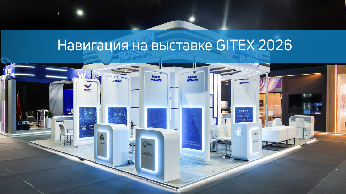
How Not to Get Lost at an Exhibition: The Indoors Navigation Experience at GITEX Morocco 2026

Large-scale exhibitions are like small cities: thousands of booths, dozens of pavilions, and hundreds of thousands of steps taken each day. In this chaos, it’s easy to miss an important meeting, fail to locate a specific exhibitor, or simply get lost among the rows. It is particularly frustrating when potential clients cannot find your booth amidst an endless sea of ​​neighbors—booth numbers are often tiny, and visual signage is almost always in short supply.

This is precisely the problem we addressed at the GITEX Morocco 2026 exhibition, where we showcased our digital navigation system.

This is precisely the problem we addressed at the GITEX Morocco 2026 exhibition, where we showcased our digital navigation system.

It all begins with the rapid digitization of the space. In just a few days, we create an accurate map of the exhibition venue—including public areas and the parking lot, so that visitors can easily locate their vehicles after a long day. This interactive 3D map is made available to attendees in advance, allowing them to explore the layout, mark specific booths, and plan their routes before even arriving at the exhibition.

At the event itself, the system works as a full-fledged navigator. It automatically determines the user's location and builds a route to any point of interest. All information about exhibitors - descriptions, contacts, event schedules - is digitized and can be quickly downloaded from any catalogue.

Key amenities for the visitor:

Navigation is available even without installing an app: simply scan a QR code, and a map showing your current location will appear in your browser. The QR code at the entrance is especially convenient—by scanning it, a guest can instantly get directions from the entrance to a specific booth or conference room.

AR navigation deserves special mention. Visitors point their smartphone camera at a QR code, and 3D arrows appear on the screen, overlaid onto the real-world view. A virtual guide shows turns, the direction to follow, the remaining distance, and the estimated travel time—all in real time. Once the user reaches their destination, the system sends a notification confirming their arrival, ensuring they don’t miss the intended booth.

👇 Subscribe and keep up to date with innovations! 👇

Learn more about solutions based on the geographic information system of the Indoors Navigation Platform

For more information about navigation in public places, follow the link: https://indoorsnavi.pro/
Сюжет РЕН ТВ о решении Индорс для Умного ЖКХ

В сюжете телеканала РЕН ТВ рассказали о цифровых решениях Indoors Navigation для сферы жилищно-коммунального хозяйства.

🔧 Как это работает: Система позволяет жителям легко ориентироваться в пространстве жилого комплекса, находить нужные офисы и сервисы. Для управляющих компаний — это инструмент контроля работы персонала, аналитики перемещений и повышения качества обслуживания.

📱 Преимущества для жителей:

• Быстрый поиск управляющей компании и аварийных служб

• Построение маршрутов по территории ЖК

• Доступ к актуальной информации через QR-коды

🏆 Результат: Технологии Indoors Navigation делают жилые комплексы умнее, прозрачнее и комфортнее для всех — от жильцов до управляющих компаний. Indoors Navigation — умные решения для умного ЖКХ.


Единая информационная среда для управления зданиями и активами — геоинформационная система (ГИС) на основе цифрового двойника объекта и геолокационных сервисов внутри помещений Indoors Navigation Platform (INP).

Learn more on the website www.indoorsnavi.pro

Discover the future of geographic information systems with the Indoors Navigation Platform. 🌐

📍 What will you see?

• The digital twin of the enterprise in action

• Indoor geolocation services

• Interactive navigation with QR codes and AR

🛠 How to integrate it?

• We create personalized solutions for each client. Contact us for a demo

👇 Subscribe and keep up to date with innovations! 👇

Learn more about solutions based on the geographic information system of the Indoors Navigation Platform

For more information about navigation in public places, follow the link: https://indoorsnavi.pro/

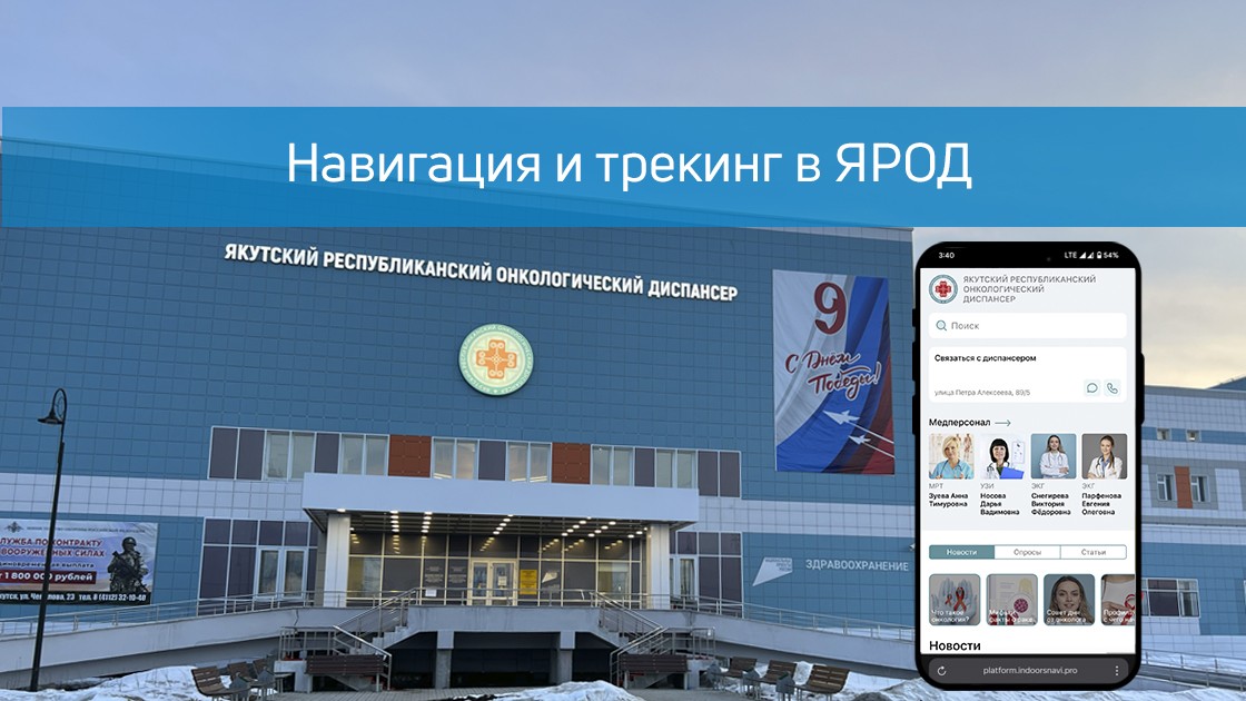
Digital navigation in YAROD: modern solutions for medicine

The company Indoors Navigation has implemented a patient navigation and tracking system in the Yakutsk Regional Oncological Dispensary (YAROD), solving the key problems of the medical facility.:

  • The difficulty of orientation in the hospital building
  • Search for doctors' offices and medical equipment
  • Control of patient movements

Implemented solutions:

  • Hardware search for medical staff
  • Accurate 3D map buildings with furniture detailing
  • The mobile app navigator with:
    — Поиском кабинетов и врачей
    — Маршрутизацией и позиционированием (+ AR-режимы)
    — 360° панорамами помещений
  • QR navigation for guests without an app
  • Tracking system patients through BLE Navitag bracelets

Implementation results:

✔ Reducing the search time for cabinets
✔ Simplification of patient monitoring
✔ Optimization of visitor flows
✔ Reducing the burden on staff

The technology is available:

  • In the mobile app

  • On interactive terminals

  • Via the web version

To learn more about new developments and the geographic information system of the Indoors Navigation Platform for medical institutions, follow the link: https://indoorsnavi.pro/

👇 Subscribe and keep up to date with innovations! 👇

#secondary

Обращение успешно отправлено!