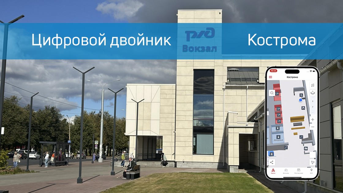
In September 2024, Indoors Navigation successfully completed a project to digitize and implement a passenger navigation system on Kostroma railway station. This project has become part of the overall digitalization program of Russian railway facilities aimed at improving passenger convenience and safety.
The main goal of the project was to create a convenient and intuitive navigation system that would allow passengers to quickly find the necessary facilities at the station, such as platforms, ticket offices, recreation areas and other important infrastructure facilities.
The project also included the digitization of the station with the creation of a digital twin, which allows both passengers and the administration to effectively interact with data about the station in real time.
The Indoors Navigation project in Kostroma has shown that the introduction of modern navigation systems at transport facilities can significantly improve the quality of passenger service. The system allows you to optimize the management of the facility, improve the organization of passenger flows and provide convenient navigation tools.
Indoors Navigation Platform — It is a universal solution for transportation facilities that will help you improve navigation and management. Contact us for a consultation and find out how our system can improve your train station or transport hub.
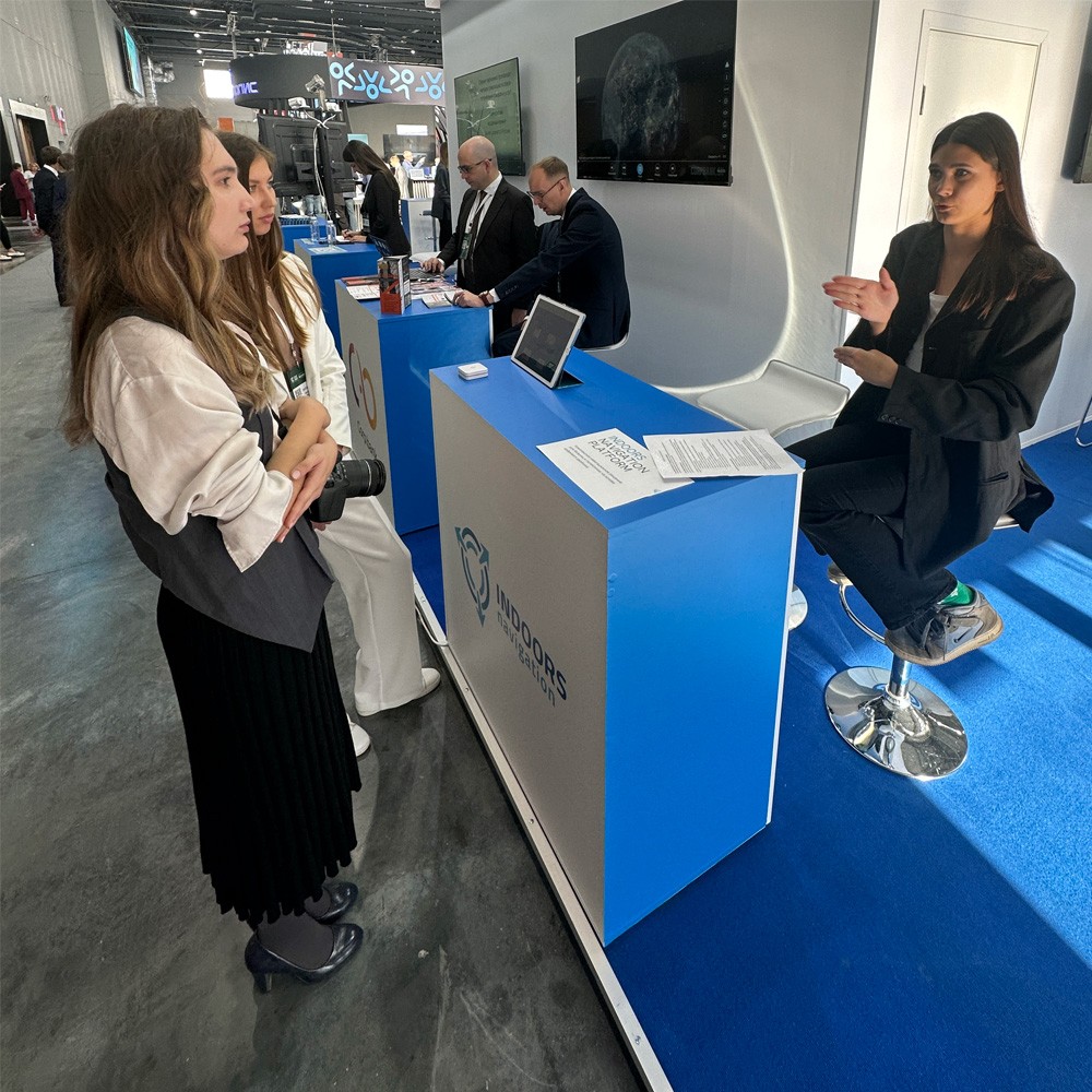
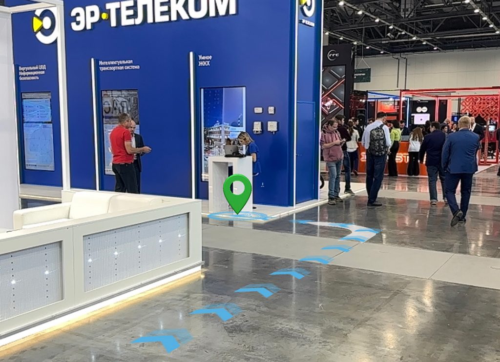
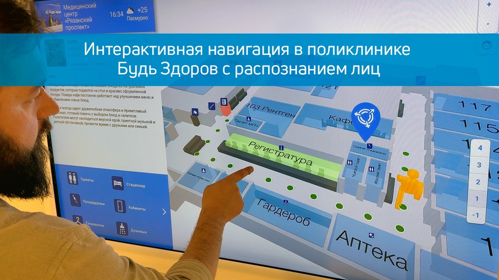
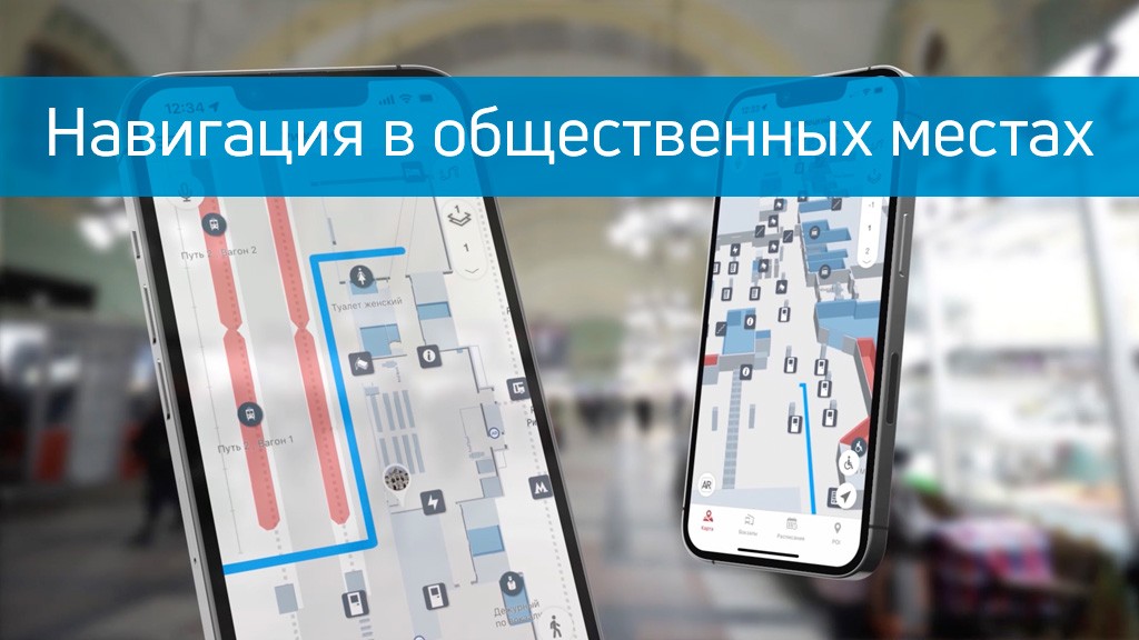
Discover the future of geographic information systems with the Indoors Navigation Platform. 🌐
📍 What will you see?
• The digital twin of the enterprise in action
• Indoor geolocation services
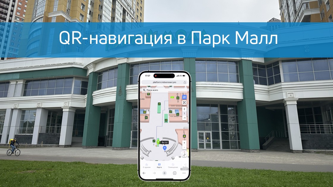
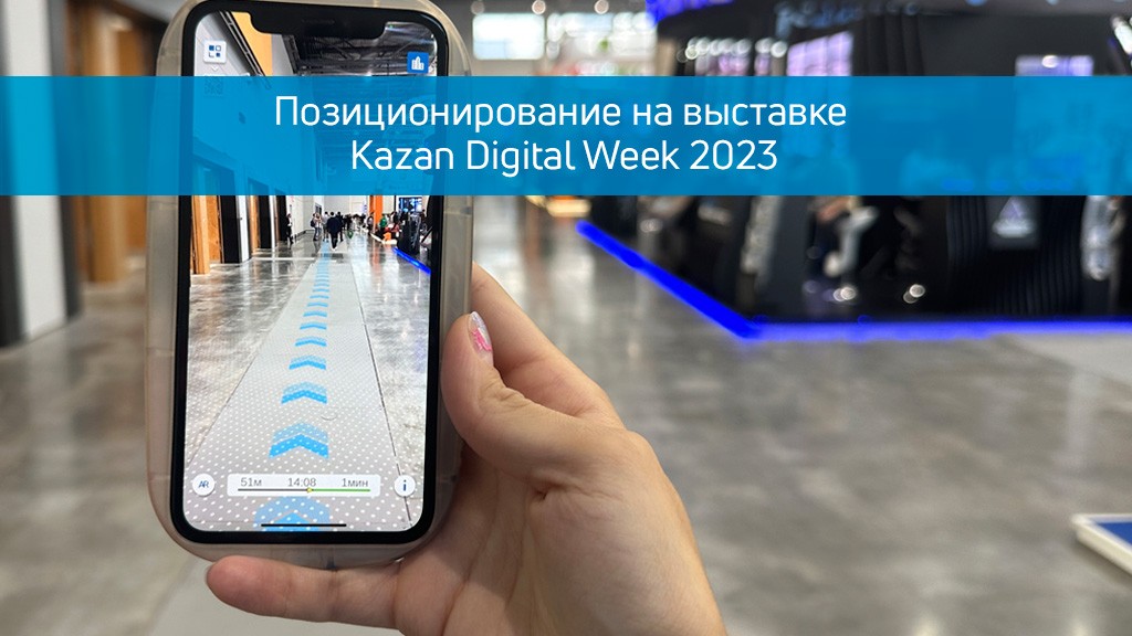
• Interactive navigation with QR codes and AR
🛠 How to integrate it?
• We create personalized solutions for each client. Contact us for a demo.
👇 Subscribe and keep up to date with innovations! 👇