 Навигация в помещениях и
цифровой двойник здания
Создайте современную систему навигации на своем объекте, с набором аналитических и маркетинговых инструментов на основе цифрового двойника объекта.
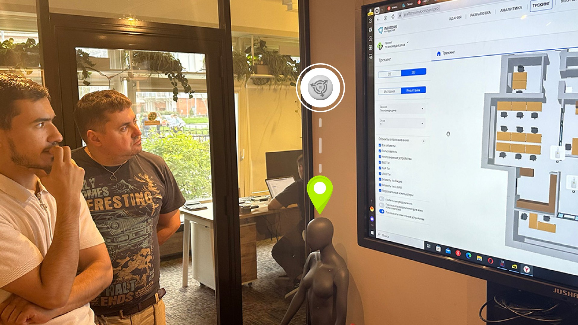
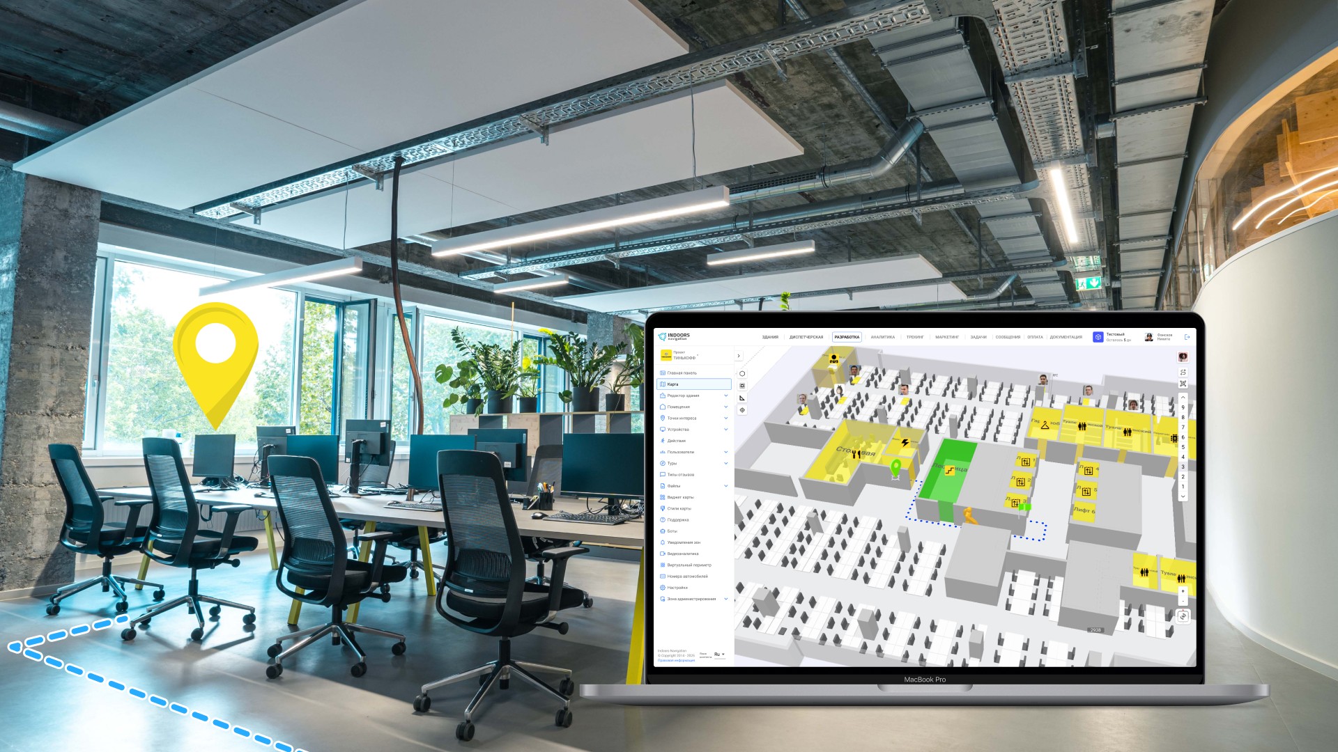
Мониторинг эксплуатации здания и управление внутренними процессами предприятия в онлайн режиме через веб панель облачной платформы Indoors Navigation Platform (INP).
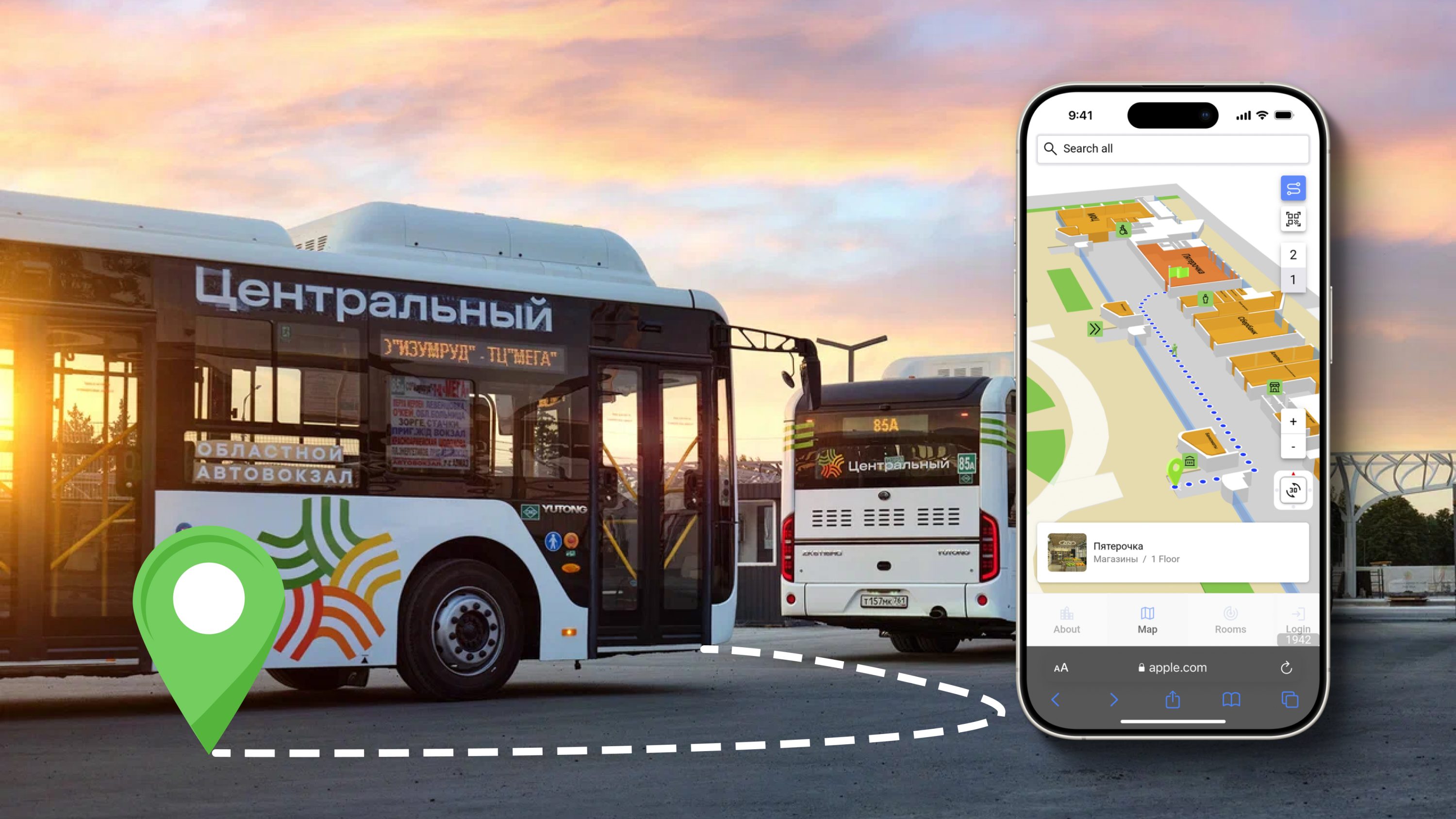
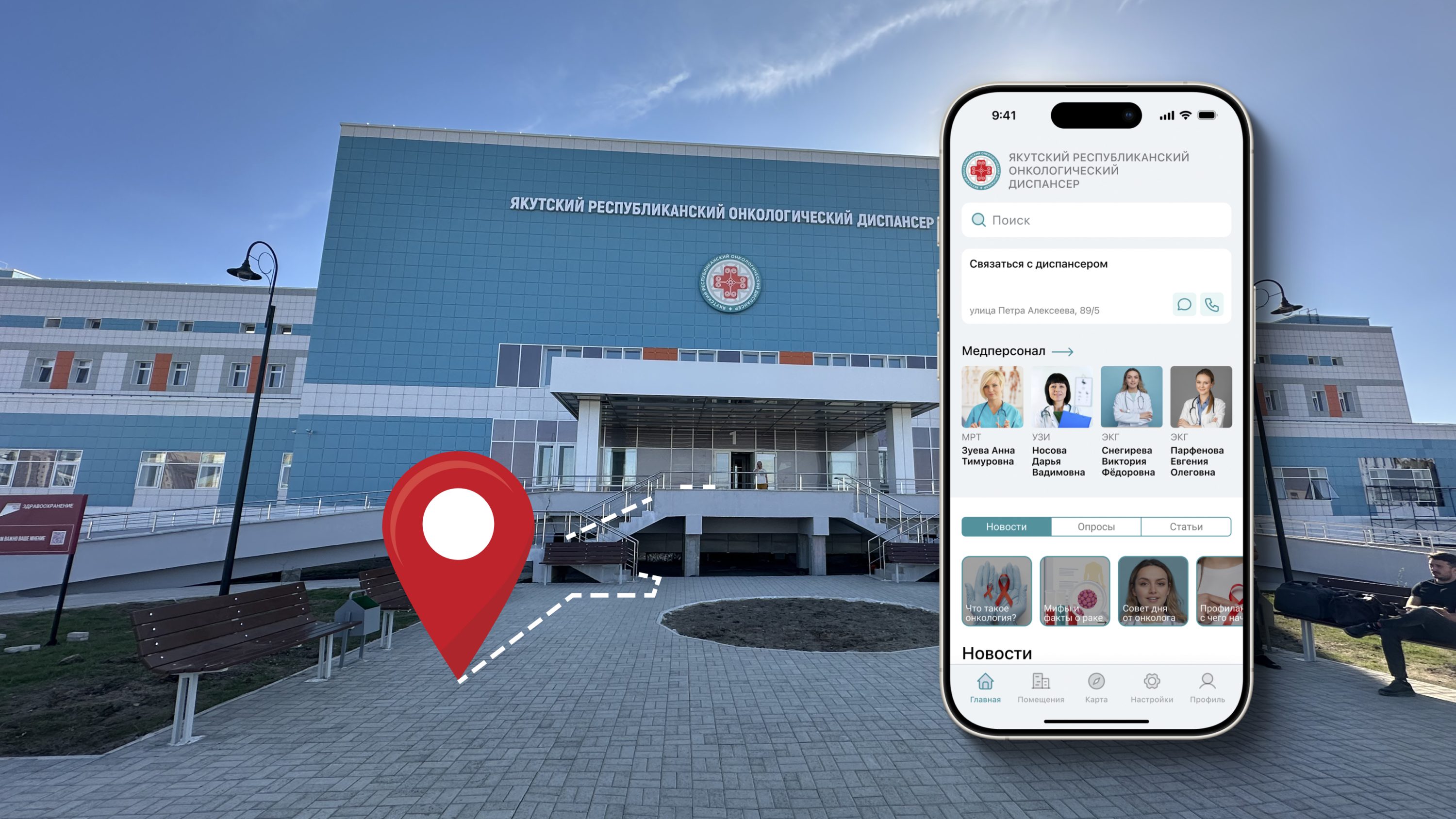
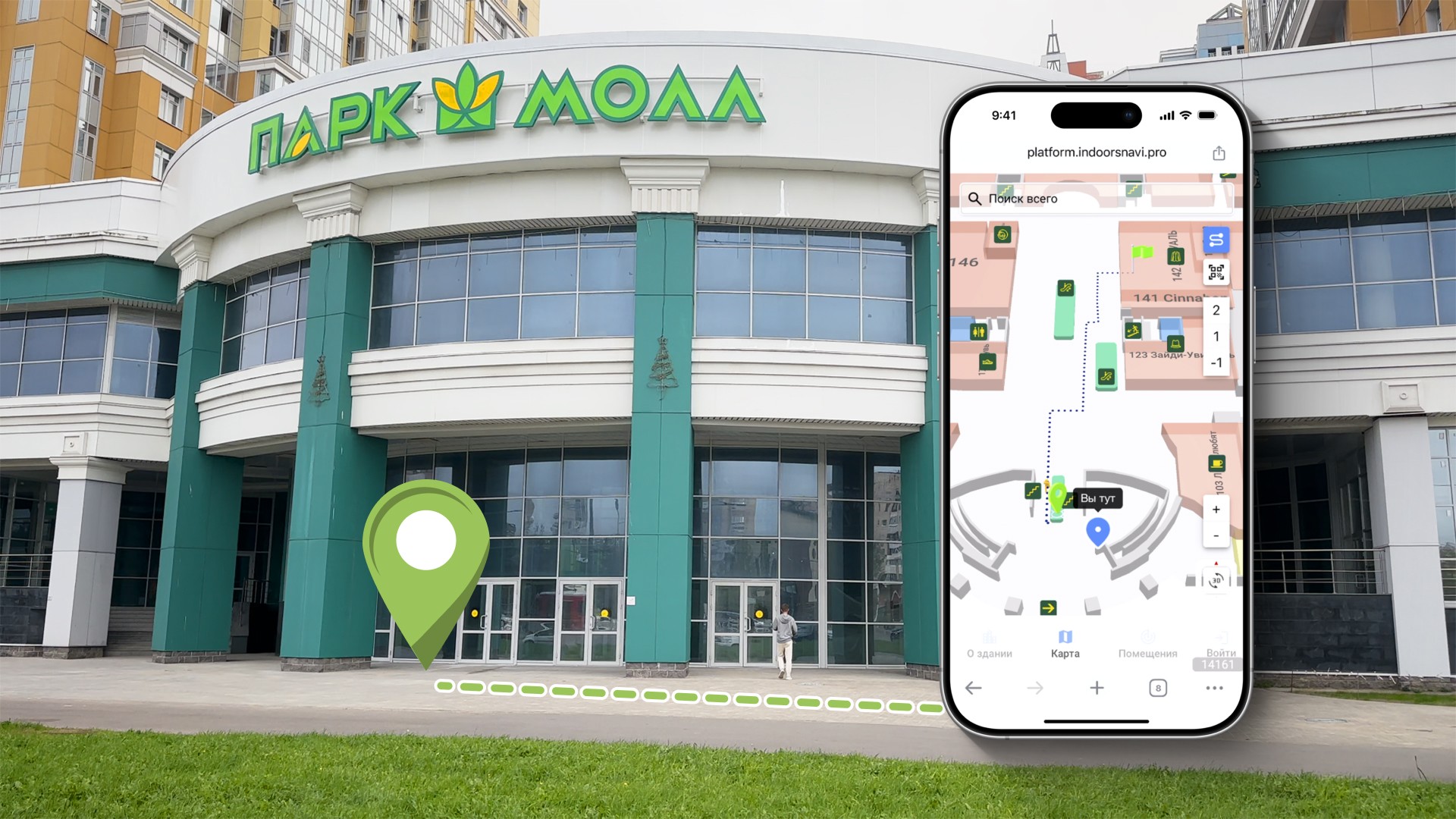
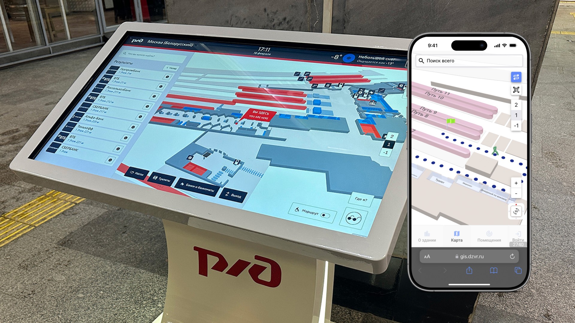
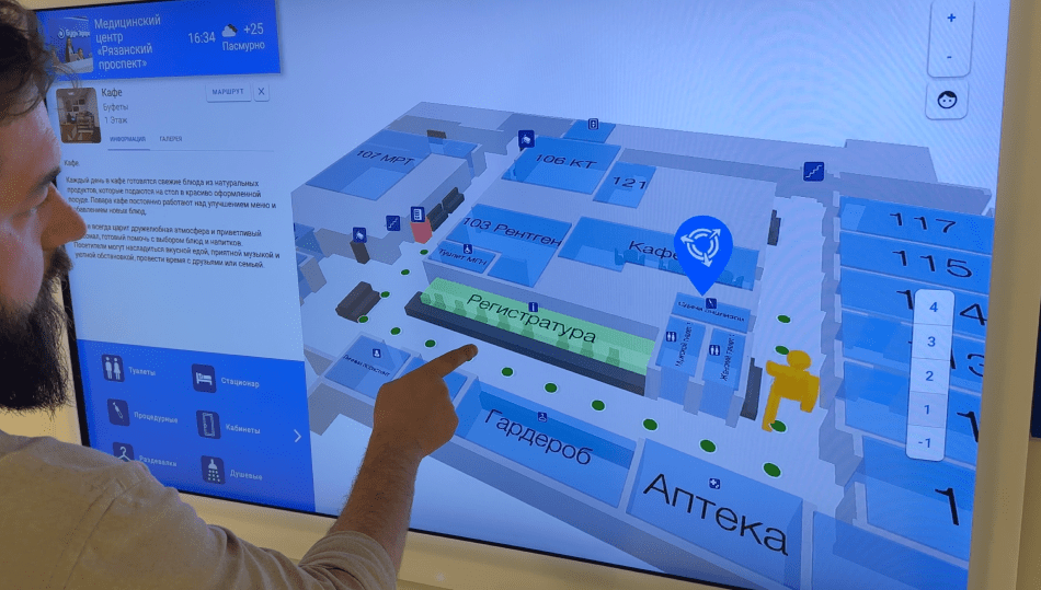
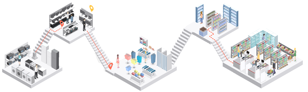
Геоинформационная система (ГИС INP) предназначена для обеспечения современной навигации в зданиях и на прилегающей территории. ГИС INP обеспечивает повышение комфорта передвижения, ориентирования, качества обслуживания клиентов и персонала предприятия.
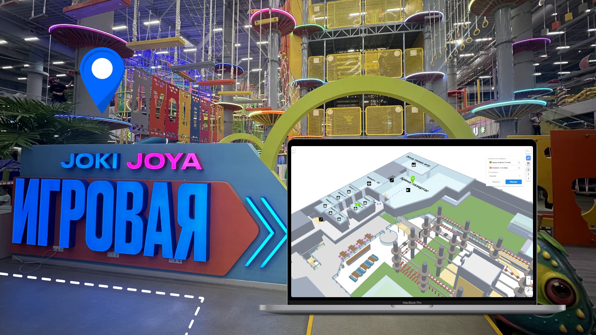
ГИС объединяет цифровую карту объекта на сайте, мобильную навигацию в помещениях на смартфоне и интерактивную навигацию в сенсорных терминалах, создав уникальный геосервис.
Мониторинг эксплуатации здания и управление внутренними процессами предприятия в онлайн режиме через веб панель облачной платформы Indoors Navigation Platform (INP).
Геоинформационная система (ГИС INP) предназначена для обеспечения современной навигации в зданиях и на прилегающей территории. ГИС INP обеспечивает повышение комфорта передвижения, ориентирования, качества обслуживания клиентов и персонала предприятия.
ГИС объединяет цифровую карту объекта на сайте, мобильную навигацию в помещениях на смартфоне и интерактивную навигацию в сенсорных терминалах, создав уникальный геосервис.