2022
Навигация в метро
Позиционирование на станциях метро становится значительно удобнее благодаря мобильному навигатору для пассажиров общественного транспорта, который быстро досткажет маршрут до нужной точки.
Мобильный навигатор на основе платформы INP помогает быстро ознакомиться с картой ТПУ и экономит время нахождения на станции, способствует повышению уровня комфорта перемещения и лояльности пассажиров. Способствует созданию безбарьерной среды перемещения МГН, слабовидящих и незрячих пассажиров.
на 50%
Повысился комфорт
перемещения пассажиров
на 60%
Вырос уровень лояльности
пассажиров
в 3 раза
Ускорилось ориентирование
Описание
Москва является ярким примером не только динамически развивающегося «умного города», но и технологичного транспортного узла. Общественный транспорт становится более популярным и востребованным, происходит постоянное расширение создаваемой для этого инфраструктуры, делая ее более масштабной и сложной для ориентирования.
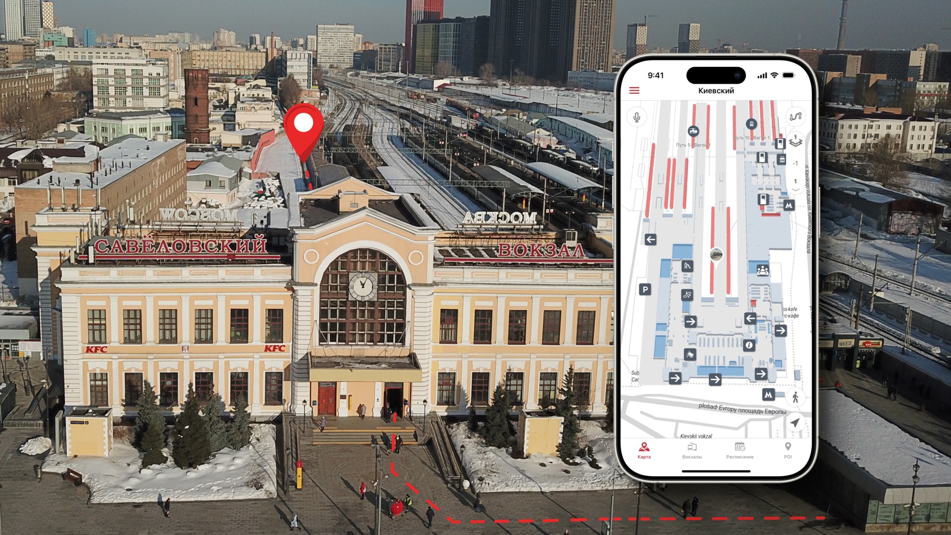
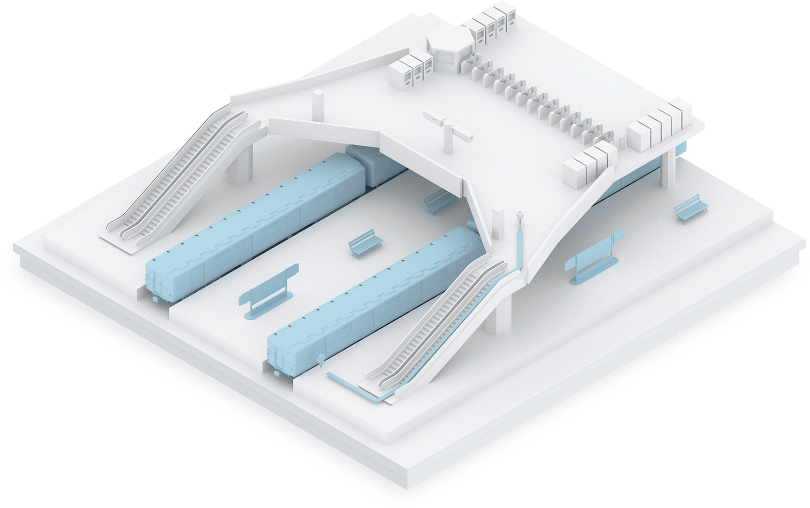
Московский метрополитен — это основа транспортной системы столицы. Именно поэтому, в рамках пилотного проекта, команда Индорс Навигейшн внедрила свою геоинформационную систему в транспортно узле Царицыно, реализовав удобный навигатор для пассажиров.
Цифровой двойник станции метро
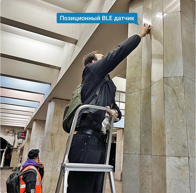
Команда Indoors Navi создала точную цифровую копию всего транспортного-пересадочного узла Царицыно с подробной трехмерной картой станции метро, МЦД, пригородных поездов, всех переходов и остановок. Установили более 100 позиционных датчики на станции.

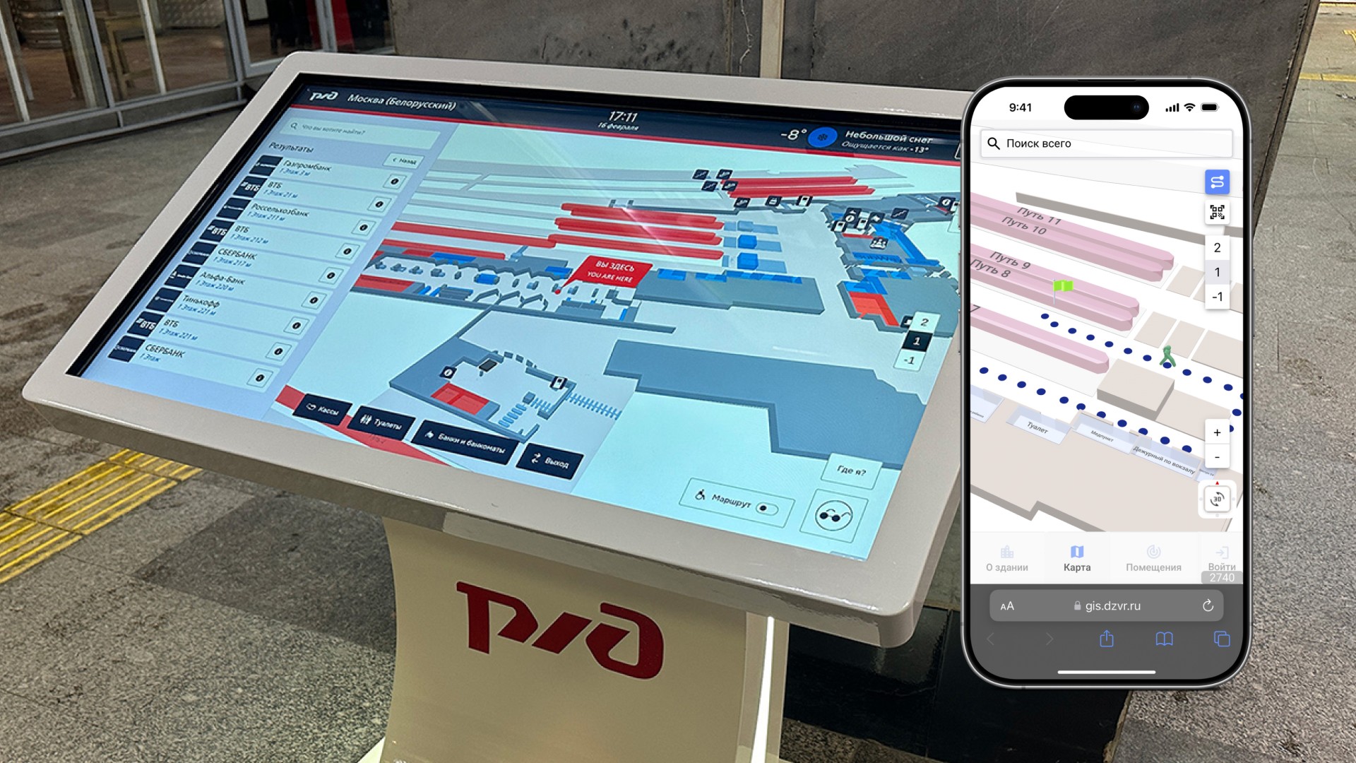
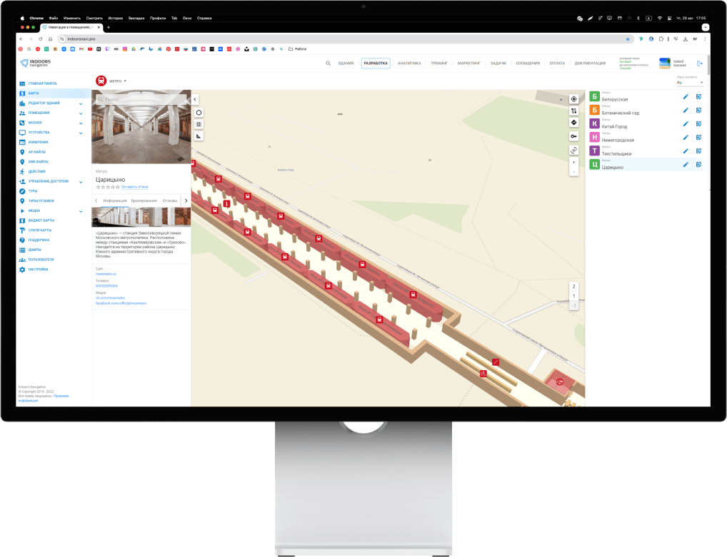
WEB панель управления
Управление сервисом осуществляется из web панели управления, в которой можно быстро изменять маршруты, обновлять информацию о объектах или проинформировать пассажира адресным сообщением. Геоинформационная система Индорс Навигейшн обеспечивает бесшовную навигацию как на подземных станциях метро, так и на уличных станциях МЦД и МЦК, непрерывно сопровождая пользователя.
AR навигация
Так же в сервисе есть возможность следовать по маршруту в режиме дополненной реальности. Отсканировав специальный маркер пользователь может видеть маршрут через камеру телефона в реальном пространстве. Сервис дополненной реальности может демонстрировать рекламный контент с 3д-графикой.
Навигатор для слабовидящих и незрячих
В пассажирском навигаторе есть специальный режим для маломобильных групп населения, в том числе для слабовидящих и незрячих. Можно построить специальный маршрут, который будет вести по предназначенным для них проходам без ступенек, лифтам и пандусам. Для слабовидящих предназначен специальный интерфейс с озвучкой и голосовыми подсказками по маршруту. В любой момент пользователь может запросить по клику помощь с привязкой к своему положению. А специально установленные датчики со звуковыми сигналами помогут им точно определить свое местоположение и проследовать до конца маршрута.
Статистика и аналитика перемещений в метро
В геоинформационной системе на основе статистики посещений определяются точки притяжения объекта, строится тепловая карта и визуализируются популярные маршруты. Администрация метрополитена получает данные о зонах скопления пассажиров и перегруженные участках с привязкой по времени и в online режиме видит перемещение пользователей.
Интеграция навигатора в другие приложения
За счет открытого API платформы и Indoors SDK функционал навигатора может быть быстро интегрирован в другие мобильные приложения, например Метро или Московский транспорт. Система быстро внедряется и легко масштабируется за счет простого монтажа без повреждения поверхности и поддерживает широкий круг мобильных устройств. Использование вертикального местоположения IoT в общественной безопасности
Мобильное приложение
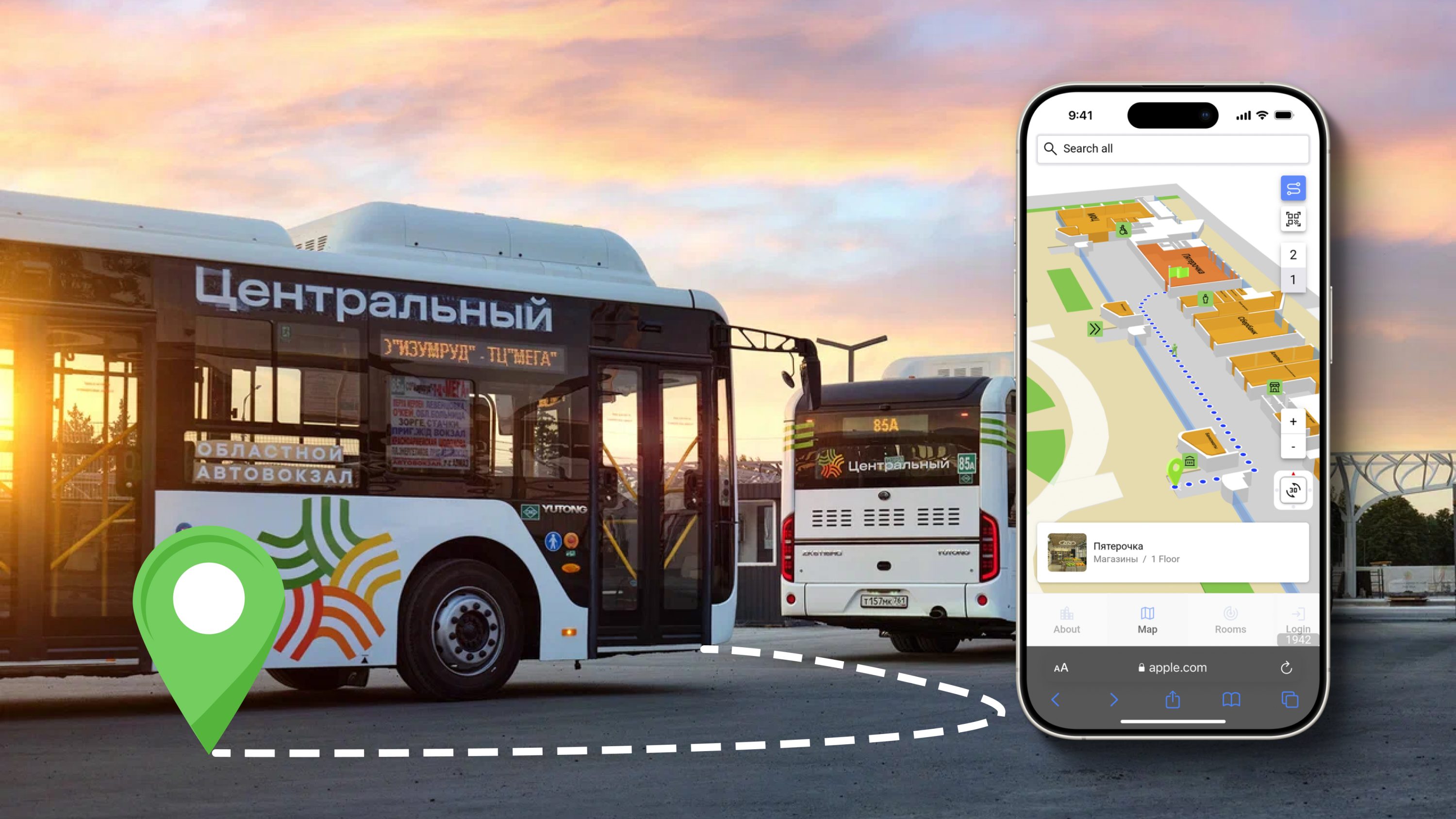
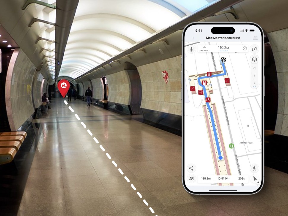
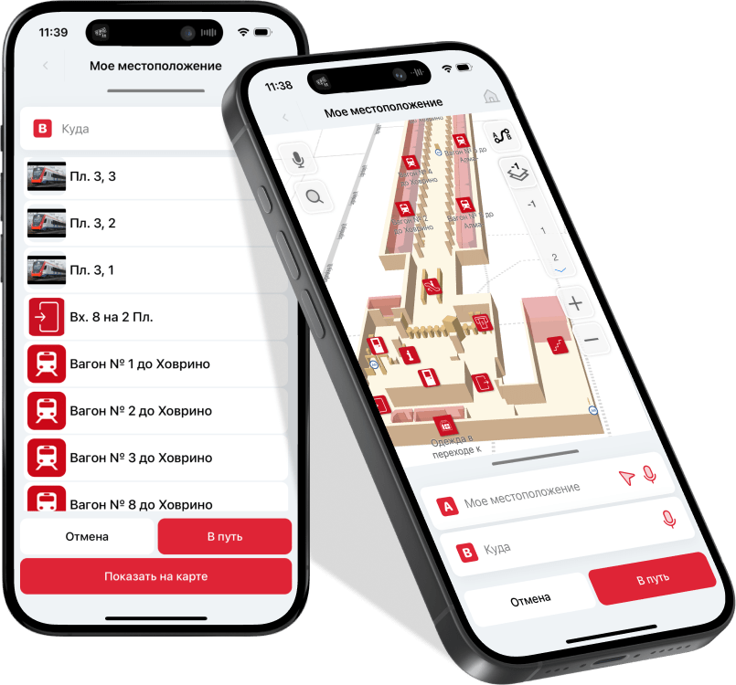
С помощью мобильного приложения пассажир может быстро сориентироваться в транспортном узле, понять где он находится и проложить маршрут к нужной ему точке: кассе, платформе или вагону.
Приложение-навигатор в реальном времени ведет его по маршруту кратчайшим путем, предоставляя информацию об инфраструктурных объектах и точках интереса на станции. Пассажир может быстро узнать какие переходы закрыты на ремонт и как лучше обойти. Какие кассы работают и их график. Где находится первый вагон, остановка автобуса или нужный магазин.


Навигация в метро
Внедрение внутренней навигации позволит предоставить пассажирам подробную карту станций в мобильном устройстве с возможностью проложить маршрут к нужной точке (выходу, переходу, остановке) находясь еще в вагоне поезда, и следовать по нему в режиме навигатора.
Тематические публикации в нашем блоге
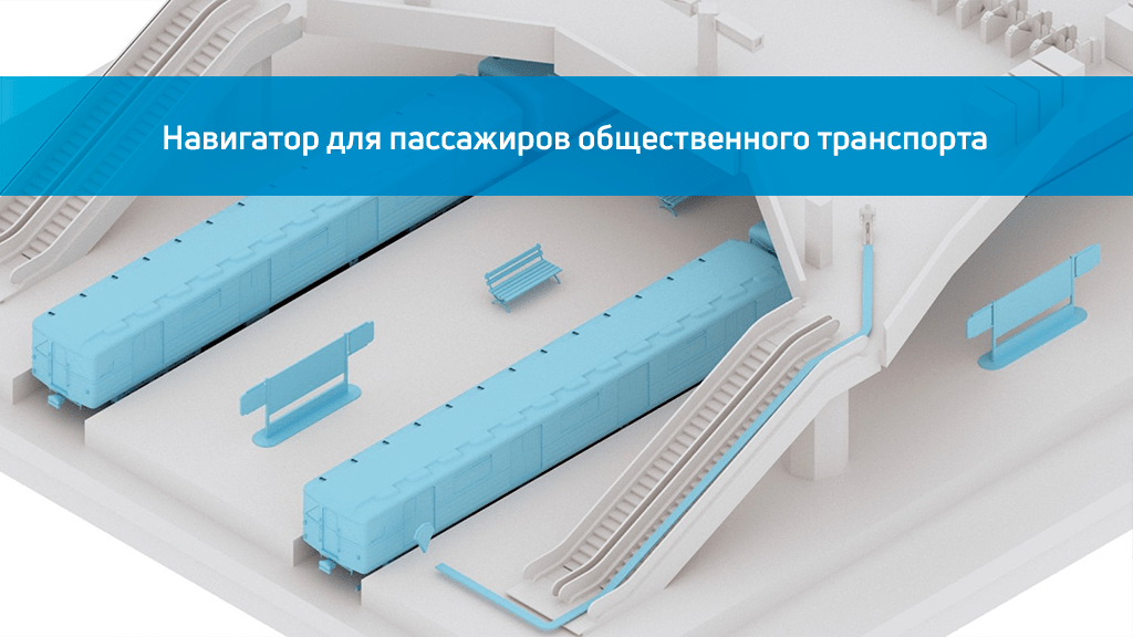
Навигатор для пассажиров общественного транспорта и позиционирование в метро
Навигация в метро становится более удобной с использованием мобильного навигатора для пассажиров, который был испытан в 2022 году на станции Царицыно. Мобильный навигатор помогает быстро ознакомиться с картой и помо….
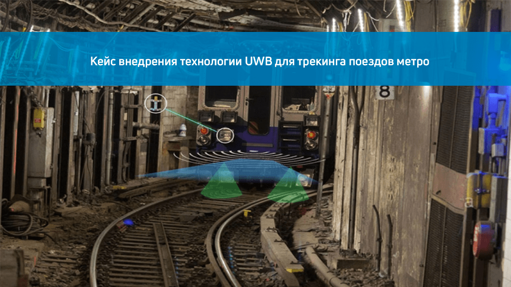
Кейс внедрения технологии UWB для трекинга поездов метро
Транспортная администрация города Нью‑Йорк подписала контракт стоимостью 14 миллионов долларов с компаниями Humatics и Siemens на разработку в течение 15 месяцев технического решения с использованием сверхширокополосной радиосв….