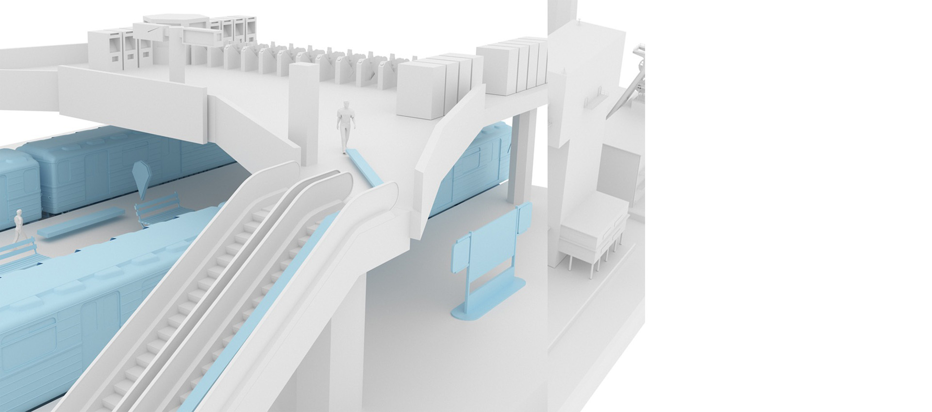
Навигация в метро
С каждым годом строится больше новых станции и пересадочных узлов, объединяются транспортные магистрали вокруг метрополитена: МЦК, ТПК, МЦД. За последние 10 лет пассажиропоток вырос на 19%.
Пассажиры зачастую не знают где находится нужный им переход, выход к улице или автобусу, проход на пересадку. Поиск осуществляется только за счет табличек визуальной навигации. В современном мире это не самый оптимальный способ, который расходует не мало времени пассажиров, тем самым затягивает их пребывание на станциях и уменьшает пропускную способность метрополитена в целом.
Внедрение внутренней навигации позволит предоставить пассажирам подробную карту станций в мобильном устройстве с возможностью проложить маршрут к нужной точке (выходу, переходу, остановке) находясь еще в вагоне поезда, и следовать по нему в режиме навигатора.
Цифровой двойник ТПУ и картографический сервис переходов метрополитена упрощает управление объектом и повышает комфорт пассажиров.
Внедрение сервиса мобильной навигации внутри помещений позволит сократить время поиска нужного маршрута внутри ТПУ и повысить ритмичности потока пассажиров.
Преимущества для метрополитена:
Цифровой двойник метрополитена:
Увеличение пропускной способности вестибюлей и ТПУ:
Улучшение качества обслуживания и повышения лояльности пассажиров:
За счет новых сервисов, а следовательно и популяризацию общественного транспорта
Упрощение информирования пассажиров:
Статистические данные:
Анализ перемещений и отслеживание пассажиропотоков (кто каким транспортом пользуется, в какое время, на каких остановках заходят и выходят, ка к и где пересаживаются) при комплексном внедрении сервиса в транспорте
Отслеживание перемещения сотрудников на объектах транспортной инфраструктуры:
Преимущества для пассажира:
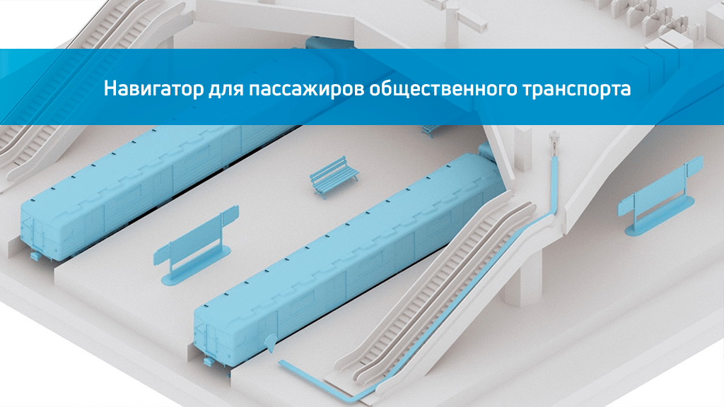
Карту транспортно-пересадочного узла (ТПУ) на своем мобильном устройстве:
Отражение основных точек и зон: входы, выходы, эскалаторы, переходы, кассы, коммерческие объекты (кафе, рестораны, магазины), место автомобиля на парковке и тп.
Удобную навигацию по переходам и выходам из станции:
С возможностью ведения по маршруту как в навигаторе
AR навигация:
Возможность проложить маршрут в игровом режиме за счет дополненной реальности

Тематические публикации в нашем блоге
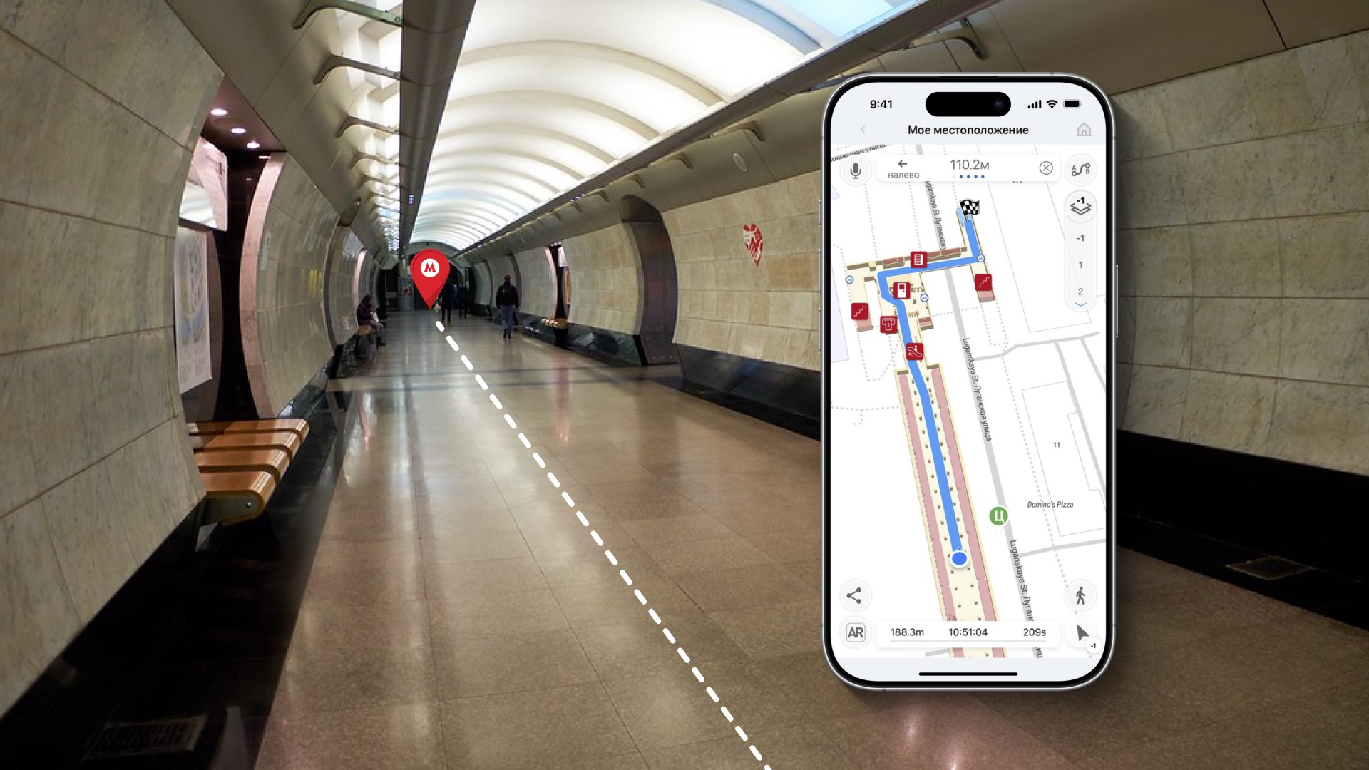
Навигатор для пассажиров общественного транспорта и позиционирование в метро.
Навигация в метро становится более удобной с использованием мобильного навигатора для пассажиров, который был испытан в 2022 году на станции Царицыно.
Часто задаваемые вопросы по навигации в ТПУ (FAQ)
Как внутреннее позиционирование может помочь в транспортных узлах?
Транспортные узлы обычно имеют большое внутреннее пространство и в основном очень переполнены. Пассажирам бывает сложно ориентироваться. Благодаря системе определения местоположения в помещении, пассажиры могут чувствовать себя более комфортно и передвигаться без лишнего стресса из за вероятности опоздать.
Как интерактивная навигация IN может помочь в управлении потоком пассажиров?
Позиционирование в помещении может помочь руководству отслеживать движение пассажиров и соответственно управлять потоками на входах и выходах.
Администрация может отправлять пользователям уведомления в приложение с информацией о наиболее разгруженных входах и выходах, доступных переходах и пустых пунктах досмотра.
Какой функционал предлагает внутреннее позиционирование IN для транспортных узлов?
Траспортный узел может использовать систему позиционирования в помещениях Индор Навигейшн для управления пассажиропотоками и обслуживающим персоналом, а также создавать интерактивные сценарии взаимодействия с пассажирами, предлагаю им воспользоваться новыми сервисами в игровой манере.
Навигация в своем смартфоне, быстрое определение местоположения, получение уведомлений с привязкой к геопозиции, отслеживание в реальном времени движения по маршруту, анализ движения материальных активов и оборудования, маркетинговые сценарии с использованием дополненной реальности и другое.