Навигация на парковках
Цифровизация парковочных пространств — это необходимый минимум при сегодняшних темпах развития города и представляет собой процесс внедрения современных решений для оптимизации управления и использования парковочных зон.
Современные решения для навигации на парковке включают в себя технологии, направленные на упрощение процесса поиска парковочного места и улучшения общей эффективности парковочных систем, повышения доступности для всех видов пользователей.
Цифровизация подземных парковок нацелена на создание интеллектуальной и удобной среды для водителей и жителей, где каждый этап парковки максимально адаптирован к потребностям: удаленное бронирование, оплата, и быстрый поиск места в общедомовом паркинге.
Повышении комфорта для водителей и пешеходов, увеличение доходности и сокращения издержек при эксплуатации парковки достигается внедрением ГИС INP.
Как работает навигация на парковке

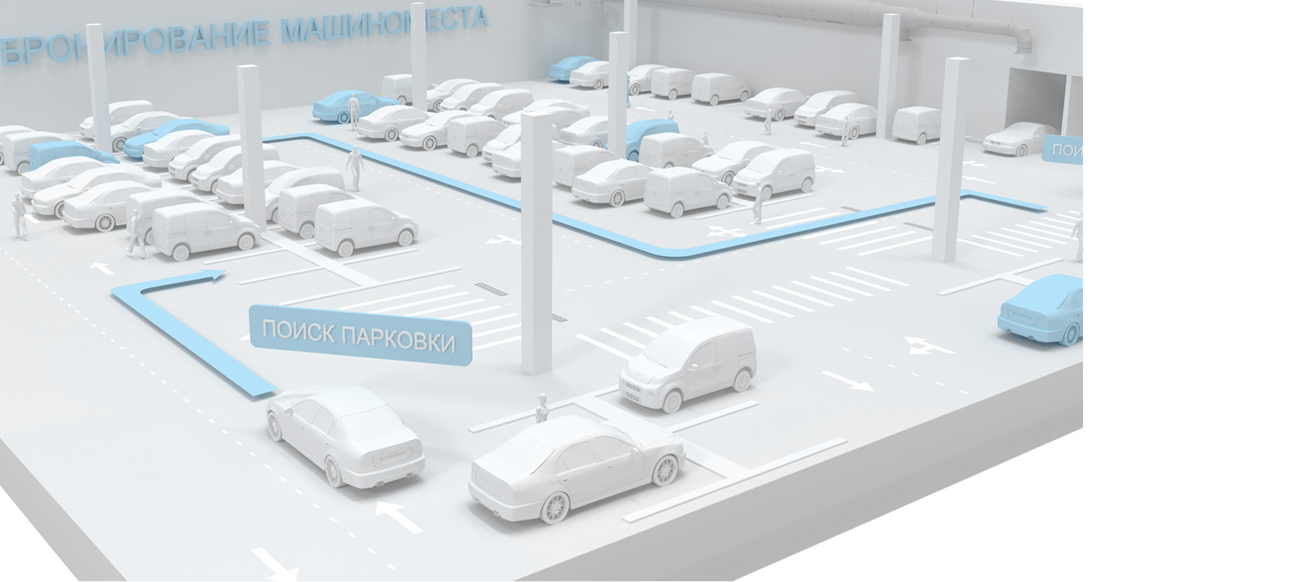
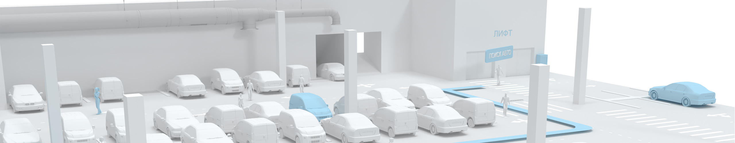
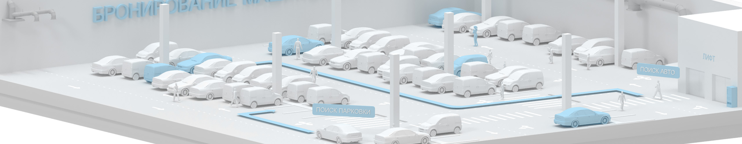
Современная навигация по цифровой парковке осуществляется через веб сайт, инфомат или мобильное приложение, являющееся частью геоинформационной системы на основе цифрового двойника парковки Indoors Navigation Platform®.

Мобильное приложение обладает функционалом навигации с отслеживанием положения пользователя, как пешехода, так и автомобилиста, по всей территории открытой или подземной парковки за счет цифровой 3д карты, администрируемой через веб-панель управления.
Этаж парковки и положение на нем пользователя определяется автоматически мобильным приложением за счет bluetooth сигналов от позиционных датчиков INB v1.2 или аналогов, установленных на объекте.

Пользователь сопровождается по маршруту как в навигаторе, а также получает возможностью посмотреть описание и фото машиноместа, забронировать его, если оно свободно и заявку одобрит администратор или собственник. Уведомления о начале и окончание бронирования поступают в мобильное приложение.
Так же пользователь мобильного приложения может использовать режим дополненной реальности (AR) для навигации по маршруту на парковке и отображения цифровой карты паркинга.

Если у пользователя нет мобильного приложения, он может отсканировать QR код на территории и загрузить в браузере мобильного телефона интерактивную карту парковки с указанием места где он находится. Построить маршрут до интересующей точки, посмотреть описание и фото машиноместа, забронировать его.

Используя встроенный в платформу INP® мессенджер, пользователь может связаться с администратором, направить запрос в канал технической поддержке или другим пользователям.
Если машиноместо занято другим автомобилем, или там не работает освещение, пользователь может отправить соответствующую жалобу/заявку из мобильного приложения с привязкой к геопозиции.

Пользоваться сервисом бронирования машиномест могут зарегистрированные пользователи в платформе INP® и вошедшие в личный кабинет под своим логином и паролем в мобильном приложении или браузере смартфона.
В личном кабинете пользователя задается ФИО, фото, e-mail, телефон, компания, должность, идентификатор, таг, социальные сети, описание, марка и номер автомобиля и другие необходимые данные.
Автоматические определение занято машиноместо или нет, осуществляется по данным о геопозиции пользователя, чей автомобиль привязан в машиноместу, или при интеграции API парковочных камер (датчиков) других вендоров.

В веб-панели управления платформы INP создается цифровая карта парковки, задаются пользовательские маршруты, входы, выходы, лифты, лестницы и другие точки интереса (POI), а также настраиваются режимы бронирования машиномест.

Администратор обрабатывает, подтверждает и отклоняет заявки на аренду машиномест от пользователей мобильного приложения в единой веб-панели управления платформы INP®. Может добавлять и удалять машиноместа, настраивать доступность бронирования, видеть данные из личного кабинета пользователя.

Статистика перемещений пользователей собирается в разделе Аналитика веб-панели управления, визуализируется в виде графиков и тепловых карт, и выгружается отчетами.

Мобильное приложение на основе Indoors SDK при интеграции по API может управлять оборудованием подземной парковки.
За счет модуля видео аналитики платформы INP® и интеграции в СКУД, возможно управление воротами и шлагбаумом при распознании лица пользователя или номера автомобиля.
Преимущества для парковки:

Цифровой двойник парковки:
Виртуальное представление парковочной зоны со всеми инженерными коммуникациями, возможностью управления оборудованием и отображения в режиме реального времени актуальной информацию о доступности парковочных мест.

Интерактивная карта парковочной зоны:
ГИС INP позволяет создать цифровую карту парковочной зоны с точным указанием расположения каждого парковочного места и их параметров. Обеспечивает сопровождение пользователя по маршруту как в навигаторе до выбранного машиноместа, лифта или выхода. Интеграция с IOT.

Мониторинг персонала и оборудования паркинга:
Для повышения эффективности труда и оптимизации рабочего времени сотрудников парковки, а также контроля выполнения ими своих обязанностей, используется модуль трекинга INP. Охранники, уборщики и инженеры буду больше времени тратить на выполнение своих обязанностей и меньше на курение, зная что руководство обладает информацией где они находятся

Бронирование и оплата парковки:
Функционал бронирования парковочных мест и их оплаты в ГИС Indoors Navigation Platform дает возможность водителям предварительно запланировать свой визит и избежать неудобств при поиске машиноместа по факту визита

Статистические данные и аналитика перемещений в паркинге:
ГИС собирает данные о использовании парковочных мест, что позволяет анализировать тенденции, прогнозировать загруженность, создавать отчеты и тепловые карты для оптимизации управления парковкой. Наглядные маршруты перемещения посетителей и персонала в разных временных разрезах.

Клиентоориентированность
Современный стандарт обслуживания водителей и владельцев машиномест позволяет создать максимальный комфорт при посещении парковки в жилом комплексе, торговом или офисном центре.
Упростите ориентирование за счет цифровой карты и навигатора на личных мобильных устройствах.

Что получает пользователь:
- Карта всей парковки в своем мобильном телефоне с визуализацией схемы парковочных зон.
- Оптимальные маршруты к свободным парковочным местам, лифтам и выходам.
- Бронирования парковочных мест заранее, обеспечивая уверенность в наличии места по прибытии.
- Быстрый поиск специализированных зон, например места для инвалидов или станции зарядки для электромобилей.
- Возможность сдачи в аренду своего парковочного мета и получение дополнительного дохода..
- Канал коммуникаций с администрацией, целевые чаты и отзывы.
- Геймификация процесса посещения за счет применения дополненной реальности. AR навигация на парковке и виртуальные игровые сценарии.

Цифровизация
Цифровизация включает в себя внедрение автоматизированных систем управления парковкой, которые могут регулировать доступ к парковочным местам, оптимизировать использование пространства и собирать аналитические данные.
INP успешно помогает управлять внутренними процессами любого парковочного пространства.
Улучшите контроль за сотрудниками вашего паркина, позволяя эффективнее распределять нагрузку и ресурсы.

Что получает администрация парковки:
- Детальную карту парковочного пространства, с указанием статуса каждого места.
- Статистические данные и аналитические отчеты в разных разрезах времени.
- Возможность управлять рабочими процессами в online режиме. Отслеживание перемещений сотрудников и оборудования на карте.
- Оптимизацию использования парковочной площади, учитывая популярность различных зон, дней, часов.
- Автоматизацию процессов контроля и обслуживания, интеграция с билетной системой и оплатой.
- Новый канал обратной связи с пользователями в одной платформе.
- Повышение безопасности на парковке и визуальные данные о событиях, происходящих на территории.
- Сократить затраты на обслуживание и повысить экономическую эффективность паркинга.

Эффективность и актуальность
Внедрение геоинформационной системы INP, применение инструментов позиционирования и трекинга, поможет повысить эффективность работы всей парковки на 30%, увеличить доходность от аренды машиномест на 25% , улучшить качество обслуживания посетителей на 20%, а сохранность активов на 15% (инвентаря и оборудования).
Тематические публикации в нашем блоге
Интеллектуальная система парковки – как это работает
Навигационные решения для парковки автомобилей работают как для внутренних, так и для открытых парковочных систем и могут быть созданы для достижения оптимальной производительности. Таким образом, использование навигационн…
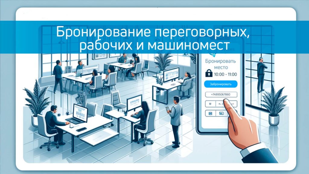
Бронирование переговорных комнат, рабочих и парковочных мест в современном мире
В современном мире, где каждая минута на счету, эффективное использование офисного пространства и ресурсов становится ключевым аспектом успешного бизнеса. Современные системы бронирования переговорных комнат, рабочих ме…
Часто задаваемые вопросы по навигации на парковках с Indoors Navigation Platform (INP)
Что такое цифровизация парковки с использованием геоинформационной системы?
Цифровизация парковки с геоинформационной системой (ГИС) представляет собой внедрение технологий для оптимизации использования парковочного пространства и улучшения навигации на парковке.
Что такое современная навигация на парковке?
Современная навигация на парковке предлагает использование технологий, таких как геоинформационные системы (ГИС), датчики, камеры и мобильные приложения для оптимизации поиска и управления парковочными местами.
Каковы преимущества современной навигации и ГИС на парковке?
Преимущества включают возможность получения дополнительного дохода, оптимизацию использования парковочного пространства, сокращение времени поиска места, повышение уровня безопасности, удобство использования и поддержку различных сервисов для водителей и пешеходов.
Каковы затраты на внедрение цифрового двойника ГИС на паркинге?
Стоимость варьироваться в зависимости от размера парковки и используемых технологий. Основная часть расходов это оборудование, программное обеспечение, интеграция со сторонними системами и пусконаладочные работы (ПНР).
Могу ли я бронировать парковочное место заранее с использованием INP?
Да, наша система навигации для помещений позволяет водителям бронировать парковочные места заранее через мобильные приложения или веб-виджет платформы Indoors Navigation Platform.
Как система оповещает о наличии свободных мест?
Платформа INP может использовать мобильные уведомления и информационные табло (инфоматы) для указания наличия свободных или занятых парковочных мест.
Как водители взаимодействуют с системой ГИС на парковке?
Водители и другие пользователи могут использовать мобильные приложения для поиска мест, бронирования и оплаты парковки, а также получения информации о состоянии парковочного пространства.
Каковы возможности интеграции существующих инженерных систем на парковке с платформой INP?
Наша платформа с интерактивной картой разработана с учетом возможности интеграции с существующими инженерными системами управления парковкой и транспортной инфраструктурой за счет открытого API.
Нужно ли скачивать специальное приложение для использования системы INP?
Не обязательно. В браузере можно пользоваться клиентское решение без установки сторонних приложений, достаточно просто отсканировать QR код или загрузить интерактивную карту с расположением машиномест.
Для использования возможности ведения по маршруте в реальном времени и отслеживания перемещений, необходимо установить мобильное приложение, которое можно найти в соответствующих магазинах для вашего устройства или интегрировать в готовое приложение за счет Indoors SDK. Подробная документация доступна в панели управления платформой INP.
Какова точность системы внутреннего позиционирования Indoors Navigation Platform?
Точность позиционирования внутри помещений INP может зависеть от типа используемого оборудования и выбранной технологии, и одет варьироваться от 0.5 метра до 3-ех метров. На улице точность определяется качеством приему GPS сигналов и составляет порядка 10 метров.
Где хранятся все данные о пользователях и как их можно использовать?
Данные о пользователях, собранные при использовании системы внутреннего позиционирования, могут быть использованы только для оптимизации маршрутов и лучшего планирования ресурсов. Они хранятся в зашифрованном виде на серверах администрации.