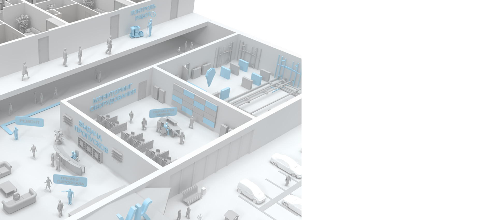
Навигация в УК
Повышении комфорта ваших жильцов, увеличение доходности и сокращения издержек при эксплуатации здания достигается внедрением ГИС INP
Цифровизация управления недвижимостью — это необходимый шаг в условиях современного развития городов. Она включает внедрение передовых технологий для оптимизации процессов управления и эффективного использования ресурсов, таких как офисные и жилые помещения.
Современные решения для управления объектами недвижимости помогают упростить взаимодействие с жильцами и арендаторами, улучшить доступность услуг и повысить общую эффективность работы управляющей компании. Автоматизация процессов позволяет значительно сократить время на обработку заявок и бронирование помещений, обеспечивая более высокое качество обслуживания.
Цифровизация офисных и жилых пространств создает интеллектуальную и удобную среду для всех пользователей, где каждый этап взаимодействия с управляющей компанией — от бронирования переговорных комнат до оплаты услуг — полностью адаптирован к их потребностям.
Цифровизация
Внедрение геоинформационной системы (ГИС) в работу управляющей компании значительно повышает эффективность управления объектами, улучшает качество обслуживания, оптимизирует затраты и усиливает контроль за всеми процессами. Это важный инструмент для современной компании, которая стремится к цифровизации и автоматизации своих процессов.
NSP
Indoors Navigation Platform® обеспечивает удобный канал связи с пользователями. Жители и арендаторы могут подавать заявки и получать уведомления о выполнении работ через мобильное приложение. Это повышает уровень удовлетворенности, улучшает качество обслуживания и укрепляет доверие к управляющей компании.
Интеграция
ГИС легко интегрируется с другими цифровыми системами управления, включая биллинговые системы, системы учета энергии и инженерные решения. Это создает единую цифровую платформу для управления всеми процессами на объекте, что упрощает координацию и управление.
Безопасность
ГИС помогает повысить уровень безопасности на территории объекта. Система может быть интегрирована с камерами видеонаблюдения и системами контроля доступа, что позволяет отслеживать подозрительные активности, фиксировать события и оперативно реагировать на внештатные ситуации.
Расходы
За счет автоматизации процессов управления и использования аналитики, ГИС позволяет снизить затраты на эксплуатацию объектов. Система помогает выявлять неэффективные зоны и процессы, что способствует оптимизации ресурсов и сокращению расходов на обслуживание зданий и инфраструктуры.
Преимущества внедрения геоинформационной системы (ГИС) для управляющих компаний

Клиентоориентированность
Современные стандарты обслуживания в сфере управления жилыми и офисными комплексами направлены на создание максимального комфорта для жителей и арендаторов. Цифровые решения помогают упростить взаимодействие с управляющей компанией, включая подачу и обработку заявок, мониторинг состояния инженерных систем и контроль за обслуживающим персоналом.
Пользователи могут легко решать свои задачи с помощью цифровых карт и навигации через мобильные устройства, что обеспечивает быструю подачу заявок и отслеживание их выполнения в режиме реального времени.
Что получает пользователь:
- Удобный доступ к цифровой карте здания с визуализацией необходимых всех объектов и систем.
- Оптимальные маршруты для быстрого решения своих задач: подача заявки, поиск нужного помещения или службы
- Быстрый доступ к специализированным зонам или услугам, например к технической поддержке или инженерам
- Простой и удобный канал коммуникации с управляющей компанией через мобильное приложение, включающий целевые чаты с привязкой к положению и отзывы
- Интерактивный процесс взаимодействия через технологии дополненной реальности, что делает использование системы не только полезным, но и увлекательным

Цифровизация
Внедрение цифровых технологий в управление недвижимостью включает автоматизацию таких процессов, как обработка заявок жителей, контроль за инженерными системами и мониторинг работы персонала. Цифровой двойник объекта помогает визуализировать все процессы и управлять ими в реальном времени, улучшая эффективность и прозрачность управления.
Система INP позволяет управляющим компаниям эффективно управлять всеми внутренними процессами, от обслуживания зданий до оптимизации использования ресурсов.
Что получает руководство:
- Детализированную цифровую карту объекта с информацией о состоянии всех инженерных систем
- Статистические данные и аналитические отчеты, которые помогают принимать обоснованные решения
- Возможность в режиме реального времени управлять работой персонала и отслеживать их перемещения на территории и в здании
- Автоматизацию процессов контроля и обслуживания, интеграцию с системами оплаты и управления заявками
- Единый канал обратной связи с жителями и арендаторами
- Повышение безопасности за счет контроля состояния инфраструктуры и мгновенной фиксации внештатных ситуаций
- Снижение затрат на обслуживание и повышение экономической эффективности управления объектом
Эффективность и актуальность
Внедрение системы INP и применение инструментов цифрового трекинга и контроля позволяют повысить общую эффективность работы объектов недвижимости на 20%, увеличить доход от аренды помещений на 15%, улучшить качество обслуживания клиентов на 20%, а также сократить потери активов и оборудования на 15%.
Таким образом, цифровизация процессов управления недвижимостью обеспечивает не только комфорт для жителей и арендаторов, но и повышает экономическую эффективность для управляющих компаний.
Тематические публикации в нашем блоге
Умное ЖКХ: будущее коммунальных услуг.
В современном мире технологии стремительно развиваются и проникают во все сферы нашей жизни. Одна из таких областей — жилищно-коммунальное хозяйство (ЖКХ). Концепция «Умного ЖКХ» становится все более популярной и востребованной, предлагая инновационные решения для управления домами и коммунальными услугами. В этой статье мы рассмотрим, что такое «Умное ЖКХ»…
Как цифровые карты помогают девелоперам продавать недвижимость.
В современном мире цифровых технологий успешные продажи недвижимости требуют инновационного подхода. Цифровые карты объектов, такие как те, которые предлагает Indoors Navigation, становятся неотъемлемой частью стратегии девело….
Домофон — от слуховых трубок до IoT
Мир сильно изменился с тех пор, как более 100 лет назад был изобретен первый домофон . В то время жители многоквартирных домов покупали товары на рынке в шаговой доступности от дома, ездили только по особым случаям и редко беспокоились о том, что к ним заглянет нежданный гость. Сегодня они покупают в…
Умные здания и их энергоэффективность
В последнее время умные здания стали очень популярными по всему миру. Это такие здания, которые используют подключенные датчики и технологию Интернета вещей (IoT), чтобы стать более эффективными и удобными для жильцов и владельцев бизнеса. Специалисты прогнозируют, что рынок умных зданий будет…
Часто задаваемые вопросы по навигации в ЖК с Indoors Navigation Platform (INP)
Что такое цифровизация жилого комплекса с использованием геоинформационной системы?
Цифровизация жилого комплекса с геоинформационной системой (ГИС) представляет собой внедрение технологий для оптимального управления зданием и взаимодействия с его жильцами, улучшения навигации как внутри помещений, так и на территории.
Что такое современная навигация в ЖК?
Современная навигация в жилом комплексе (ЖК) предлагает применение передовых технологий, таких как геоинформационные системы (ГИС), датчики, камеры и мобильные приложения для оптимизации поиска и управления пространством вашего здания.
Каковы преимущества современной навигации для жилого дома (МКД)?
Преимущества включают возможность получения дополнительного дохода, оптимизацию использования общественного пространства, сокращение времени поиска нужного места, повышение уровня безопасности, удобство использования и поддержку различных сервисов для жильцов и гостей.
Каковы затраты на внедрение цифрового двойника ГИС в многоквартирных домах?
Стоимость варьироваться в зависимости от размера жилого комплекса и используемых технологий. Основная часть расходов это оборудование, программное обеспечение, интеграция со сторонними системами Управляющей компании и пусконаладочные работы (ПНР) непосредственно в самом ЖК.
Каковы возможности по интеграции с другими системами?
Наша платформа с интерактивной картой разработана с учетом возможности интеграции с существующими инженерными системами управления зданием и инженерной инфраструктурой за счет открытого API.
Как пользователи взаимодействуют с системой ГИС в жилых комплексах и УК?
Сотрудники управляющей компании и другие пользователи могут использовать мобильные приложения на основе ГИС INP для поиска нужного помещения или авто на парковке в МКД, бронирования машиноместа, а также заказа пропусков, заявок на ремонт или уборку. Встроенный мессенджер помогает всегда оставаться на связи с исполнителем работ от УК.
Каковы возможности интеграции существующих инженерных систем жилого комплекса (ЖК или МФК) с платформой INP?
Наша платформа с мультимедийной 3Д картой разработана для возможности интеграции с существующими инженерными системами управления дома (МКД) и другой инфраструктурой за счет открытого API.
Нужно ли скачивать приложение для использования системы INP в ЖУ или МФК?
Не обязательно. В браузере можно пользоваться клиентское решение без установки сторонних приложений, достаточно просто отсканировать QR код или загрузить интерактивную карту с расположением машиномест.
Для использования полного функционала и возможности ведения по маршруте в реальном времени и отслеживания перемещений, необходимо установить iOS или Android мобильное приложение, которое можно найти в соответствующих сторах для вашего устройства или интегрировать в готовое приложение за счет Indoors SDK. Вся подробная и актуальная документация по работе с платформой доступна в панели управления INP.
