МГН Навигация
Комплексное навигационное решение для маломобильных групп населения, в том числе слабовидящих и незрячих.
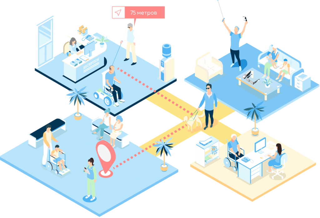
Навигация играет ключевую роль в повседневной жизни. Особенно для маломобильных групп населения, слабовидящих и незрячих людей. И наша ГИС INP способна облегчить им ориентацию в пространстве и предоставить доступ к необходимой информации.
В нашей платформе разработан специальный навигационный модуль, который позволяет строить специальные маршруты без ступенек, вести голосом по маршруту, подсказывая расстояния и места поворотов, информировать о окружающем пространстве и расположенных рядом объектах или препятствиях.
Внедрите INP для создания доступной и комфортной среды в вашем городе или здании!

Улучшение доступности
Безбарьерная среда с автоматическим определением этажа и местоположения в здании глобально упрощает самостоятельное перемещение в общественных местах МГН.

Информация об окружении
для облегчения ориентации и бесшовной навигации. Точки интереса, ближайшие объекты и препятствия, подсказки о расстояниях и поворотах при ведении по маршруту.

Умная адаптация маршрутов
к индивидуальным потребностям. Специальным маршруты ведущие без ступенек через лифты и пандусы. Запрос помощи с привязкой к текущему положению.

Голосовой помощник
Все в личном смартфоне, исключение дополнительных затрат и помощников. Интеграция голосового управления для еще большего удобства.
Зачем это нужно для МГН
Навигация для слабовидящих и незрячих является крайне важным инструментом для обеспечения им доступа к информации и ориентации в городском пространстве и зданиях. Современный город — это сложный комплекс обладающий огромной инфраструктурой.
Любому человеку нелегко ориентироваться в новых местах и зданиях с большим количеством помещений, особенно, если он оказался там впервые.
А маломобильным группам населения ориентироваться и перемещаться еще сложнее, особенно слабовидящим и незрячим. Например, найти в здании проходы без ступеней, ближайший лифт или подъемник может стать целым приключением.
В современном мире у маломобильных групп населения существует ряд сложностей с перемещением:

Мобильность
Низкая самостоятельность перемещений;

Трудности ориентирования
в городском пространстве и общественных местах;

Отсутствие современных и эффективных цифровых решений
которые помогают в пространстве.
Социальный навигатор с удобным картографическим сервисом позволит предоставить МГН возможность удобного позиционирования, поиска и движения по маршруту к точкам интереса.
С развитием технологий навигация для слабовидящих и незрячих стала более доступной. Приложения для мобильных устройств на базе INP могут позволить людям использовать свои смартфоны для определения местоположения и поиска нужных мест в окружающем пространстве.
Используя современные технологии и голосовое управление можно предоставить информации о ближайших объектах и препятствиях на пути.
Удобство для слабовидящих и незрячих
Навигация для незрячих людей может быть достаточно сложной, но в настоящее время существует множество технологий и инструментов, которые помогают им ориентироваться в окружающем мире.
Платформа Indoors Navigation Platform обеспечивает слабовидящим и незрячим специальный интерфейс с озвучкой и голосовыми подсказками, упрощая навигацию в окружающем мире.

Голосовой помощник бот «Нави».
Обеспечивающий взаимодействие с приложением и картой, позволяет добиться взаимодействия с экраном практически без кликов.

Картографический бот «Нави».
Заменяет интерфейс карты и предупредит пользователя о приближении к опасной зоне или препятствия аудио сообщениями в мобильном устройстве или установленных акустических датчиках.

Специальные акустические датчики.
Специально разработанные датчики для навигации маломобильных групп населения, способны издавать особые звуковые сигналы, позволяя слабо видящим и незрячим пользователям понять свое местоположение в пространстве, где находится объект, к которому они построили маршрут и препятствиях на пути следования.

Успешное тестирование решения Индорс Навигейшн для слабовидящих и незрячих в Московском метрополитене подтвердило эффективность и полезность:
в 5-6 раз
Быстрее определения
положения с использования
приложения INP
в 2 раза
Быстрее поиск конечной точки маршрута с использования приложения INP
90%
Положительных отзывов у участников тестирования
приложения INP
Тематические публикации в нашем блоге
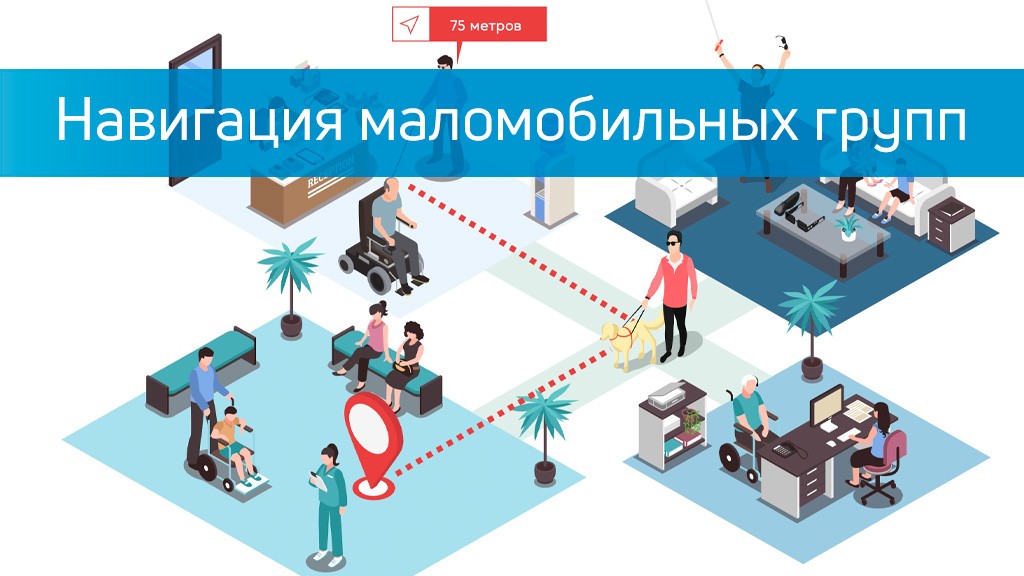
Навигация маломобильных групп населения
Часто представители маломобильных групп населения испытывают трудности при перемещении не только на улице, но и в зданиях. Особенно это касается людей, не способных передвигаться без инвалидного кресла, слабовидящих и незрячих. Приложение-навигатор, разработанное командой Indoors Navigation, позволяет…
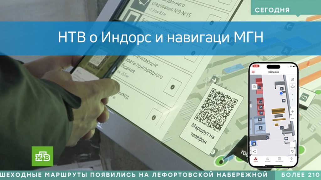
Сюжет НТВ о решении Индорс для МГН
В новостной передаче Сегодня телеканал НТВ вышел сюжет о решение Индорс Навигейшн для людей с ограниченными возможностями на железнодорожных вокзалах. В этом видео рассказано, как наша система навигации помогает людям с ограниченной подвижностью (МГН) легко ориентироваться в сложных тр…
Eдиная информационная среда для управления зданиями INP

Геоинформационная система с цифровым двойником здания.
Создание точной модели объектов для эффективной навигации и взаимодействия с посетителями.

Геолокационные сервисы внутри и снаружи помещений.
Бесшовная навигация, определение местоположения и ведение специальному по маршруту для маломобильных групп населения.

Голосовое управление и ассистент.
Упрощение взаимодействия с ГИС системой и облегчение связи с администрацией объекта по средствам мобильного приложения.

Интеграция с существующими системами и приложениями.
Универсальный доступ к информации и сервисам для слабовидящих и незрячих, подключение к имеющимся информационным системам.
Навигация для слабовидящих и незрячих людей является важным аспектом их повседневной жизни, а наше решений INP может помочь им ориентироваться в пространстве и получать доступ к информации.

INDOORS SDK iOS
Сервисы навигации для маломобильных пользователей могут быть реализована и в вашем мобильном приложении за счет внедрения INDOORS SDK для iOS и Android устройств.

INDOORS SDK Andriod
Интеграция функционала нашей геионформационной системы осуществляется за несколько часов благодаря подробной документации и открытому API.

Мы предоставляем информацию о всех возможностях нашей платформы с детальным описанием интеграции API и SDK.

Поддержка
Чтобы экономить время разработчиков мы оказываем консультации и техническую поддержку 24/7.
