2022
Навигация на выставке Иннопром 2022
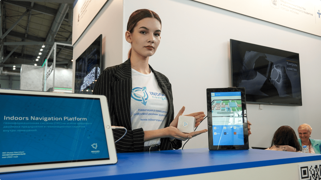
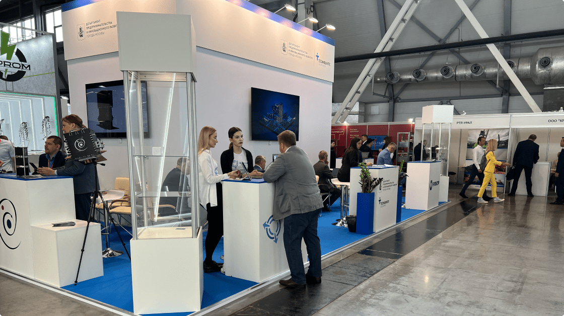
На выставке Иннопром 2022 компания Индорс Навигейшн представила свою передовую геоинформационную систему Indoors Navigation Platform (INP), созданную для обеспечения удобной и точной навигации внутри помещений
Решение INP использует цифровой двойник выставки, интегрируя технологии отслеживания материальных активов и сбор аналитических данных для повышения эффективности управления пространством на крупных мероприятиях.
более 60%
Увеличение вовлеченности посетителей
на 30%
Снижение временных
затрат на поиск стендов
Цели и задачи проекта
Ключевая задача на Иннопром 2022 состояла в том, чтобы продемонстрировать возможности Indoors Navigation Platform по навигации на мероприятиях, где присутствует множество участников и экспонентов, распределённых по сложной структуре выставочного пространства. Indoors Navigation предложила решение, которое предоставляло участникам и посетителям выставки интуитивный и точный инструмент для ориентации среди стендов, залов и мероприятий.
Система была нацелена на:
- Обеспечение точной навигации для посетителей и участников с помощью интерактивных карт.
- Отслеживание материальных активов на выставке, что позволило участникам контролировать передвижение оборудования и предметов экспозиции.
- Сбор и анализ данных о перемещениях посетителей для дальнейшего использования в маркетинговых и организационных целях.
Примеры использования
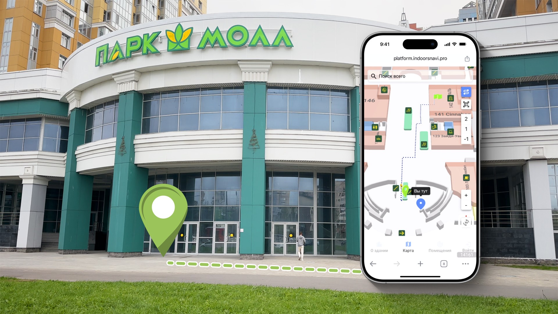
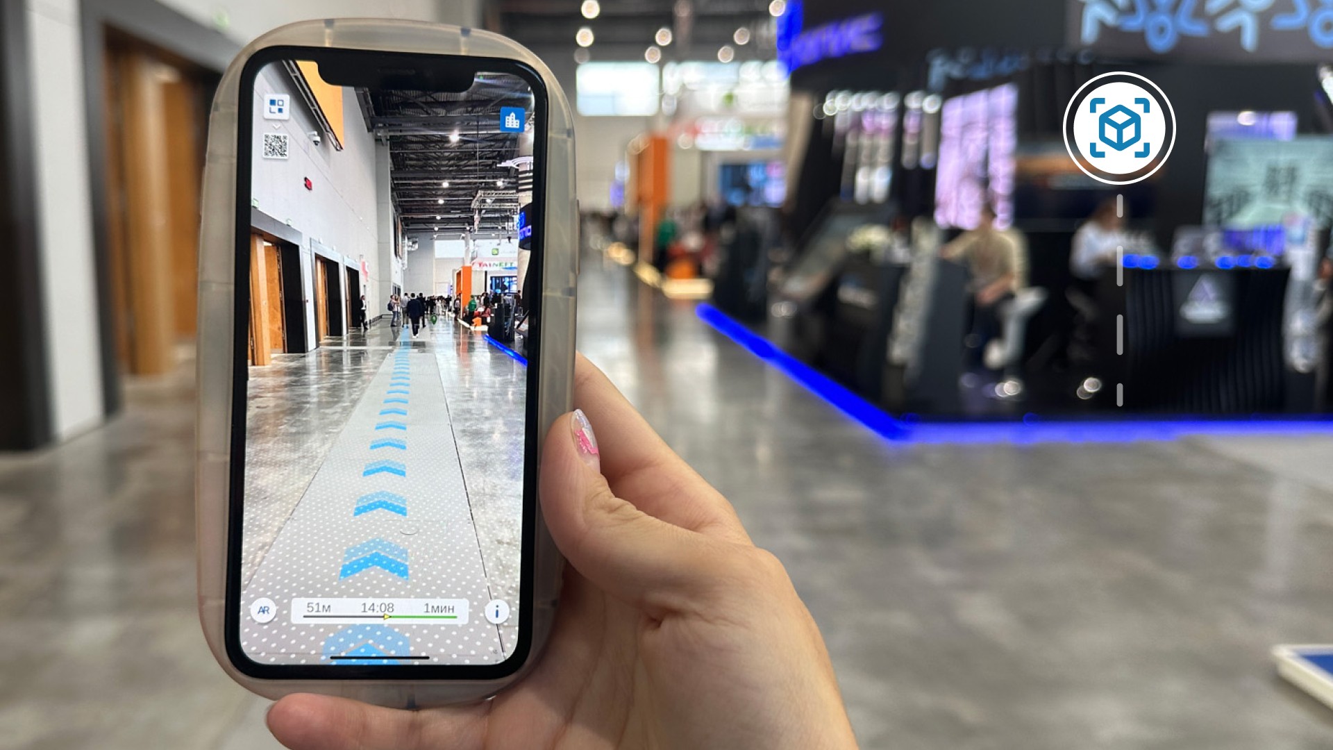
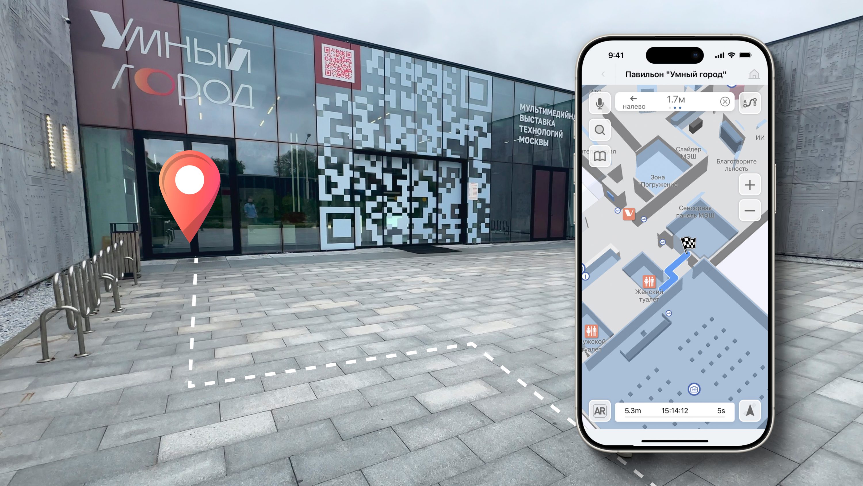
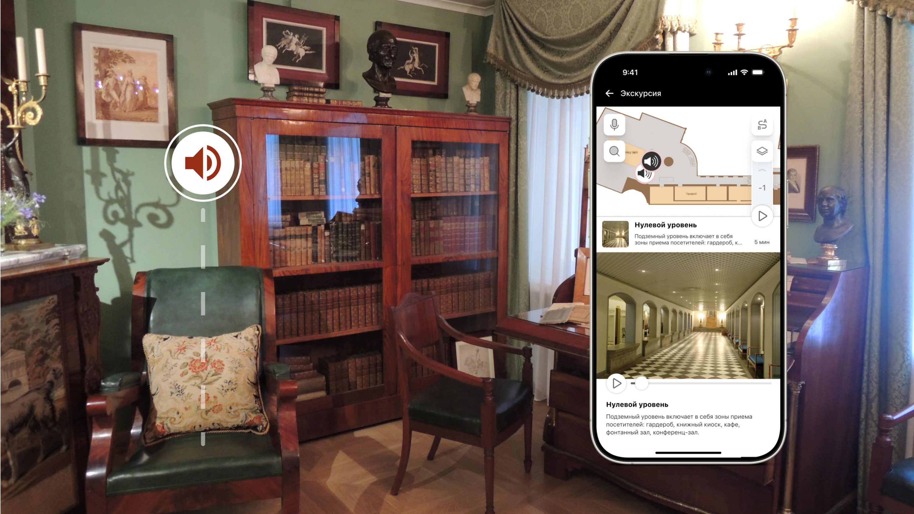
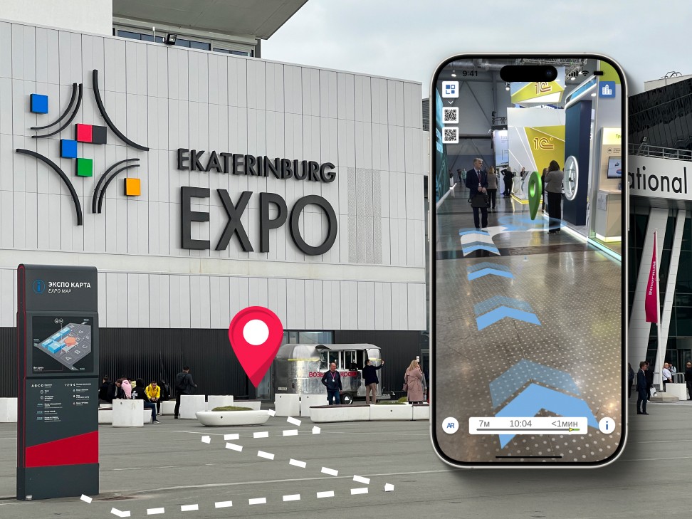
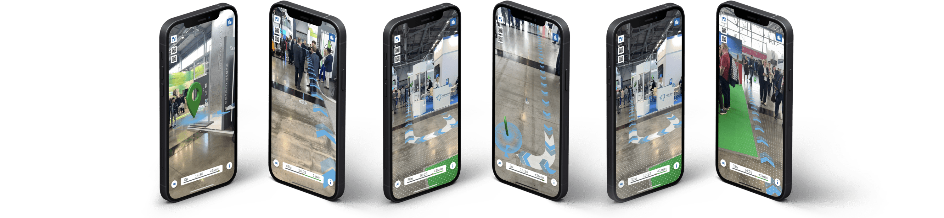
- Навигация по выставке: Посетители могли использовать мобильное приложение Indoors Navigation для того, чтобы находить стенды компаний, события и различные зоны выставки, такие как зоны отдыха, туалеты и кафе. Приложение позволяло пользователям не только ориентироваться на территории, но и строить кратчайшие маршруты к интересующим объектам.
- Отслеживание активов: Indoors Navigation Platform обеспечила отслеживание оборудования и объектов экспозиций, что позволило организаторам в реальном времени видеть, где находятся важные предметы. Это улучшило контроль за выставочным пространством и снизило риск потери активов.
- Аналитика посещаемости: Система позволяла собирать и анализировать данные о перемещении посетителей, строить тепловые карты посещаемости стендов и зон, что дало организаторам ценную информацию для оптимизации будущих мероприятий.
Техническая архитектура
Для реализации Indoors Navigation Platform на выставке Innoprom 2022 использовались следующие компоненты:
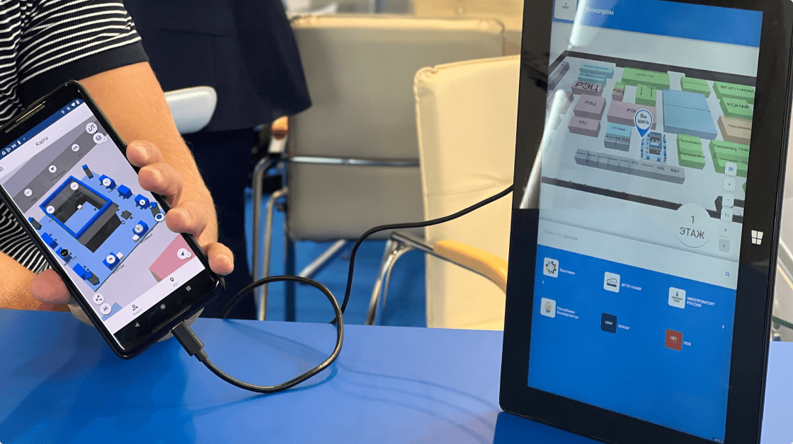
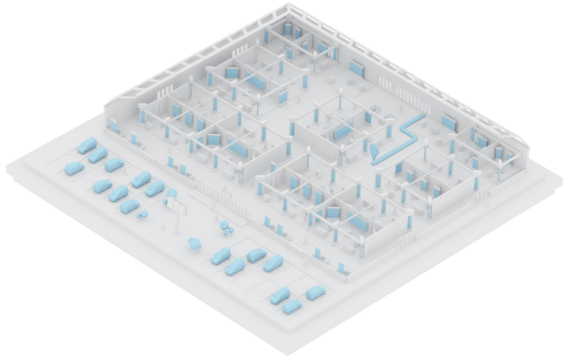
- Цифровой двойник выставочного комплекса: Точная 3D-модель выставочных залов и помещений, которая была доступна как через веб-виджет, так и через мобильное приложение.
- BLE-маяки: Использовались для отслеживания местоположения пользователей и активов в реальном времени.
- Централизованная панель управления: Участники могли управлять навигацией и контролем активов с одного интерфейса, что обеспечивало оперативное внесение изменений в маршруты и карты.
Потенциальные метрики
- Увеличение вовлеченности посетителей: Более 60% посетителей выставки использовали мобильное приложение для навигации, что позволило им значительно сократить время на поиск нужных стендов.
- Снижение временных затрат на поиск стендов: Благодаря точной системе навигации посетители тратили на 25-30% меньше времени на поиск интересующих объектов по сравнению с традиционными картами и путеводителями.
- Улучшение контроля над активами: Indoors Navigation Platform позволила сократить риск потери или перемещения выставочного оборудования, что снизило издержки на логистику и управление экспонатами.
Результаты внедрения
Внедрение Indoors Navigation Platform на Иннопром 2022 позволило улучшить взаимодействие посетителей с экспонатами и участниками выставки. Система доказала свою эффективность в условиях большого потока людей и сложной структуры выставочного пространства. Приложение и веб-виджеты значительно упростили передвижение по выставке, а также предоставили организаторам и участникам мощные инструменты для аналитики и управления активами.
Заключение
Использование INP на крупных выставках, таких как Иннопром, показывает огромный потенциал системы для улучшения пользовательского опыта и оптимизации управления пространством. Технологии навигации, трекинга активов и сбора данных помогают организаторам не только создавать комфортные условия для посетителей, но и получать ценную аналитику для повышения эффективности будущих мероприятий.
Навигация на выставке
Применение навигации внутри выставочных пространств позволяет сделать посещении более удобным и предоставить администрации подробную информацию о их участниках с аналитикой перемещений
Тематические публикации в нашем блоге
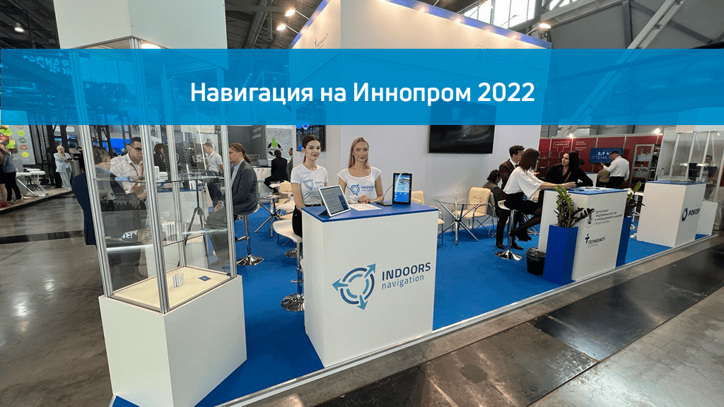
Навигация на Иннопром 2022
Компания Индорс Навигейшн приняла участие в выставке Иннопром 2022, где представила свою гео-локационную платформу на основе цифрового двойника объекта для навигации в помещениях, отслеживания материальных активов и сбора аналитической информации.