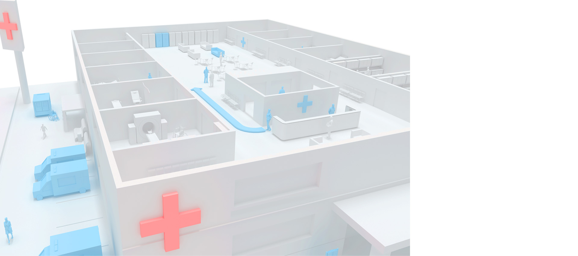
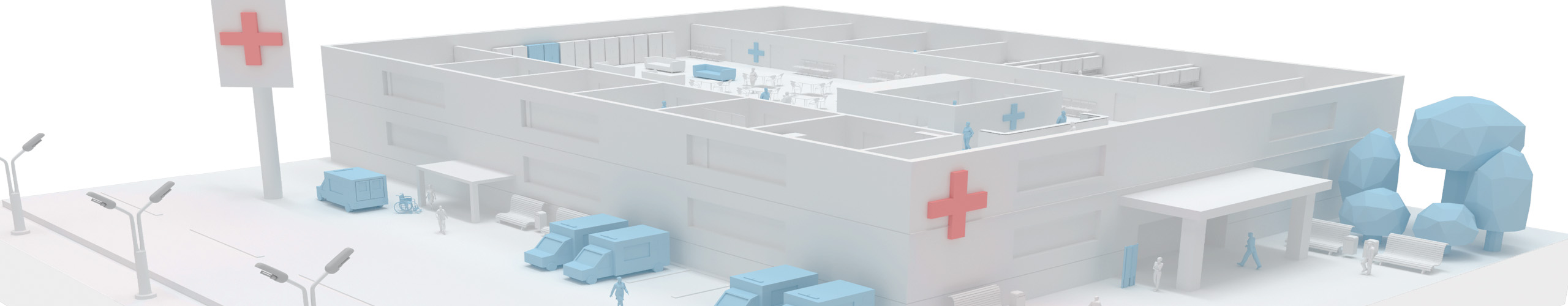
Навигация в больницах
Применение современных систем позиционирования для помещений позволяет повысить качество обслуживания посетителей, упростить работу медицинского персонала и сократить операционные расходы медицинского учреждения.
Цифровизация медицинских учреждений позволяет поднять уровень ухода за пациентами, создавая максимальный комфорт пребывания и положительный пользовательский опыт.
Решение INP успешно помогает управлять внутренними процессами больниц и поликлиник, эффективно распределять нагрузку на персонал, администрировать материальные ресурсы и оборудование.
Аналитические данные говорят о том, что 20% посетителей просит помощи у медицинских работников с подсказкой маршрута, тем самым отвлекая его от прямых обязанностей.
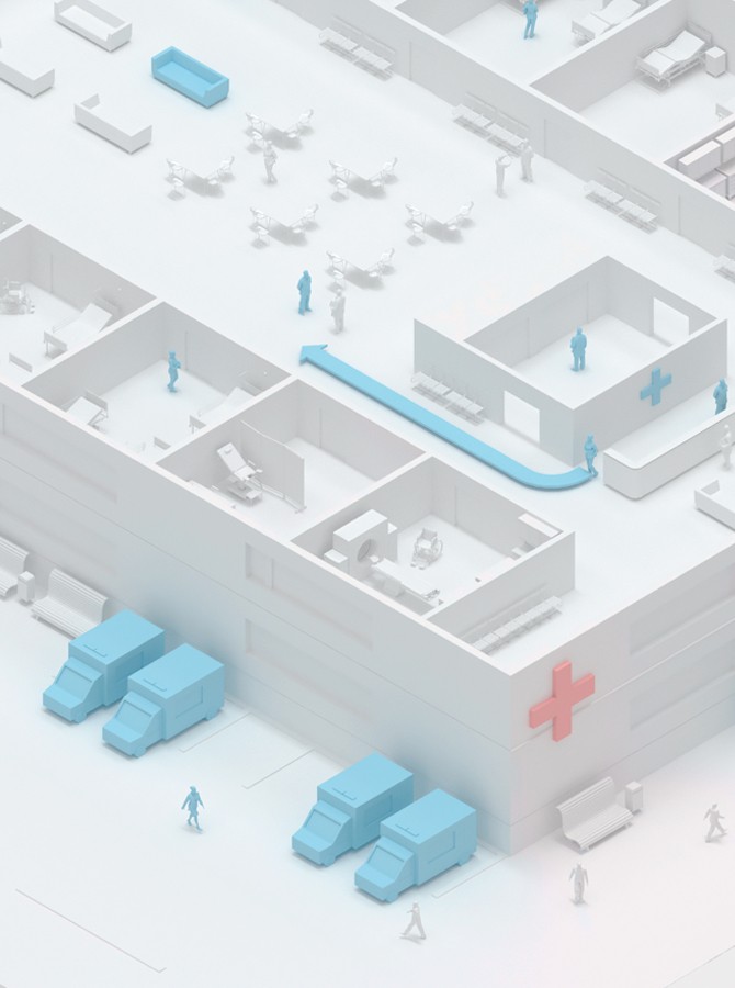
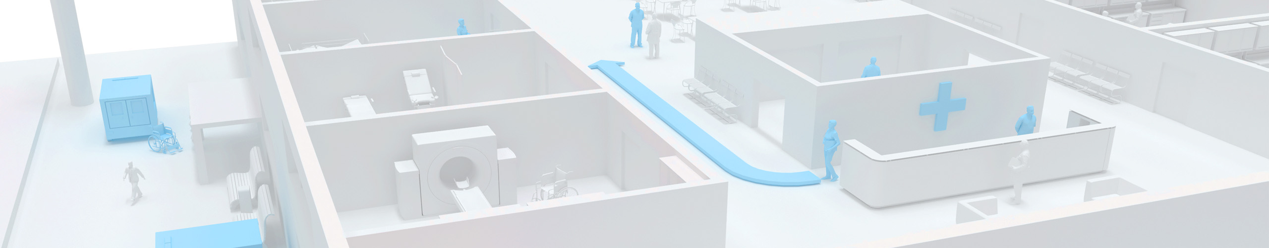
Часто в медицинских учреждениях посетители регулярно сталкиваются с определенными сложностями в поиске нужного кабинета или палаты. Наличие нескольких корпусов, переходов и запутанных коридоров значительно усложняет ориентирование и заставляет пациентов тратить лишнее время на поиск нужного места. С похожими сложностями сталкивается и персонала, который не успевает вовремя приходить в палату для оказания помощи.
В любой поликлинике и больнице всегда актуальна проблема поиска нужного оборудования и препаратов, контроля их перемещения и сохранности. Пропавшие материальные активы повышают издержки и усложняют работу сотрудников.
Платформа Indoors Navigation Platform (INP) применима для решения задач управления инфраструктурой любых медицинских учреждений: поликлиники, больницы, диагностические центры, скоропомощные стационарные комплексы.
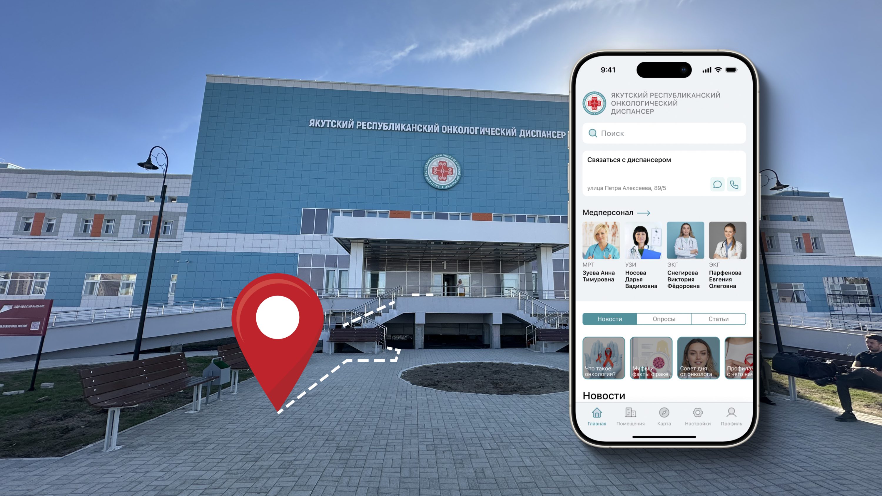
Геоинформационная система (ГИС) и Indoor-навигация для посетителей больниц и поликлиник – это возможность визуализировать свое расположение и нужное помещение в медицинском учреждении в real-time режиме.
Посетителю достаточно использовать свой мобильный телефон, чтобы искать требуемые кабинеты врачей, палату во время посещения больницы, комнаты сдачи анализов или прохождения процедур. Добраться до них с минимальной тратой времени благодаря кратчайшему маршруту и ведение по нему как в навигаторе, а в результате получить максимальное удовлетворение от посещения повысив уровень лояльности к данному медицинскому учреждению.
Преимущества внедрения геоинформационной системы (ГИС) для больниц и поликлиник:
Улучшение качества обслуживания пациентов:
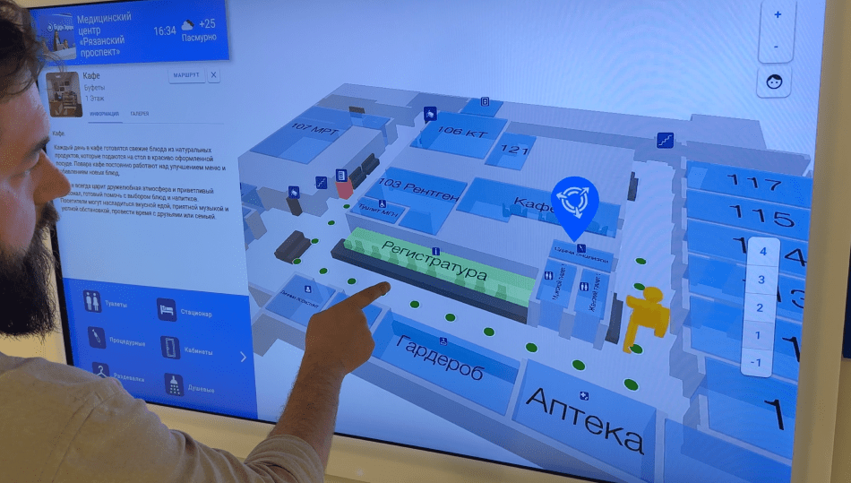
С использованием системы навигации в поликлинике или больнице посетители смогут быстрее находить кабинет нужного врача, процедурные или комнаты сдачи анализов. ГИС создаст кратчайший путь до нужной точки и сэкономит время, построив маршрут с учетом лестниц и лифтов для МГН
Отслеживание оборудования и препаратов в больнице:
ГИС позволяет оптимизировать управление активами больниц через решение трекинга активов. Сотрудники медицинского учреждения смогут быстро отслеживать расположение оборудования (узи аппараты, инвалидные коляски и др.), минимизируя время его поиска. Значительно снизится пропажа дорогостоящих препаратов
Мониторинг персонала поликлиники:
ля увеличения эффективности труда за счет оптимизация рабочего времени медицинских работников и контроля выполнения ими своих обязанностей применяется система трекинга. Сотрудники буду больше времени на уход за пациентами и меньше на курение или распитие чая, зная что их руководство обладает такой информацией
Обеспечение социальной дистанции и запретных зон:
ГИС автоматически информирует о большом скоплении людей в одном помещении или попадании в опасные (запретные) зоны
Электронная очередь и информирование:
ГИС может вести мониторинг электронной очереди с привязкой к гео позиции и отправлять посетителям уведомления когда подходит их черед заходить в кабинет

Клиентоориентированность
Новый стандарт обслуживания посетителей и ухода за пациентами позволяет создать максимальный комфорт при посещении поликлиники или больницы.
Применение современных систем позиционирования для помещений позволяет повысить качество обслуживания посетителей, упростить работу медицинского персонала и сократить операционные расходы медицинского учреждения.
Упростите ориентирование за счет многофункциональной карты и навигатора на уже привычных всем устройствах.
Используйте нашу платформу INP с широким набором современных маркетинговых и аналитических инструментов обеспечив безопасное и эффективное обслуживание пациентов и упростите работу персонала.

Что получает пациент и посетитель:
- Карта поликлиники или больницы с корпусами, кабинетами врачей и палатами.
- Построение маршрута и ведение по нему до любого объекта в реальном времени.
- Получение персонализированных уведомлений с учетом положения.
- Удаленная запись к врачу и электронная очередь.
- Отчеты по визитам в кабинеты и история посещений.
- Канал коммуникаций с медицинским учреждением, целевые чаты и отзывы по врачам.
- Безбарьерная среда для маломобильных групп населения (МГН).
- Электронный помощник и гид для МГН, в том числе и незрячих.
- Геймификация процесса посещения за счет применения дополненной реальности. AR навигация в поликлинике и виртуальные игровые сценарии.

Цифровизация
В современных реалиях ключевым инструментом управления является цифровизация процессов, происходящих на всех уровнях функционирования медицинского учреждения.INP успешно помогает управлять внутренними процессами медицинских учреждений.
Упростите для сотрудников управление большим медицинским центром или больницей, состоящей из нескольких зданий, позволяя эффективнее распределять нагрузку и ресурсы.
Отправляйте персонализированные и релевантные уведомления пациентам и сотрудникам, гарантируя своевременное ознакомление с ними при попадание в определенную зону.

Что получает медицинское учреждение:
- Интерактивная карта поликлиники или больницы со всеми объектами и активами на нихю
- Статистические данные и аналитические отчеты в разных разрезах времени.
- Отслеживание перемещений медицинских сотрудников, оборудования и препаратов в режиме реального времени на карте, повышение сохранности материальных активов больницы.
- Возможность управлять рабочими процессами в online режиме.
- Оптимизация потоков пациентов и посетителей.
- Новый канал обратной связи с пациентами в одной платформе.
- Повышение безопасности пациентов и медицинских работников .

Эффективность и актуальность
Внедрение геоинформационной системы INP, применение инструментов позиционирования и трекинга, сможет повысить эффективность работы поликлиник и больниц на 12%, снять 5% нагрузки с медицинских работников, улучшить качество обслуживания пациентов на 20%, а сохранность активов на 35% (оборудования и препаратов).
Тематические публикации в нашем блоге
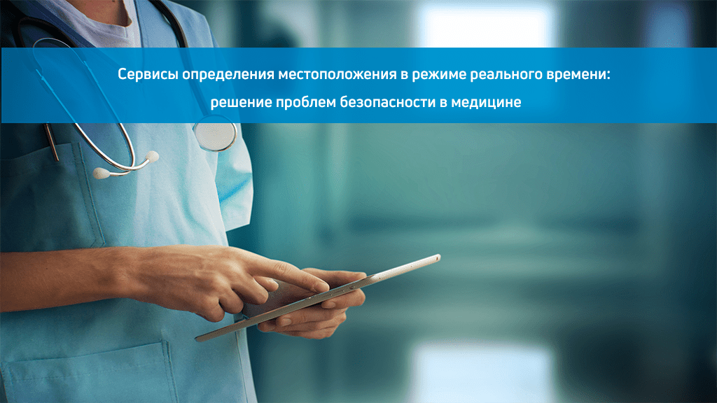
Сервисы определения местоположения в режиме реального времени: решение проблем в медицине
Пандемия значительно увеличила нагрузку на работников здравоохранения из-за высокого числа пациентов в критическом состоянии, сокращения препаратов и повышения рисков заболевания. Для многих сотрудников возросшая нагрузка…
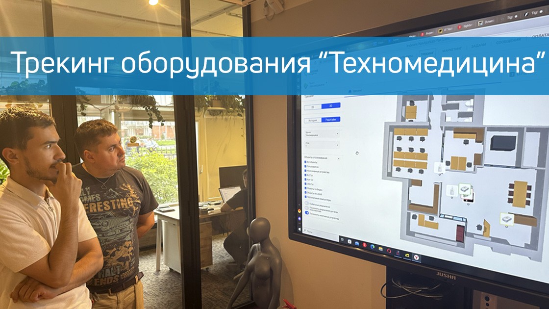
Трекинг медицинского оборудования
Команда Индорс Навигейшн развернула систему отслеживания перемещения персонала и медицинского оборудования в шоуруме официцального дистрибьютора профессионального медицинского оборудования, компании Техно Медицина. В нескольких помещениях было установлено оборудование — приемники для счи…
Тематический кейс в нашем портфолио
Часто задаваемые вопросы по Indoors Navigation Platform (INP) в медицинских учреждениях (FAQ)
Как система внутреннего позиционирования INP помогает улучшить обслуживание в медицинских учреждениях?
Медицинские учреждения в основном переполнены и имеют большие внутренние помещения. Пациентам бывает сложно найти подходящее место для приема. С системой внутреннего позиционирования INP пользователи могут легко найти нужную кабинеты без какого-либо стресса.
Могут ли посетители получать дополнительные сведения о медицинском учреждении с помощью системы INP?
Да, система INP может предоставлять посетителям дополнительную информацию о медицинском учреждении, такую как расписание приемов, информацию о врачах и многое другое.
Какая информация доступна пользователям в приложении INP?
В приложении INP пользователи могут просмотреть карту здания, найти нужную комнату или палату, получить инструкции по пути следования получить информацию о расписании приемов и услугах.
Как внутреннее позиционирование может помочь в управлении чрезвычайными ситуациями в больницах?
В чрезвычайных ситуациях система внутреннего позиционирования INP может помочь в отслеживании активов и персонала. Карты покажут расположение всех важных машин и местонахождение врачей. Это поможет быстро реагировать в опасных для жизни ситуациях.
Можно ли использовать систему внутреннего позиционирования INP для отслеживания медицинского оборудования?
Да, система внутреннего позиционирования INP может быть использована для отслеживания расположения медицинского оборудования. Это может помочь в быстром нахождении нужного оборудования в случае необходимости и повышения его сохранности.
Как работает система внутреннего позиционирования INP?
Геоинформационная система INP использует различные технологии: Bluetooth, Wi-Fi, AoA BLE, UWB, GPS и Глонасс для отслеживания местоположения пациентов и персонала внутри здания. Информация о местонахождении отображается на карте в браузере, инфомате и мобильном приложении, которое пользователи могут использовать для навигации.
Сколько времени занимает внедрение интерактивной навигации INP в медицинском учреждении?
Как правило внедрение интерактивной навигации занимает около одной недели. Подробнее можно ознакомиться с описанием процесса интеграции можно в разделе документация.
Требует ли технология каких-либо дополнительных установок оборудования?
Система внутреннего позиционирования INP может работать в браузере без использования дополнительного оборудования. Если требуется отслеживание в реальном времени, то требует установка оборудования в соответствии с выбранной технологией: позиционных BLE датчиков, Wi-fi / Buetooth шлюзов, UWB приемников или AoA локаторов.
Какова точность системы внутреннего позиционирования INP?
Точность системы внутреннего позиционирования INP может зависеть от типа используемого оборудования и выбранной технологии, и может варьироваться от 0.5 метра до 3-ех метров.
Какие виды устройств поддерживает система внутреннего позиционирования INP?
Геоинформационная система INP поддерживает большинство современных устройств, включая смартфоны на iOS и Android, а также устройства на базе Windows и Mac OS.
Нужно ли скачивать специальное приложение для использования системы INP?
Не обязательно. В браузере можно пользоваться ГИС INP без установки сторонних приложений, достаточно просто отсканировать QR код или загрузить карту по ссылке.
Для использования возможности ведения по маршруте в реальном времени и отслеживания перемещений необходимо скачать специальное приложение, которое можно найти в соответствующих сторах для вашего устройства или интегрировать в ваше приложение по средствам IndoorsSDK.
Где хранятся все данные о пациентах и как их можно использовать?
Данные о пациентах, собранные при использовании системы внутреннего позиционирования, могут быть использованы только для оптимизации маршрутов и лучшего планирования ресурсов. Они хранятся в зашифрованном виде на серверах медицинского учреждения.
Как обеспечивается безопасность данных в системе INP?
Система INP использует современные методы шифрования данных и другие меры безопасности для защиты информации о пациентах и персонале. Вся информация хранится на защищенных серверах и доступна только авторизованным пользователям.
Следит ли система INP за моими личными данными?
Система INP собирает данные только о местоположении пользователя, и эти данные используются только для обеспечения более эффективной навигации внутри медицинского учреждения. Все данные хранятся на защищенных серверах и не передаются третьим лицам без вашего согласия.
Могут ли пациенты отключать систему внутреннего позиционирования INP?
Да, пациенты могут отключать систему внутреннего позиционирования INP в своих настройках приватности. Однако, это может затруднить поиск нужных кабинетов или палат, и они могут потребовать дополнительного времени на ориентирование.
Можно ли интегрировать систему внутреннего позиционирования INP с другими медицинскими системами?
Да, система внутреннего позиционирования INP может быть интегрирована с другими медицинскими системами, такими как системы управления пациентами, электронной медицинской картой и другими.
Как определяется стоимость внедрения индор навигации в больнице или поликлинике?
Стоимость внедрения навигации в помещениях поликлиники или больницы зависит от нескольких факторов, включая площадь, этажность и планировку здания, количество помещений и пользователей, тип используемой технологии и точность позиционирования, требуемый функционал системы.
Важно отметить, что внедрение индор навигации поможет сократить время и улучшить качество обслуживания пациентов, а также повысить эффективность работы персонала медицинского учреждения, что поможет окупить вложения в систему в течении нескольких лет.