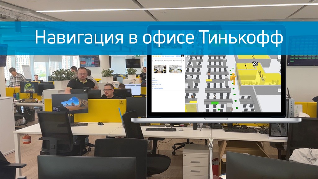
As part of a pilot project, the Indoors Navigation team implemented the geographic information system Indoors Navigation Platform (INP) at the Tinkoff office.
Платформа позволяет осуществлять навигацию в мобильном приложении с помощью позиционных датчиков, работающих по технологии iBeacon и дополненной реальности (AR), а без мобильного приложения — по QR кодам в браузере любого устройства.
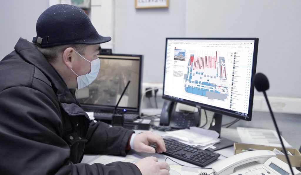
Through the control panels, the administrator can monitor the movement of users in real time, open a heat map, view the history of office movements and route tracks. You can see the test result in the video clip, the positioning accuracy is about 2 meters.
We suggest you watch the story about indoor navigation of the Russia 1 channel in our blog on the link.
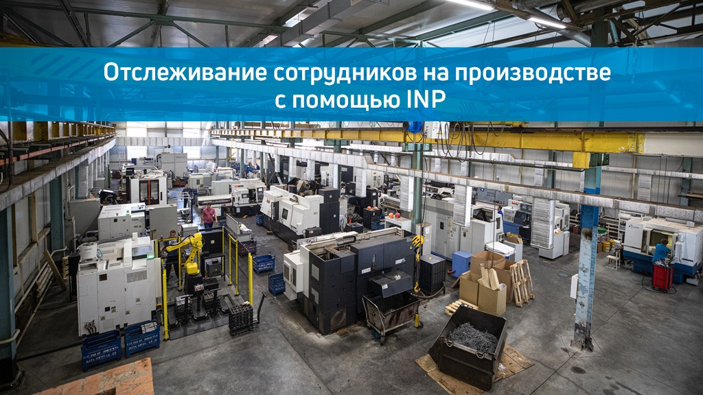
Improving work efficiency by optimizing the working hours of employees and controlling their movement at a factory or other industrial facility is one of the most important tasks for any modern company thinking about digitalizing its business processes.
The geographic information system of the Indoors Navigation Platform allows you to create a digital twin of the enterprise in the shortest possible time and at minimal cost with maximum functionality. Tracking employees in production using INP is available in all types of industrial enterprises.
We tested the operation of our geoinformation system in a manufacturing facility with a large number of metal structures and were able to achieve positioning accuracy within half a meter, as seen in the video below.
You can always easily find more detailed information about projects related to indoor positioning and the activities of Indoors Navigation in our blog..
UWB навигация — это технология cверхширокополосного позиционирование (UWB-позиционирование) — одна из самых последних технологий определения положения внутри помещений, которая дает точность до 0,5 метра.
Using Ultra-WideBand technology, it is possible to accurately determine the location of a person in a building and display it on the map of his smartphone screen, with the ability to guide a route to the desired point.
The Indoors Navigation team tested the operation of UWB equipment on the INP platform in a small office. You can see the test result in the video clip, the positioning accuracy of half a meter is achieved.
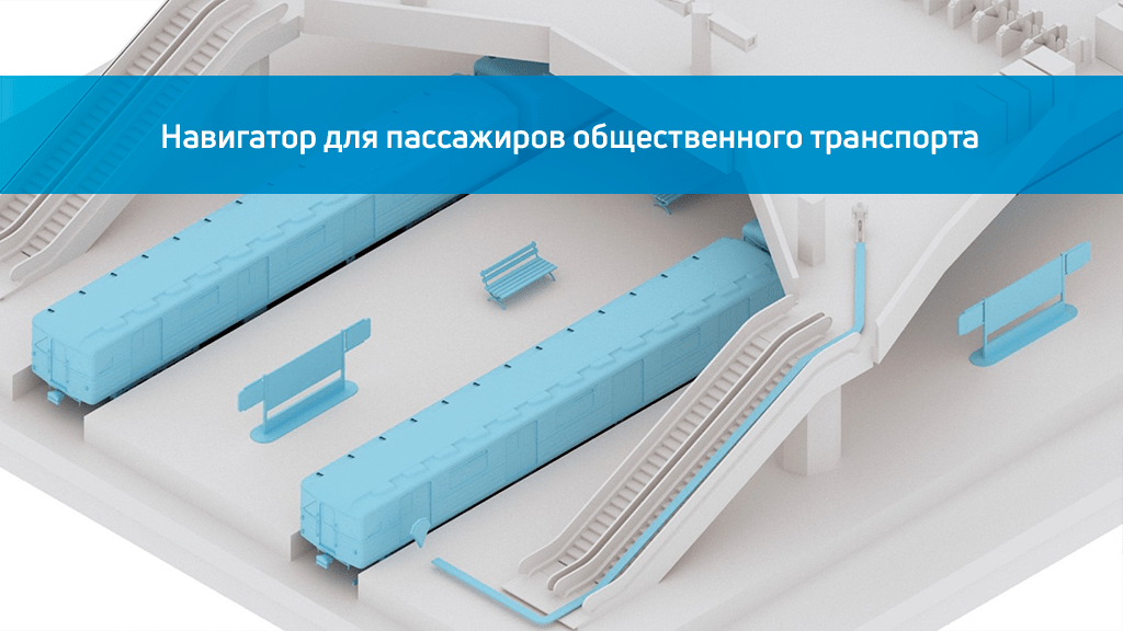
Navigation in the subway is becoming more convenient with the use of a mobile navigator for passengers, which was tested in 2022 at Tsaritsyno station.
The mobile navigator helps you quickly familiarize yourself with the map and helps you save time at the station, helping to increase the comfort level of passengers.
Indoors Navigation has digitized the entire Tsaritsyno transport hub and made a detailed map of the metro station, MCD, commuter trains, all crossings and public transport stops. As part of the project, more than a hundred navigation sensors were installed at TPU Tsaritsyno.
Using the developed mobile application, the user will be able to quickly navigate the transport hub, understand where it is located and plot a route to the area or object he needs. The navigator will keep it running continuously throughout the entire route.
The app also has a mode for navigating visually impaired and blind passengers, which helps them with voice prompts along the route. They are offered safer routes and the opportunity to order help with a click or a voice command in the application.
Using the API and SDK, the functionality can be quickly integrated into other iOS and Android applications, even by third-party developers, and update management and route editing can be performed online in the system's web dashboard.
Indoors Navigation Platform — универсальная система управления потоками посетителей, повышающая комфорт их перемещения.
For more information about the case of the implementation of the Indoors Navi positioning systems, see the link.
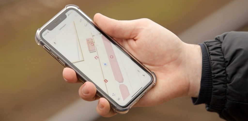
Company Indors Navigation LLC resident of the Zelenograd Innovation Territorial Cluster, she deployed a navigation system inside Pavilion F of the Expoforum in St. Petersburg at the XXII International Exhibition Radio Electronics and Instrumentation.
The organizer of the exhibition, FAREXPO LLC, relied on the use of modern technologies and provided exhibitors and visitors with a modern and convenient indore navigation system.
Now, anyone can use the mobile application to view a digital copy of the exhibition pavilion with the location of stands, exhibitors and important facilities, as well as build a route to them and move along it.
Indoors Navigation LLC (https://indoorsnavi.pro) is one of the first developers of navigation systems for buildings and has released a geolocation platform for indoor navigation based on the digital twin of the object. The platform also allows you to track movements inside the building, collect analytical information about visitors, and track personnel and valuable assets. It includes an audio guide, an augmented reality navigation module, and a navigation module for MGN with voice prompts.
Potential clients are companies specializing in the construction and management of large buildings and structures.
You can also find all the information you are interested in on our on the website, а так же скачать наше приложение для навигации по выставке вы можете с помощью QR-кода.
В течении нескольких месяцев наши сотрудники разработали специальный алгоритм определения положения в помещении на основе угла прибытия радиосигнала — Angle of Arrival (AoA).
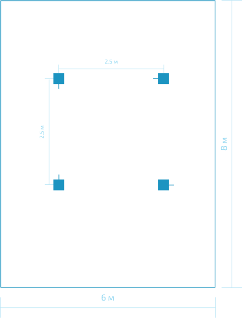
In one of the rooms of the building, we installed 4 IN-AR locators, which were connected to one IN-AoA-G gateway with a UTP cable via an Ethernet interface. Two IN-AoA-Beacon-1 BLE 5.1 tags were used as the tracking object.
The experiment was conducted in a room with a rectangular layout and dimensions of 6x8 meters. Each locator was installed at the same distance from each other and the walls of the room (see the picture). The radar antennas were pointed in different directions relative to each other.
We placed several INOA Beacon 1 markers in different places of the room and tracked their movement, constantly evaluating the accuracy of location determination in real time on the INP platform using the software we developed and a new AoA navigation algorithm.
As a result of this experiment, we obtained the accuracy of determining the position in the room using the Angle of Arrival method equal to 1 meter.
Contact us and you will receive a solution based on the latest advances in indoor positioning! We are always happy to cooperate!
To learn more about AoA technology, visit the page.
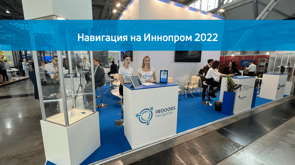
Indoors Navigation took part in Innoprom 2022, where it presented its geolocation platform based on a digital twin of an object for indoor navigation, tracking tangible assets and collecting analytical information.
In the networking area of the collective stand GBU "KRZ" demonstrated the work of its solution with a navigation accuracy of 1 meter.
Navigation in the premises of Moscow railway stations was implemented by Indoors Navigation using a Geo-information System (GIS) based on a digital twin of the facility and indoor geolocation services — the Indoors Navigation Platform.
GIS Indoors Navigation allows you to determine the location of any objects, for example, such as train stations, which are complexes with large infrastructure for passenger transportation.
It is not easy for a passenger to navigate in places with a large number of crossings and exits, when the route is not regular, and searching through navigation signs alone is not the most convenient.
By implementing navigation in railway station premises for Russian Railways at the end of 2021, in 3 months we digitized 42 stations, making accurate 3D maps with the location of the premises and routes. We installed 3,000 BLE positional sensors at 9 Moscow railway stations, set up navigation, and integrated them into a specially designed Railway Stations mobile application ( iOS and Android).
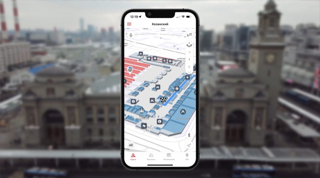
Passengers now receive an accurate map of the train station on their mobile device with the ability to plot a route to the desired point: exit, crossing, stop, while still in the train carriage, and follow it in navigator mode. This helps to reduce the time needed to navigate the passenger and the entire route.
Navigation on the station map.
The indoor positioning system is based on Bluetooth signals, but it also takes into account Wi-Fi and GPS for navigation outside buildings. Indoor navigation is enabled by the SDK built into the mobile application, which is installed on iOS and Android devices.
— В приложении пользователь находит 3д карту вокзала и актуальную информацию о каждом помещении, которая регулярно может обновляется.
— Местоположение пользователя точно определяется на карте.
— Пользователь может искать нужный объект или услугу в здании: кассы, парковки, рестораны, магазины, кафе, в том числе и в офлайн-режиме, и выбирать маршрут движения.
— Приложение создает наглядный маршрут на 2д/3д карте и ведет пользователя к нужному объекту.
— Пользователь может добавлять в избранное наиболее часто посещаемые вокзалы, оставлять отзыв о магазинах и других объектах.
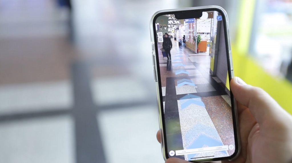
AR navigation at the train station.
By scanning a special marker in AR mode, the user can move while observing the route through the phone's camera in real space due to 3D graphics.
The augmented reality service allows you not only to show routes, but also to demonstrate creative advertising content in a playful manner with 3D animation.
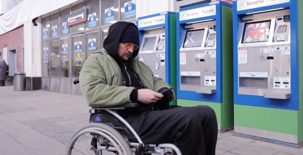
Navigation for people with limited mobility.
The application has the ability to build special routes for the category of people with limited mobility (MGN) and guide them using voice prompts only along the passages, elevators and ramps designated for them.
Marketing and analytics of movements at the train station.
The station administration receives information about crowded areas and the most congested sections in different time periods.
The owner of the premises can receive additional income through a new channel of geocontext advertising — mailing lists from tenants.
The mobile application directly informs visitors about events, closed platforms and repairs, promotions and discounts in stores by sending targeted PUSH messages based on preference data and location information.
Based on the statistics of visits, the points of attraction of the object are determined, a heat map is built and popular routes are visualized.
The application is integrated with social networks, allows you to quickly communicate with visitors and share your location.
Staff training at the train station.
To optimize work processes, a special mobile application is installed on the phone for employees, a badge or bracelet is issued, and electronic BLE tags are attached to tangible assets.
The station administrator monitors the movement of staff in real time, can control the locations and working hours of employees, and see the movement of material assets inside the building and on the territory.
Indoors Navigation Platform — a universal building management platform that allows you to solve many tasks related to determining the position of users, monitoring operational systems and services, and increasing monetization.
To learn more about the solution for navigation at railway stations, see the article our case review blog.
Our approach to indoor positioning is to develop a low-cost, easy-to-use, and efficient location system.
The Indoors Navigation Platform (INP) uses state-of-the-art mathematical algorithms to calculate the most accurate indoor location for our customers.
Let's discuss them now.
1. Метод позиционирования по «ближайшему».
Detecting the "nearest" is one of the simplest geolocation technologies that provides information about the relative location of an object. The user's position is determined using radio signals from sources (beacons) whose location in the room is known. When a mobile device detects more than one beacon, the position is determined at the location of the beacon with the strongest signal.
The accuracy depends on the deployment density of the beacons and the range of their signals. The method is implemented in the Indoors Navigation Platform (INP) using Bluetooth and Wi-Fi technology.
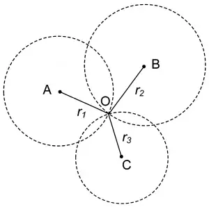
2. Methods of Lateration, Trilateration and Multilateration.
All three terms alliteration, trilateration, and multilateration refer to determining position by distance. During lateration and trilateration, the position of an object is determined by measuring its distance from several reference points. This is also called the range measurement method. In trilateration, at least three fixed known points are needed to determine the position.
3. A method based on signal parameters.
Most wireless localization systems calculate the distance to the positioning device using either time information or angle differences. In both cases, they are affected by the multipath effect. Because of this, the accuracy of the calculated location may be reduced.
An alternative method is to estimate the distance from an unknown node to a reference node. This method is only possible with the help of radio signals. Wireless systems position the device using the parameters of the received signal, with the Received Signal Power Level Indicator (RSSI) being the most widely used. RSSI measurement estimates are highly dependent on environmental interference, and they are also non-linear. These methods work with Bluetooth and Wi-Fi technology.
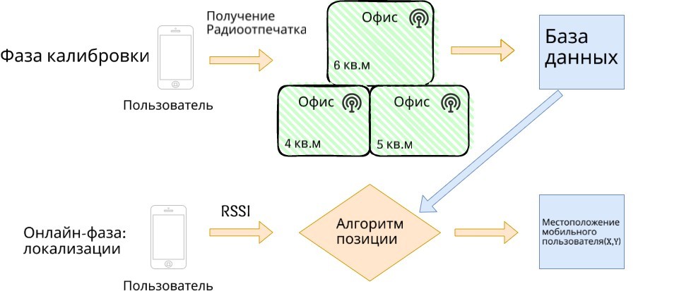
4. A method based on the reference points of the signals (fingerprint).
The fingerprint-based method is based on a built-in map of indoor signal levels and does not require the use of indoor radio propagation models. In order to determine the location using this method, a database is created containing information about signal levels at various points in the room, as well as a room plan. The signal strength map from Wi-Fi access points and Bluetooth beacons should be "linked" to real coordinates in accordance with the room plan. The user's location can be estimated by measuring the level of signals from beacons (access points) and searching for exact matches in the database, with reference to a point on the map where the same signal levels are measured.
This method consists of two stages:
Stage 1 is the so—called calibration phase, an autonomous measurement phase.
Stage 2 is the localization phase.
The stand-alone phase is designed to measure the RSSI at each control point of the room. At this stage, we collect RSSI from all beacons and in four directions at each measurement location. These collected RSSI data are stored in a database along with their measurement coordinates.
When the geolocation system is running, the mobile device measures the signal strength in an unknown location, and then the current measured signal strength values are compared with the database and the location of the greatest match is determined. Where the user's position point is moved.
This method provides a relatively high accuracy of location determination, however, due to signal reflections, periodic jumps to an unreliable position occur.
The main disadvantage of the method is the time-consuming calibration process.
Another problem with the method is its sensitivity to changes in the surrounding space: the movement of objects into the building (people, furniture), diffraction and reflections, which lead to changes in signal propagation.
To maintain positioning accuracy, the calibration process should be repeated periodically to recalculate a predefined map with signal levels.
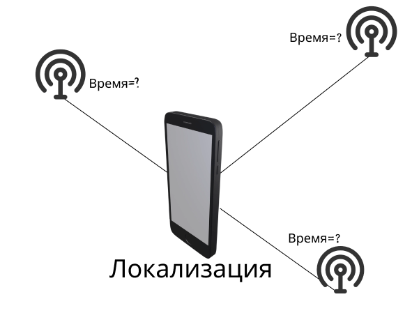
5. The method of determining the angle of arrival of the signal.
Angle of Arrival (AoA) technology is a typical ranking algorithm on some devices to determine the direction of arrival of a signal from a transmitting node, and calculate the relative position or angle between an unknown node; then triangulation or other methods are used to determine the location.
Compared to other technical solutions, AoA indoor positioning has higher accuracy and a larger coverage area, while maintenance and cost of implementation are low.
Indoors Navigation is one of the first Russian developers of geographic information systems for indoor positioning, which includes analytical and marketing tools, and a digital twin of the facility. Over the years, we have successfully demonstrated our ability to quickly adapt to new trends and realities by developing new ways to geolocate indoors. Today, indoor positioning and navigation solutions include technologies based on Wi-Fi, Bluetooth Low Energy (BLE), and AoA.
We will be glad to cooperate with you!
Contact us and you will receive a solution based on the latest advances in indoor positioning!
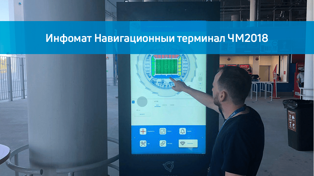
On the eve of the 2018 FIFA World Cup, we installed a navigation infomat on each floor of football stadiums for indoor navigation, familiarization with the stadium map and its exits. Infomat accelerates viewers' search for their place in the sector and optimizes visitor flows.
Инфомат для навигации Индорс Навигейшн сделан в антивандальном исполнении и может работать в неотапливаемых помещениях, оборудован кондиционером для эксплуатации летом и печкой — зимой. Как показала статистика инфомат для индор навигации пользовался большим спросом у посетителей ЧМ2018 и помогал не только найти свое место на стадионе, но и ближайший туалет или пункт питания.
The navigation stand is integrated into the general navigation information system Indoors Navi. The infomat can display advertising content set from the control panel of the Indoors Navigation Platform.
Этот веб-сайт использует файлы cookie для улучшения вашего опыта во время навигации по веб-сайту. Из них файлы cookie, которые классифицируются как необходимые, хранятся в вашем браузере, поскольку они необходимы для работы основных функций веб-сайта. Мы также используем сторонние файлы cookie, которые помогают нам анализировать и понимать, как вы используете этот веб-сайт. Эти файлы cookie будут храниться в вашем браузере только с вашего согласия. У вас также есть возможность отказаться от этих файлов cookie. Но отказ от некоторых из этих файлов cookie может повлиять на ваш опыт просмотра.
Необходимые файлы cookie абсолютно необходимы для правильной работы веб-сайта. В эту категорию входят только файлы cookie, обеспечивающие базовые функции и функции безопасности веб-сайта. Эти файлы cookie не хранят никакой личной информации.
Любые файлы cookie, которые могут не быть особенно необходимыми для функционирования веб-сайта и используются специально для сбора персональных данных пользователей с помощью аналитики, рекламы и другого встроенного содержимого, называются необязательными файлами cookie. Перед запуском этих файлов cookie на вашем веб-сайте обязательно получить согласие пользователя.