

Festival Navigation
Цифровая платформа для управления event-мероприятием и фестивалем, которая создает дополнительный комфорт посетителям, новые каналы коммуникации и рекламы спонсоров.
The use of modern positioning systems at indoor and outdoor festival venues dramatically improves the visitor experience, optimizes staff performance, and enhances event safety.
Festival digitalization enhances the visitor experience, creating positive impressions and strengthening brand loyalty. The INP solution helps effectively manage festival internal processes: monitoring visitor flow, coordinating volunteers and security services, and tracking equipment and inventory.
According to statistics, visitors spend up to 40% of their time at a festival searching for the right locations: stages, restrooms, food outlets, and medical facilities. One in five guests misses a performance of their favorite artist because they couldn't find the stage in time. One in three leaves an event with a negative impression due to disorientation and chaos.
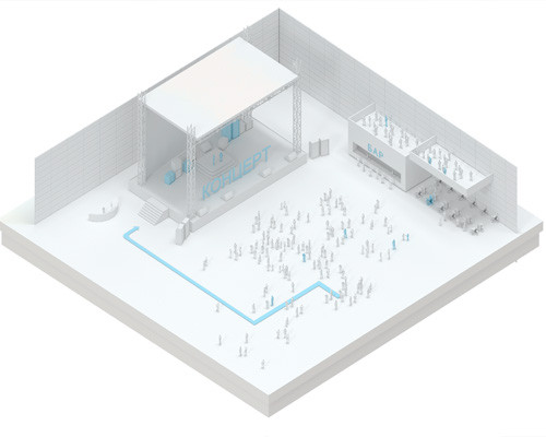
The Indoors Navigation Platform (INP) is suitable for the efficient infrastructure management of any mass event: from music festivals and sporting competitions to cultural forums and open-air exhibitions.
The geographic information system (GIS) and indoor/outdoor navigation for festivalgoers allow them to visualize the location and find necessary facilities in real time, from stages and camping areas to parking, food courts, and medical centers.
Guests simply use their smartphone—scan a QR code at the entrance or open the app—to create the shortest route and follow it as easily as a traditional city navigator. As a result, they spend minimal time searching, don't miss anything, and maximize their enjoyment of the event, which directly increases their loyalty and desire to return next year.
Benefits for the Festival

Improved Guest Experience
With the navigation system, festivalgoers can quickly find the right stages, entrances and exits, camping areas, restrooms, food courts, first aid stations, and charging points. The GIS creates the shortest route, taking into account the terrain, temporary fencing, and areas with varying traffic volumes, and also helps people with disabilities navigate the site comfortably.

Access and security management
GIS can inform guests about restricted or dangerous areas, control access to service and technical areas, help manage crowd flow near stages and in narrow spaces, and ensure safety during large gatherings. In the event of an emergency, the system displays the precise location of people and plots optimal evacuation routes.

Otslezhivaniye oborudovaniya i inventarya 37 Equipment and inventory tracking
GIS allows for efficient management of festival assets, tracking the location of sound and lighting equipment, stage structures, generators, medical kits, radios, and other equipment. This reduces search time, simplifies logistics, and eliminates the risk of loss during dismantling.

Monitoring the work of staff and volunteers
The tracking system helps optimize the work time of security staff, volunteers, technical personnel, and medical services, monitor their performance, and improve response times to emergency situations. As a result, staff can focus more on assisting guests rather than rushing around.

Real-time guest information and service
The system allows visitors to receive personalized push notifications about upcoming performances, schedule changes, special guest set start dates, food court promotions, and parking occupancy. Integration with an electronic queue management system for food outlets and device charging stations is also possible.


Client orientation
Современный стандарт обслуживания на массовых мероприятиях — это не только качественный звук и артисты, но и продуманный цифровой сервис. Фестиваль, где гость не теряется, не стоит в бесконечных очередях и получает всю нужную информацию в смартфон, запоминается надолго. Посетитель с высокой вероятностью вернется в следующем году и порекомендует событие друзьям.

Advantages for visitors:
- Interactive map of the entire festival area: stages, camping, parking, food courts, toilets, first aid stations, lounge areas, charging points and water stations.
- Route planning and real-time navigation to any point within the territory, taking into account fences, terrain, and crowds.
- Personalized notifications based on the guest's current location: "Your favorite artist will start on the Main Stage in 5 minutes," "The food court at Entrance A is now available."
- Удалённое бронирование услуг: заказ еды из фуд-корта к определенному времени, бронирование места в лаунж-зоне или на парковке, запись на мастер-класс.
- Electronic guide and assistant for people with disabilities, including voice navigation for visually impaired guests, information on accessible routes and areas with ramps.
- Visit history and the ability to rate each zone, scene, or activity helps organizers improve the event in the future.
- Communication channel with the organizers: targeted chats by zone, quick feedback, the ability to file a complaint or report a problem (broken toilet, overflowing trash can, emergency medical care).
- Gamification of the stay: use of augmented reality (AR) for navigation around the territory, virtual quests with prizes from partners, "Visit all scenes" challenges with cumulative bonuses.


Digitalization of events and festivals
In today's world, digitalization of processes at all levels is becoming a key tool for managing mass events. The INP platform successfully helps manage the internal processes of festivals of any complexity: from a local open-air event to a multi-day international event.
Simplify your team's management of a large festival site with multiple stages, camping areas, parking, and support facilities. Efficiently distribute workloads, optimize staff performance, and make decisions based on real-time guest traffic data.
Send personalized and relevant notifications to attendees and staff, ensuring they are kept informed when they are in a specific festival area - be it the stage, food court or entrance area.

What do festival organizers receive:
- Interactive map of the territory with all objects: stages, technical areas, food points, toilets, first aid stations, entrance areas, parking, camping.
- Statistical data and analytical reports in various time frames: heat maps of footfall, scene and zone occupancy, peak hours, visitor routes.
- Tracking personnel and equipment movements in real time on a map, improving employee safety and the security of festival assets.
- The ability to manage work processes online: monitor the execution of tasks by services, distribute volunteers to hot spots, and coordinate technical personnel.
- Optimization of guest flows within the territory, identification of bottlenecks and "dead zones", redistribution of food outlets and restrooms for next time based on real data.
- New guest feedback channel in one platform: collecting reviews, suggestions, complaints and promptly solving problems right during the event.
- Improving the safety of guests and staff: access control to service and hazardous areas, automatic notification of crowds, evacuation management with indication of the location of each visitor.

The relevance of implementing the GIS Indoors Navigation Platform when holding events
The implementation of the INP geographic information system and the use of positioning and tracking tools allows for a significant increase in the efficiency of festival management.
- Overall staff productivity increases by 15-20% due to route optimization and reduced downtime.
- The response time of security and medical services to incidents is reduced by 40–50%.
- Net Promoter Score (NPS) increases by 15–25 points thanks to user-friendly navigation and personalized information.
- Losses of equipment and inventory are reduced by 30–50% thanks to asset tracking.
- Sponsor revenue increases—you provide them with heat maps and data on the actual traffic volume of their areas, not promises.
Thematic publications on our blog
3 Ways to Improve Food Delivery Services Using Bluetooth Beacons
We live in a world where, most of the time, people are either too busy to cook or too lazy. This is why food delivery services around the world had high revenues (USD 121.848 million) in 2018. Predicted…
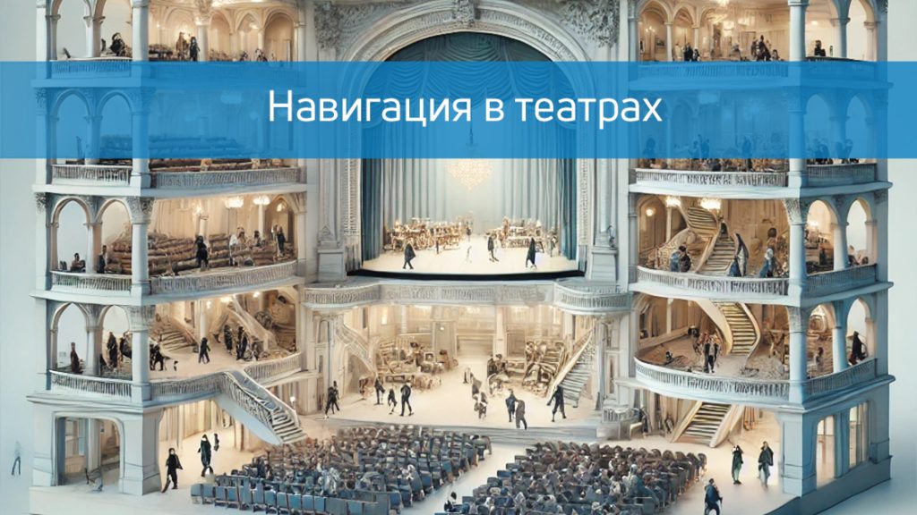
Modern navigation in theaters
A visit to the theater is always a celebration of art and culture. However, in large and modern theaters, visitors often face problems that can make it difficult to fully enjoy the event: finding the right room, confusing routes, long queues at the cloakroom or buffet. Modern…
Frequently Asked questions about concert navigation
How does navigating an open-air festival differ from navigating inside a building?
In open areas, a combination of GPS/GLONASS (accuracy of 5-10 meters) and Wi-Fi positioning is used instead of BLE beacons. For areas with complex terrain or surrounded by tall structures, we add additional UWB anchors or pseudo-satellites. The user interface and routing remain as user-friendly as indoors.
Do guests need mobile internet for navigation to work?
Yes, internet access is required to download the map and create a route. We recommend that organizers provide guest Wi-Fi at key entry points or offer an offline mode: the site map downloads once when first opened and then works without a network connection. This is a mandatory requirement for events in remote locations with poor coverage.
How does the system behave in large crowds (thousands of people in one area)?
How does the system behave in large crowds (thousands of people in one area)?
Is it possible to integrate the INP system with the festival ticketing system?
Yes. We transmit data about guests' actual passage through different zones to the ticketing system (e.g., "visitor entered the VIP zone"). This allows us to automatically redeem tokens, verify access rights, and collect analytics by guest category (regular ticket / VIP / press / volunteers).
How quickly can a system be deployed at a festival that takes place once a year?
We are ready to launch navigation 2-4 weeks before the event. The minimum lead time is 1 week for basic QR navigation (map digitization, POI uploading, code generation). Real-time positioning (BLE) requires 2-3 weeks, including beacon installation (usually 1-2 days) and calibration. We work with clients who contact us a month before the event.
Can the system be used for festivals with changing locations from year to year (road shows)?
Yes, that's our specialty. We create a digital twin of a new location based on satellite imagery, field measurements, or plans you provide. All setup is done remotely. BLE beacons are small, autonomous devices that are easily transported and reinstalled at a new location. You invest in the equipment once and use it at all your events.
How will visitors know about the existence of navigation at the festival?
Комплексная коммуникация:
- Инфоматы (киоски) на крупных узловых точках для гостей без смартфонов или с разряженными телефонами.
- QR-коды на входных билетах, программках, информационных стойках, указателях и каждом стенде.
- Баннеры при входе: «Сканируй QR — не потеряй любимую сцену».
- Ссылка на карту в push-уведомлениях, SMS и email-рассылках перед фестивалем.
- Анонс на официальном сайте и в соцсетях.
Is it possible to display sponsored ads in a navigation app?
Yes, and this is one way to monetize. You can place banners on the map (for example, "Relaxation area from sponsor X"), in POI cards, and in push notifications ("Sponsor Y invites you for coffee at the main stage"). A real-time report on impressions and clicks is provided to the sponsor.
What happens to the system after the festival ends? Is all data lost?
No. You receive a full analytics dump: daily heat maps, flow patterns, hourly zone occupancy, staff efficiency, and service response times. This data is invaluable for planning the next event: which zones to expand, where to add entrances, where to place more restrooms or food outlets. You also get to keep the equipment (BLE beacons, gateways) and reuse it next year.