RSSI in Indoor Asset Tracking systems

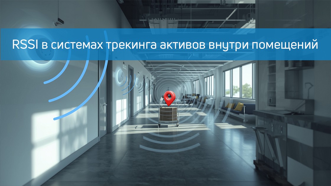
RSSI (Received Signal Strength Indicator) is an indicator of the received radio signal power, measured in decibels (dB). The closer the number is to zero, the stronger the signal, and values like -80 dB indicate significant attenuation. In the systems internal positioning (indoor navigation) RSSI serves as one of the key tools, especially where GPS is unavailable. It is most often used with technologies such as Bluetooth Low Energy (BLE) and Wi-Fi (IEEE 802.11).

In BLE networks, RSSI helps to estimate the relative distance between the transmitter (tag, beacon) and the receiver, for example, to assess the quality of the connection or the power consumption of devices. In Wi-Fi networks, this indicator is used not only for positioning, but also for analyzing coverage, network diagnostics, and solving connection problems.

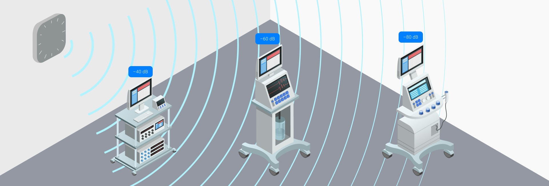
Here, the "noise level" is a background electromagnetic "blockage", and the calibration coefficient adjusts calculations for specific equipment. Since devices from different manufacturers may interpret the RSSI differently, the measurement scale may vary. The typical operating range is approximately -80 dB to -30 dB (the minimum level is when the device is very close to the transmitter).

How RSSI is used for indoor positioning and asset tracking

In the systems indoor asset tracking (asset tracking within RTLS — Real-Time Locating Systems) RSSI is one of the simplest and most affordable solutions. Its popularity is explained by the fact that many devices already support BLE or Wi-Fi, meaning there is no need to introduce expensive additional equipment.

To build a tracking system, you need:

  • Beacons or tags (e.g. BLE tags, sensors, smartphones) that emit a signal;
  • Receivers (gateways) that register the signal strength;
  • A software platform (RTLS) that collects RSSI, analyzes data, and calculates asset positions.

Using the drop in signal power as you move away, the system can estimate the distance between the beacon and the receiver.

Algorithms based on RSSI

The classical mathematical model used to calculate distance based on a signal is power loss (attenuation) model:

Where:

  • P(d) — measured signal strength;
  • d is the distance between the devices;
  • A and B are constants specific to a particular transmitter.

By default, A=−82A = -82A=-82, B=3B = 3B=3 are often used for BLE devices, but in practice, engineers "calibrate" these parameters for a specific environment, which significantly increases accuracy.

Then, to determine the position of the object, you can apply partial filter (particle filter)The system creates a set of hypothetical "particles" — potential object positions, each particle is assigned a weight depending on the discrepancy between the measured RSSI and the expected one according to the model. The final position is the weighted average of these particles.

Possibilities and limitations of the RSSI method

Advantages:

  1. Cost-effectiveness — you can often use an existing Wi-Fi or BLE infrastructure;
  2. Versatility — the technology is not tied to any one standard: it works with BLE, Wi-Fi and even RFID.
  3. Ease of implementation — Easily scales to different scenarios: tracking equipment, employees or other assets.

Disadvantages:

  1. Signal interference — Walls, furniture, and metal structures affect RSSI, causing reflections, attenuation, and multipath;
  2. Limited accuracy — RSSI can most often give a "zonal" localization, with an error of several meters;
  3. Dense infrastructure is needed — especially for large rooms; lack of receivers can create blind spots;
  4. Height problems (Z-axis) — the method does not determine the vertical location well (for example, on which floor the tag is located).

Comparison: RSSI vs AoA

One of the alternatives to RSSI is AoA (Angle of Arrival, the angle of arrival of the signal). Here are the key differences:

AoA often provides greater accuracy, especially in complex environments, but it is more expensive and requires equipment that supports Bluetooth 5.1 and an antenna array.

When should I choose RSSI for indoor navigation?

If it is important cost-effectiveness and you want to use an existing infrastructure (Wi-Fi or BLE).

If allowed accuracy within a few meters: for retail analytics, geomarketing, tracking personnel or assets in a warehouse, this level of accuracy is often sufficient.

If the project does not require strict submeter accuracy: in such cases, RSSI can be combined with other technologies (for example, AoA) — RSSI covers a large area, and AoA “adjusts” coordinates in critical areas.

RSSI remains one of the most common ways to indoor localizationespecially when simplicity, versatility, and low cost are important. However, it has its limitations: accuracy, sensitivity to the environment, and the need for calibration.

If the task requires high precision (for example, for robotics, AR navigation, or warehouse automation), it's worth considering methods like AoA. But in most cases, RSSI is the optimal choice for asset tracking, analytics, and indoor navigation.

Leave a request for: https://indoorsnavi.pro/

👇 Subscribe and keep up to date with innovations! 👇

Smart navigation in modern education: how technology is changing the university

Education in the digital age

In the modern world, education is undergoing a period of large-scale transformations. According to the latest data from the Ministry of Science and Higher Education of the Russian Federation, there are more than 1,200 higher education institutions in Russia. Over 4 million students study at these universities. Hundreds of colleges and technical schools are added to this number, where about 2 million people receive education.

Every year, the number of applicants is growing, and with it the burden on the infrastructure of educational institutions is increasing. Modern universities are complex architectural complexes where dozens of buildings are interconnected by a network of passageways and stairs. For first-year students and university guests, navigating such an area can be a real challenge.

Why navigation is important for educational institutions

The problem of orientation in the space of an educational institution concerns all participants in the educational process. Students, especially first-year students, often get lost in the labyrinths of university corridors. Applicants and their parents spend valuable time searching for the right classrooms. Even permanent staff sometimes have difficulty finding new premises after redevelopment.

In these conditions, modern navigation solutions are becoming not just a convenient addition, but a necessity. They help to create a comfortable environment for all participants in the educational process and significantly increase the efficiency of the educational institution.

Innovative solutions in university navigation

Today, technology offers many ways to solve the problem of orientation in space. Digital maps with an interactive interface have become one of the most effective tools. They allow you to build the optimal route to the desired office, taking into account all the features of the building layout.

Mobile applications with geolocation function have become a real breakthrough in the field of university navigation. They not only help you find the right office, but they can also send push notifications about important events, schedule changes, or emergencies.

QR codes posted on information stands provide quick access to up-to-date information. Touchscreens at key points of the university provide detailed information about the location of facilities and services. And voice assistants make navigation accessible even for people with disabilities.

Practical application of navigation systems

Modern universities use a whole range of solutions inside their buildings. Dynamic direction indicators help you navigate in real time, and interactive floor diagrams allow you to study the layout of the premises in detail. Route indicator lights provide additional visual support for navigation.

Outdoor information stands with Wi-Fi navigation are used in the open spaces of the campus. Augmented reality technologies allow you to build routes based on the current situation on the university grounds. This is especially important during periods of bad weather or repair work.

Advantages for different user groups

Modern navigation opens up new possibilities for students. They can quickly find the right classrooms and classrooms, receive notifications about class rescheduling and schedule changes. The system suggests the location of the nearest cafes, libraries and other services, making student life more comfortable.

Applicants and their parents have the opportunity to explore the university's territory on their own, find the admissions office and get all the necessary background information. This reduces the stress of admission and creates a positive first impression of the institution.

The university staff also benefits from the introduction of modern navigation systems. Administrators spend less time explaining routes, and a unified information management system allows them to respond quickly to changes.

Global experience in the implementation of navigation systems

The world's leading universities are actively implementing innovative solutions in the field of navigation. The Massachusetts Institute of Technology uses augmented reality technology to create interactive campus maps. Stanford University uses artificial intelligence to analyze student flows and optimize routes.

The University of Cambridge has integrated biometric identification into its navigation system, which allows not only to determine the location of students, but also to provide an additional level of security. Such solutions are becoming the standard for leading educational institutions.

Russian cases

Russian universities are not actively implementing modern navigation technologies. Even Lomonosov Moscow State University does not have its own mobile application with navigation around the campus and inside academic buildings.

But the Moscow Institute of Physics and Technology has a digital web map and uses student mobile applications with augmented reality functions that help navigate not only buildings, but also on campus.

The future of University navigation

The prospects for the development of navigation systems in education look impressive. Integration with smart city systems will make it possible to create even more effective solutions for spatial orientation. The use of artificial intelligence will open up new possibilities for personalization of navigation.

The development of personalized services will make the system more user-friendly. Neural networks will be able to analyze student flows and suggest optimal routes, taking into account the current workload of rooms and corridors.

And what happened in the end

Modern navigation solutions are becoming an integral part of the educational infrastructure. They not only make life easier for students and staff, but also enhance the prestige of educational institutions, demonstrating their readiness for the technological challenges of the future.

The introduction of smart navigation systems is an investment in the quality of education and the comfort of all participants in the educational process. In the context of growing competition between educational institutions, such innovations are becoming an important competitive advantage.

Indoors Navigation company is ready to offer comprehensive solutions for the creation of modern navigation infrastructure in educational institutions of any kind.

Leave a request for: https://indoorsnavi.pro/

👇 Subscribe and keep up to date with innovations! 👇

#secondary

Обращение успешно отправлено!