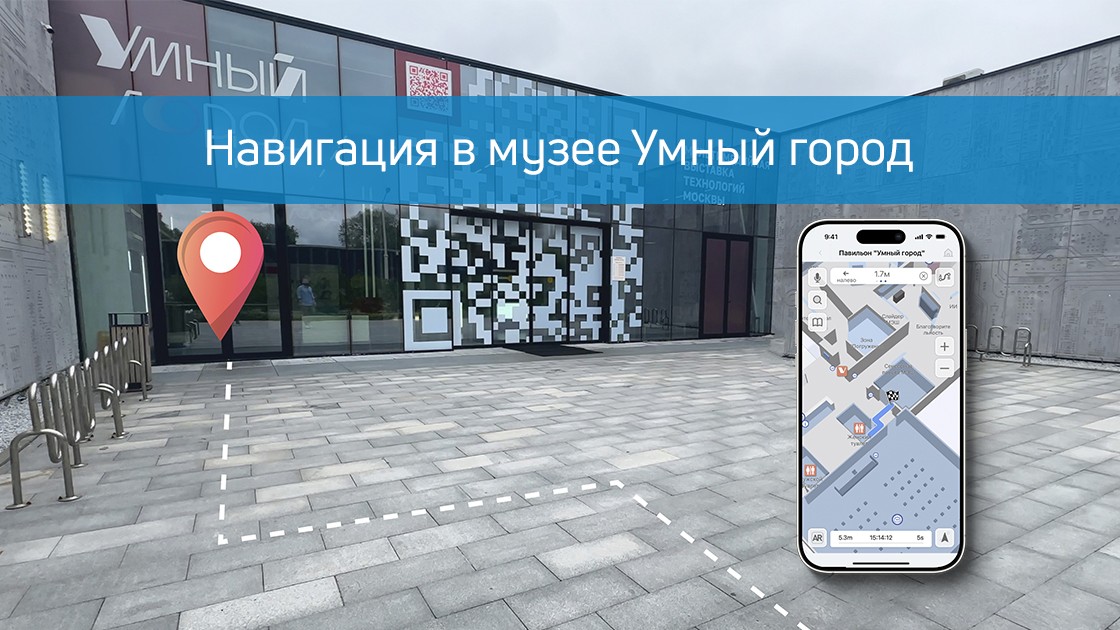
What happens if you combine the museum with smart city technologies? The Smart City pavilion at VDNH will turn out to be a living laboratory of the future, where we, the company Indoors Navigation, have implemented one of the most comprehensive projects of digital transformation of the exhibition space.
In this video, we will show how modern navigation and positioning technologies create a fundamentally new experience for visitors and provide powerful management tools for the administration.
You will see how it works.:
🗺️ A single geographic information system based on the digital twin of the entire pavilion. 📱 A mobile application with intelligent navigation and AR routes. 🎧 A "smart" audio guide that automatically turns on at the desired exhibit. 👁️ A video tracking and analytics system for managing visitor flows. 🌐 A virtual 360° tour that allows you to plan a visit from home.
Our project is not just a map in your phone. It is a complex ecosystem that makes visiting a museum a fascinating journey, and its management is efficient and data-oriented.
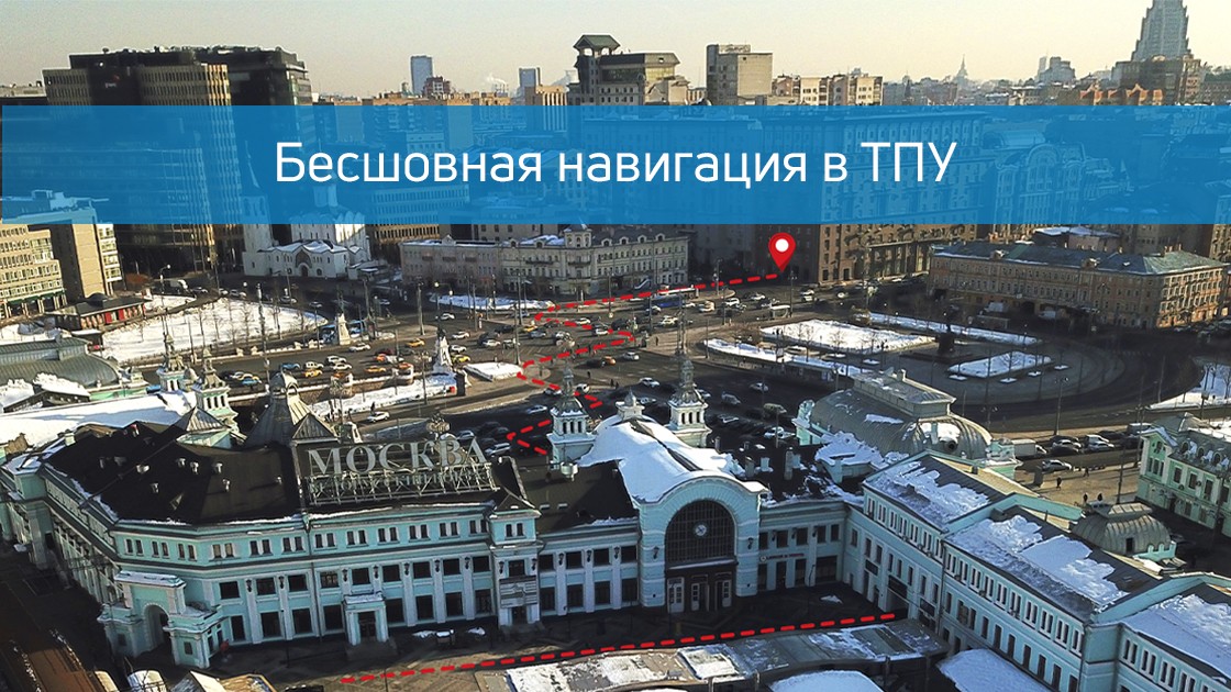
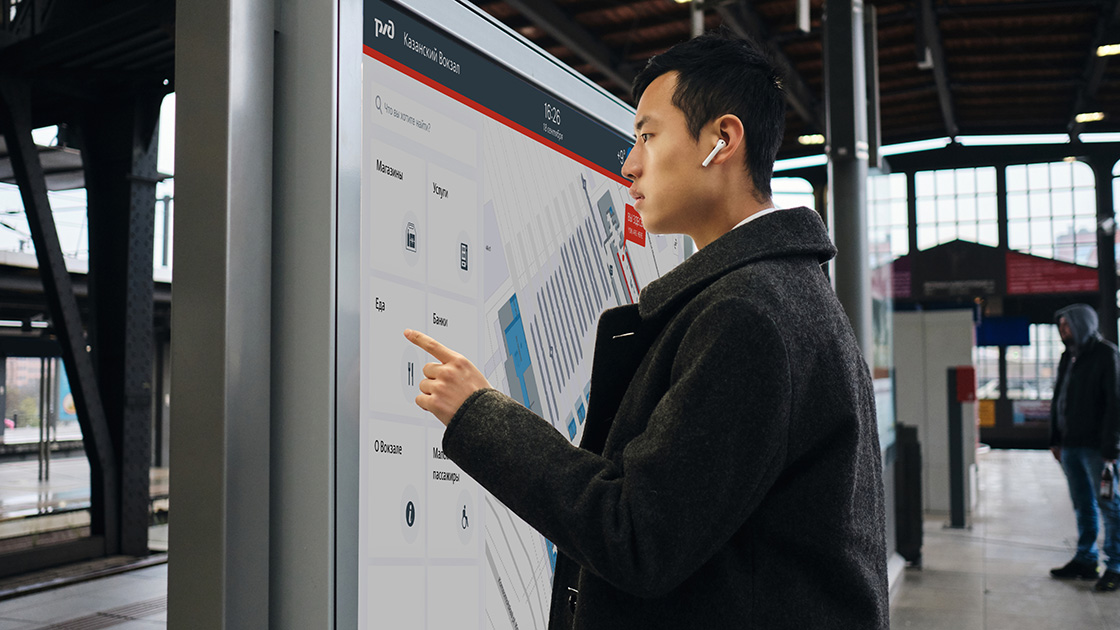
In the heart of any megalopolis, where the flows of people, trains and cars intersect, the main challenge of modern urbanism arises — the problem of orientation. The Belorussky transport hub in Moscow is not just a point on the map, it is a complex organism that unites the metro and railway stations of the same name, ground transport stops, underpasses and a well-developed infrastructure of services. Hundreds of thousands of people pass through it every day, and for many, this experience is associated with stress, loss of time, and the need to constantly switch between maps, signs, and questions from passersby. Indoors Navigation has taken on the ambitious task of turning this maze into a transparent, intuitive digital environment where navigation becomes seamless, continuous and completely natural.
From an architectural maze to a digital twin
The first and most difficult stage of the project was to create a high-precision digital copy of the entire TPU. Our engineers and cartographers have carried out extensive work on laser scanning and photogrammetry in order to digitalize not only the room plans, but also all their spatial characteristics. We have digitized the multi-level metro lobbies with their complex passageways, waiting rooms and platforms of the railway station, underground pedestrian galleries, exits to city streets and even the location of turnstiles, elevators and escalators. The most important part of the work was the inclusion of all significant points of interest in the general map — from cafes and shops to ATMs, storage rooms and toilets, because for a person the ultimate goal of the route is often not an abstract geo-coordinate, but a specific place where you can satisfy your need.
The result of this painstaking work is not just a map, but a complete digital model that understands the logic of human movement. The system knows that to switch from the Kazan direction to the Tagansko-Krasnopresnenskaya metro line, you need to go up to the second floor and go through an underpass, and it can calculate the time of this route taking into account the workload of the halls and the speed of the escalators. It takes into account which exits are open at different hours, and can warn the user that the lobby closest to his destination is closed for renovation, suggesting the best alternative way.
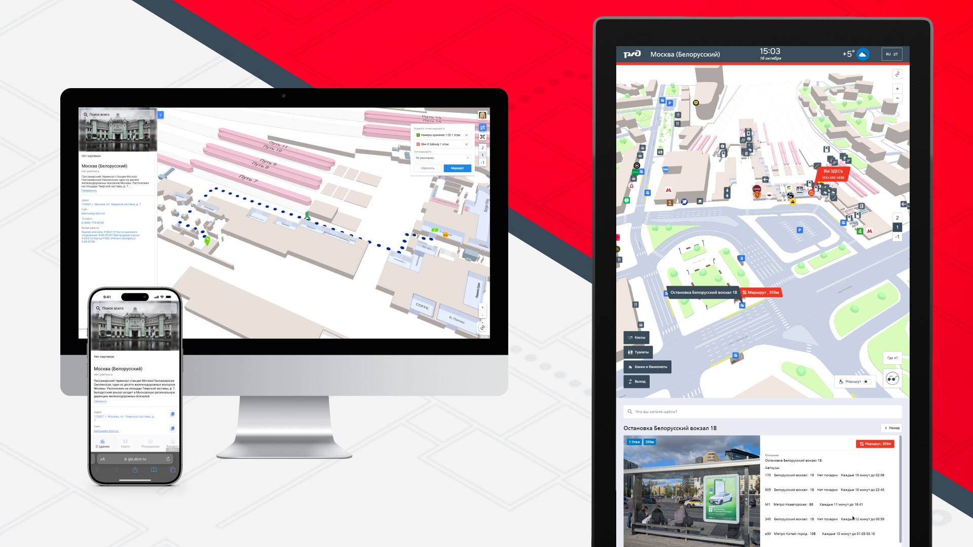
Three faces of one system: application, terminal and web
The key philosophy of the project was versatility and accessibility. We understood that different users prefer different channels of information in different situations, so the navigation system was implemented in three complementary formats synchronized with each other in real time.
The mobile app It has become a personal guide for regular TPU users. Integrated with urban transport applications, it allows you to build a door—to-door route, for example, from a house in the Moscow region to a specific office on Leningradsky Prospekt, taking into account all transfers. The uniqueness of the solution is that at the moment when a person goes down to the subway or enters the station building, the application does not lose it, as happens with GPS navigators, but smoothly switches to using indoor positioning technologies, continuing to guide him through the same interface, with the same voice, with the same accuracy..
Information terminalslocated at key points of the hub — at the entrances to the subway, in the central halls of the station, at the exits to the platforms — have become a salvation for tourists, people without smartphones or those who just want to quickly navigate the place. Touch kiosks with large screens allow you to find the right service in a few taps or set a route to any point of the TPU. The terminal system forms its own network, where each kiosk knows its location, which allows it to offer the most relevant routes from exactly the point where the person is located.
Web version Navigation, accessible from any browser, has become a trip planner for those who like to prepare in advance. A potential passenger can study the TPU circuit from home or office, understand where to get off the train in order to get to the right metro lobby faster, and even "walk" along the future route in 3D mode in order to feel confident in reality.
Use cases: from daily routes to emergency situations
The real value of seamless navigation is revealed in the specific scenarios that are played out daily within the walls of the Belarusian TPU.
For a hurrying passenger, the system becomes a time-saving tool. An office worker who is late for morning planning can still set a route to the exit to Butyrsky Val Street in the aeroexpress carriage, and the application will take him the shortest way, bypassing the crowds of tourists at the main entrance to the metro, warning that there is increased traffic at the junction between stations today and it is better to go up to the floor above. According to our data, using optimized routes allows you to save an average of 5-7 minutes per transfer, which adds up to several saved hours per month.
For the tourist , navigation becomes a guarantee of peace of mind. A foreigner who finds himself at the Belorussky railway station for the first time no longer feels lost. He can find on the map not only a storage room for his suitcase, but also a currency exchange point with the best exchange rate, and from there he can be guided to the bus stop he needs. Integration with the machine translation system in terminals makes navigation available in dozens of languages, erasing the language barrier.
For people with limited mobility, the system provides an accessible route function. When building a path, it takes into account the presence and working condition of elevators, ramps and lifts, allowing a person in a wheelchair or with an injury to the musculoskeletal system to reach the goal without unforeseen obstacles.
For the TPU administration, the collected anonymized data on human flows is an invaluable tool for managing infrastructure. Analytics shows where traffic jams occur regularly, which exits are being used inefficiently, and how flows can be reallocated to increase the overall throughput of the node. This allows not only to increase security, but also to place commercial outlets — kiosks, advertising structures — more efficiently, increasing their passability and, as a result, profitability.
Technologies that make this possible
The seemingly simple user interface hides a complex technology stack. The seamless transition between outdoor and indoor navigation is provided by a hybrid algorithm that switches in real time between GPS, GLONASS, data from cell towers, Wi-Fi triangulation and the signal from Bluetooth beacons installed indoors. The positioning accuracy inside buildings reaches 1-3 meters, which is enough to identify a specific door or escalator.
A dynamic routing system based on graph databases constantly recalculates optimal paths, taking into account not only the static geometry of space, but also operational information about the closure of an exit, repairs, or an emergency situation. Integration with the API of urban transport systems allows you to show up-to-date schedules of commuter trains and buses, making navigation truly lively and useful.
Conclusion: seamless as a new standard of urban life
The project at TPU Belorussky clearly demonstrates that the future of urban mobility lies in integration and seamless operation. The urban environment is no longer a set of disparate zones with different navigation rules and is turning into a single, understandable and friendly digital space.
The successful implementation of this project is only the first step. The technologies developed in one of Moscow's most complex transportation hubs are ready to scale to other urban infrastructure facilities: airports, large business centers, university campuses, stadiums, and shopping galleries.
The company Indoors Navigation continues to develop this area, working on the integration of navigation systems with smart urban services such as e-tickets, carsharing and delivery services. Our goal is for people in the city of the future to be able to solve their problems without thinking about logistical barriers, trusting technology to play the role of an invisible but reliable guide.
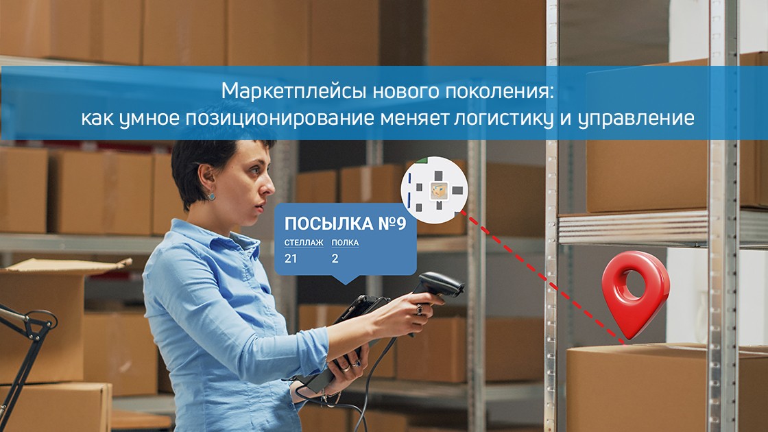
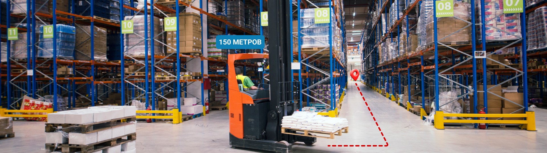
A quiet revolution is taking place in the huge distribution centers of modern marketplaces, where tens of thousands of products pass through every day, and hundreds of employees move between the shelves. Traditional management methods based on paper lists and manual accounting are giving way to intelligent positioning systems that transform chaotic movement into a slender digital ballet. These technologies, combining tracking of goods, equipment and personnel, create a fundamentally new environment for marketplaces – an environment where every object and every employee become part of a single digital ecosystem with precision to the centimeter.
Modern positioning systems inside marketplace warehouses are complex technological complexes that combine ultra-broadband (UWB) tags, Bluetooth beacons, and computer vision. Unlike traditional accounting systems that require constant manual data entry, the new solutions offer continuous monitoring of all assets in real time. When an order collector takes an item off the shelf, the system not only records this action, but can also suggest the optimal route to the next collection point, saving precious seconds, which turn into hours and days of saved time on the scale of a large warehouse.
The anatomy of a Smart warehouse: from tags to analytics
At the heart of any modern marketplace distribution center is a positioning system that resembles the nervous system of a living organism. Every product, every cart, and every employee are equipped with special tags that continuously exchange signals with a network of receivers deployed throughout the warehouse. These signals do not pass through concrete walls and metal structures, but they can achieve accuracy that is unattainable by conventional GPS technologies. Such systems are particularly impressive in multi-tiered warehouse complexes, where traditional navigation methods simply lose their orientation in three-dimensional space.
Один из крупнейших маркетплейсов внедрил подобную систему на своем флагманском складе площадью более 100 000 квадратных метров. Результаты превзошли все ожидания: точность комплектации заказов увеличилась на 15%, а скорость обработки заказов выросла на 20%. Но что еще важнее – система позволила выявить неочевидные узкие места в логистических потоках, которые годами оставались незамеченными. Оказалось, что некоторые зоны склада создавали своеобразные «пробки», где сотрудники тратили до 30% рабочего времени на ожидание. После реорганизации этих зон общая эффективность работы склада выросла как минимум на 12%, что в денежном выражении составило десятки миллионов рублей ежегодной экономии.
Pick-up points as a center of customer experience
Marketplace pick-up points, often located in busy urban areas, pose a particular challenge to positioning systems. With limited space and high visitor traffic, every minute of downtime results in queues and customer dissatisfaction. Intelligent tracking systems allow you to optimize these processes, turning chaotic traffic into a strictly organized flow. When the courier arrives for unloading, the system already knows exactly where each shipment should be placed, and the staff at the pick-up point receive precise instructions on their mobile terminals.
The example of a network of pick-up points in one of the leading marketplaces is particularly illustrative, where the introduction of a positioning system has reduced the average customer service time from 7 to 3 minutes. This is made possible by accurate tracking of each order within the premises – from the moment it is received to delivery to the final recipient. The system automatically determines the optimal storage location for each parcel, taking into account its size and delivery time, as well as predicts peak loads, allowing staff to be reallocated in advance. As a result, customers receive their orders faster, and operators work at a more comfortable pace without hassle.
Marketplace Office Centers: a digital ecosystem
Outside of warehouses and pick-up points, positioning systems find equally interesting applications in office complexes of marketplaces, where hundreds of employees from various departments are concentrated. In these smart spaces, tracking technologies help not only to find people and equipment, but also to optimize the office space itself. By analyzing actual employee movement routes between departments, the system can offer more efficient job placement, reducing unnecessary movements and increasing overall productivity.
After implementing the positioning system, a large marketplace with an office campus of 25,000 square meters found that about 40% of meetings between employees of different departments occur randomly in corridors and recreation areas. This observation led to a revision of the concept of office space – instead of the traditional zoning by departments, special collaborative zones were created, which increased the efficiency of cross-functional interaction by 18%. At the same time, the system made it possible to reduce the loss of office equipment (laptops, projectors, mobile devices) to almost zero, since now the location of each valuable item is always known with accuracy to a specific office.
Transport logistics: from the warehouse to the customer's door
Транспортные потоки маркетплейсов представляют собой сложнейший организм, где системы позиционирования играют ключевую роль. Отслеживание транспортных средств начинается еще на территории распределительных центров, где каждая машина проходит через систему точного позиционирования, позволяющую оптимально распределить доки для разгрузки. В пути транспорт оснащается специальными трекерами, которые работают даже в условиях городских «каньонов», где обычные GPS-сигналы теряются среди высотных зданий.
The combination of transport tracking and internal positioning systems in warehouses provides particularly impressive results. One of the European marketplaces, which implemented such integration, reduced the downtime of vehicles during unloading from 90 to 35 minutes. This is possible due to the fact that the system knows in advance the exact location of each product in the warehouse and can prepare it for loading even before the arrival of the car. Drivers receive precise instructions on their tablets, including the optimal route through the warehouse and the specific dock where they need to drive to. As a result, transport no longer stands idle in queues, but works as a well-established mechanism, saving time and fuel.
The future of smart marketplaces
Развитие систем позиционирования для маркетплейсов движется в сторону все большей интеграции и интеллектуализации. Современные решения уже сегодня начинают включать элементы искусственного интеллекта, способные не просто фиксировать текущее состояние, но и прогнозировать развитие ситуаций. Система может заранее предупредить о вероятном возникновении «узких мест» в логистических цепочках или предложить оптимальное перераспределение персонала между участками работы. В перспективе это приведет к созданию полностью автономных складов, где большая часть решений будет приниматься искусственным интеллектом на основе данных систем позиционирования.
The company Indoors Navigation is at the forefront of these technologies, offering marketplaces comprehensive solutions for accurate tracking of goods, equipment and personnel. Combining high positioning accuracy with a powerful analytical platform, our systems are already helping the largest market players optimize their operations and improve customer service. In a world where speed and accuracy of order fulfillment are becoming key competitive advantages, intelligent positioning systems are no longer optional – they are becoming an essential element of a successful marketplace, its digital nervous system that ensures the smooth operation of all processes from the moment an order is placed to its receipt by the customer.
Когда каждый товар, каждый сотрудник и каждый транспорт в цепочке поставок маркетплейса становится видимым и управляемым, это меняет саму философию электронной коммерции. Больше нет необходимости держать избыточные запасы «на всякий случай» – теперь можно точно знать, где находится каждый товар в режиме реального времени. Нет нужды тратить ресурсы на поиск потерявшихся отправлений или простаивающего оборудования – система предоставляет всю необходимую информацию мгновенно. И самое главное – появляется возможность принимать управленческие решения, основанные не на предположениях, а на точных данных, собранных со всей инфраструктуры маркетплейса. В этом и заключается подлинная ценность современных систем позиционирования для электронной коммерции – они превращают сложные, запутанные процессы в прозрачную, эффективную и предсказуемую систему.
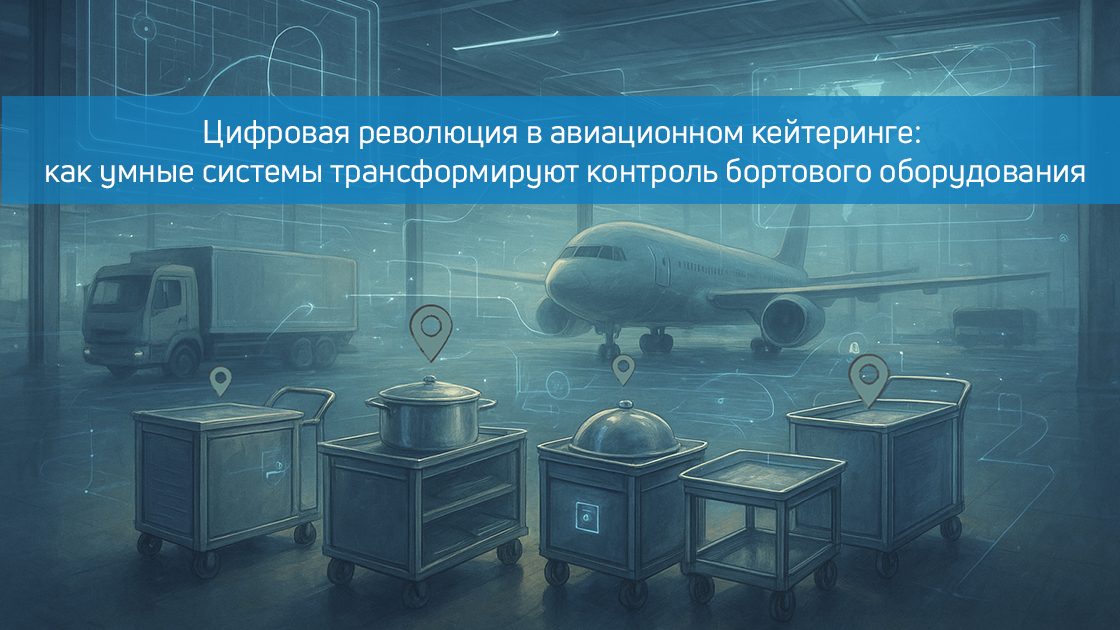
The invisible chaos behind the scenes of aviation kitchens
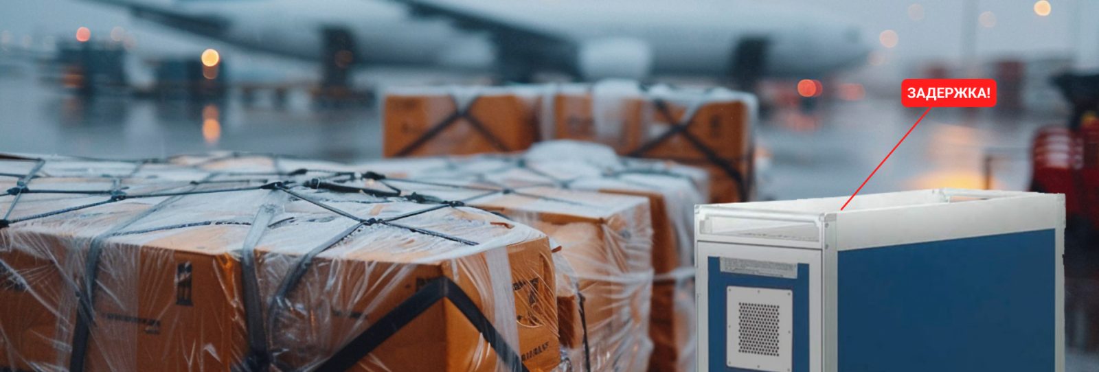
In the giant catering complexes of international airports, where tens of thousands of on-board rations are prepared and packaged daily, there is a complex ecosystem of kitchen equipment, whose turnover resembles a well-established but extremely fragile mechanism. Each pan, heating trolley, and serving tray, worth hundreds of dollars, runs a complex route from a centralized kitchen through storage areas, loading terminals, and all the way to the aircraft cabin, where it begins its return journey after use. Traditional accounting systems based on paper logs and manual checks have long been unable to cope with the scale of modern air transportation, creating control gaps that result in millions of losses for airlines.
Modern digital tracking systems for on-board kitchen equipment are complex technological complexes combining RFID tags, Bluetooth beacons, UWB locators and cloud-based analytical platforms. Unlike outdated accounting methods that require hours of inventory and are prone to human error, the new solutions offer continuous monitoring of each piece of kitchen equipment in real time, creating a digital twin of all airline equipment. When a heated trolley leaves the catering company's warehouse, the system not only records this event, but can also predict its further route, automatically detecting anomalies and potential losses.
The anatomy of Smart control: from Tag to Cloud
The heart of the modern on–board equipment control system is a network of sensors and identifiers that turn ordinary kitchen items into connected IoT devices. Each piece of equipment is equipped with a special tag capable of withstanding extreme temperatures of washing and disinfection, while maintaining the ability to transmit a signal at a distance of up to 100 meters. These tags, working in symbiosis with a network of receivers deployed throughout the airport – from the kitchen workshops to the apron areas – create a detailed digital map of movements with an accuracy of up to 30 centimeters, which is especially critical in conditions of limited space in cargo compartments and onboard kitchens.
Dubai International Airport, after implementing an RFID tracking system for 85,000 avionics, reported a 67% reduction in inventory losses in the first year of operation. But more importantly, the system made it possible to identify non–obvious bottlenecks in logistics chains where equipment was delayed for no apparent reason. Data analysis showed that about 15% of food carts spent an extra 2-3 hours in transit areas due to suboptimal return routes. After optimizing these processes, the airport was able to reduce the total fleet of equipment by 12%, saving more than $3 million annually on purchases of new inventory alone.
Passenger experience: invisible concern for comfort
For premium class passengers waiting for delicious meals on board, equipment monitoring systems become a guarantee that specially ordered gastronomic experiences will not turn into disappointment due to lost equipment on the way to the plane. Intelligent tracking systems allow catering services to track in real time that a specific caviar feeding kit or a special baby food heater has already been loaded on board and is in its proper place. This is especially critical for transit flights, where equipment can be overloaded several times between planes, creating potential points of failure in a complex logistics chain.
Qatar Airways was able to reduce the number of incidents with missing serving items in business class by 82% after the introduction of a precision tracking system for on-board equipment. The system, integrated with the flight attendants' mobile devices, warns staff in advance of any deviations from the loading plan, allowing them to quickly resolve problems before they become noticeable to passengers. As a result, the level of satisfaction with on-board meals increased by 18 percentage points according to annual surveys, which for the premium segment airline is directly converted into customer loyalty and repeat bookings.
Airport staff: from chaotic searches to transparent control
For catering staff and ground staff, equipment tracking systems become digital assistants, eliminating the endless search for a specific cart or serving set among thousands of similar ones. Mobile terminals with integrated navigation through the interior of the airport allow you to find the necessary equipment in minutes, rather than hours, as it used to be. This feature is especially valuable in the huge warehouse complexes of hub airports, where business class inventory alone can occupy several thousand square meters of shelving space.
At London Heathrow, the introduction of an equipment positioning system for 12,000 catering staff has reduced the average search time for a specific item from 47 to 6 minutes. But more importantly, the system automatically records who took specific equipment and when, creating a transparent system of responsibility. After the system was launched, the number of inventory damage cases decreased by 41%, as each employee now knew that their actions with the equipment were being recorded and could be analyzed later in the event of an incident.
Warehouse logistics: from manual accounting to digital flow
На складах бортового оборудования, где хранятся тысячи наименований инвентаря общей стоимостью в десятки миллионов долларов, системы трекинга совершают настоящую революцию в методах управления. Умные стеллажи с RFID-антеннами автоматически фиксируют поступление и выдачу каждого предмета, исключая возможность «исчезновения» оборудования между инвентаризациями. Системы компьютерного зрения, дополняющие RFID-технологии, способны распознавать повреждения на ранней стадии – например, микротрещины в керамической посуде или деформацию металлических частей тележек, – что позволяет своевременно выводить такой инвентарь из оборота до того, как он станет причиной инцидента на борту.
Singapore-based catering company SATS, after implementing the smart warehouse system, was able to increase equipment turnover by 23% without expanding warehouse space. This was made possible by accurately analyzing the actual return dates of each type of inventory and optimizing its storage. By analyzing historical data, the system has learned to predict peak loads on specific types of equipment before holidays or major events, allowing resources to be redistributed between different airport warehouses in advance.
Traffic flows: synchronization of ground operations
Особая сложность в управлении бортовым кухонным оборудованием возникает на этапе транспортировки между кухней, складом и самолетом. Специализированные грузовики и тележки, курсирующие по перрону, часто становятся «черными ящиками», где теряется контроль над инвентарем. Современные системы трекинга решают эту проблему, устанавливая датчики не только на само оборудование, но и на транспортные средства, создавая полную цифровую цепочку перемещений. Когда тележка с подогревателями пищи покидает кухню, система автоматически проверяет соответствие списка загруженного оборудования заданию на рейс, сразу выявляя возможные ошибки.
At Frankfurt Airport, the introduction of such a system has reduced the number of errors when loading on-board equipment by 73%. Every truck heading to the plane is now equipped with a tablet that shows the driver in real time the list of inventory to be loaded and its exact location in the back. This is especially important in the maintenance of wide-body aircraft, where loading takes place through several doors at the same time, and any error in the distribution of equipment can lead to flight delays.
Boarding: precision precision before departure
The final and most crucial stage in the chain of movement of on–board kitchen equipment is its loading into the aircraft. Here, tracking systems are integrated with the aircraft's on-board systems, creating a digital twin of the entire loaded inventory. Flight attendants use their tablets to get an accurate layout of each piece of equipment in the kitchen areas, which is crucial for operational passenger service during the flight. If a cart was mistakenly loaded onto the wrong plane, the system will instantly detect this discrepancy and alert staff before the doors close.
Delta Airlines, after implementing the precision loading control system, was able to reduce the number of flight delays related to on-board power problems by 68%. The system automatically checks the loaded equipment against the menu of a particular flight, immediately identifying inconsistencies. For example, if pork carts were mistakenly loaded onto a flight with a majority of Muslim passengers, the system will give a signal before the plane departs from the gate, allowing you to quickly correct the situation and avoid a potential conflict on board.
The Future of smart control: from tracking to forecasting
The development of control systems for on-board kitchen equipment is moving towards the integration of artificial intelligence and predictive analytics. Modern systems are already beginning to not only record the current state, but also predict equipment wear, optimal routes for its movement, and even potential points of failure in logistics chains. In the future, this will lead to the creation of fully autonomous on-board inventory management systems, where most decisions will be made by algorithms based on the analysis of huge amounts of historical and real data.
Lufthansa Technik is already testing a system that, based on tracking data and usage analysis, can predict the need to repair or replace kitchen equipment before it fails. This is especially important for expensive specialized devices such as on-board ovens or coffee machines, the downtime of which can seriously affect the quality of service in the premium class. In the future, such systems will be able to automatically order spare parts or even new inventory, maintaining optimal inventory levels without excessive costs.
Conclusion: digital transparency as a competitive advantage
For modern airlines and airports, on–board kitchen equipment control systems are no longer just an accounting tool - they are becoming a strategic asset that affects key business indicators. Reducing losses of expensive inventory, optimizing logistics processes, preventing flight delays, and increasing passenger satisfaction are all directly translated into financial results and reputational benefits.
Indoors Navigation, with its unique experience in developing precision positioning systems for complex infrastructure facilities, offers the aviation sector comprehensive solutions that combine high tracking accuracy with deep analytics and ease of integration into existing processes. In an industry where every minute of downtime results in thousands of dollars in losses, and a lost serving set can ruin a passenger's experience of the entire flight, digital transparency in flight equipment management is becoming not a luxury, but a necessity.
Когда каждый предмет бортового инвентаря – от дорогой кофемашины до простой ложки – становится видимым и управляемым на всем пути от кухни до салона самолета и обратно, это меняет саму философию авиационного кейтеринга. Больше нет необходимости держать избыточные запасы оборудования «на всякий случай» – система точно знает, где находится каждый предмет и когда он будет доступен для следующего использования. Нет нужды тратить сотни человеко-часов на ручные проверки и инвентаризации – вся информация доступна в реальном времени. И самое главное – появляется возможность принимать управленческие решения, основанные не на догадках, а на точных данных, собранных со всей цепочки движения бортового оборудования. В этом и заключается подлинная ценность цифровой трансформации в авиационном кейтеринге – она превращает сложный, запутанный процесс в прозрачную, эффективную и предсказуемую систему.
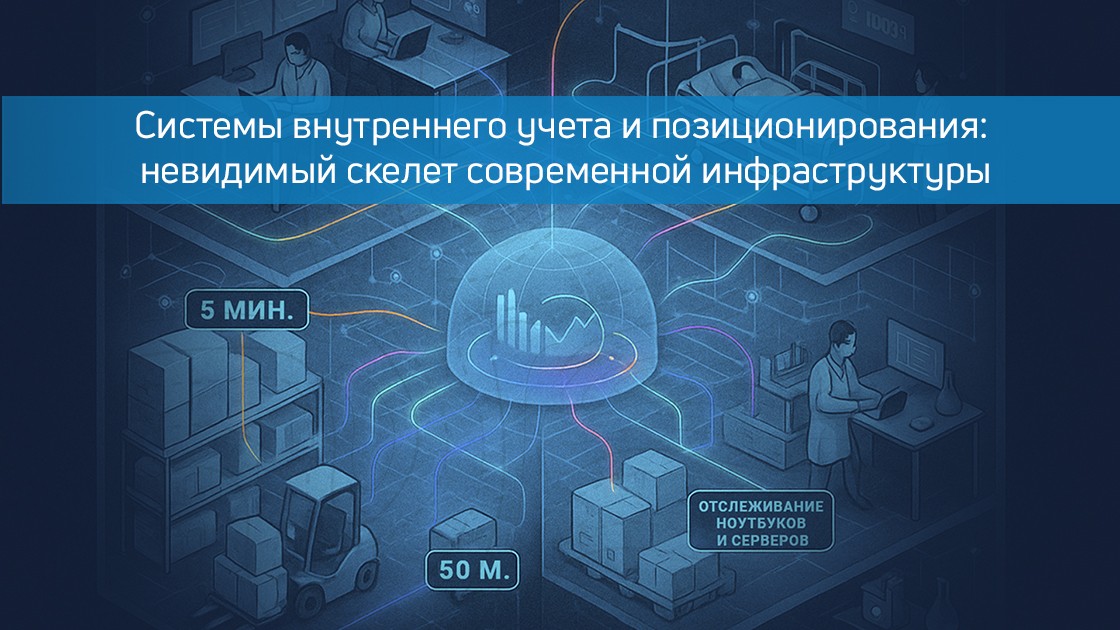
In huge office centers, where hundreds of employees move between floors every day, in multi–tiered hospital complexes with their endless corridors, on industrial sites the size of a small city - everywhere there is an invisible problem that has not been solved effectively for a long time. It's about accurately recording and tracking the movement of equipment, people, and assets within large enclosed spaces where traditional GPS/GLONASS technologies are powerless. Modern internal positioning systems have become the missing link that turns chaotic traffic into orderly data that brings real economic benefits.
When walls stop being an obstacle: indoor tracking technologies
Modern internal accounting systems are complex ecosystems that combine Bluetooth Low Energy technologies, ultrasonic sensors, RFID tags, and computer vision. Unlike the primitive accounting systems of the past, which required manual data entry or periodic inventories, the new solutions offer continuous monitoring in real time. In bank offices and depositories, this means instant detection of the movement of valuable assets, in hospitals – the ability to quickly find expensive medical equipment, and in warehouses – optimization of logistics flows without stopping work processes.
The transformation that has taken place in transport hubs is particularly significant. Major airports such as Дубай или СингапурFor several years now, internal positioning systems have been used to track trolleys, loading equipment and luggage, which cannot be said about Russian ones. Accuracy of up to tens of centimeters allows you not only to know where an object is located, but also to analyze its movement patterns, identifying bottlenecks in logistics and saving millions on process optimization. When every extra meter of baggage cart travel, multiplied by thousands of flights, turns into significant costs, such systems pay off in an amazingly short time. And such systems pay off even faster when frequent losses of carts and containers of on-board kitchen equipment, which are not cheap at all, are stopped by service companies at different airports.
Office spaces: from chaos to transparency
Modern business centers, especially those owned by large IT companies, have long ceased to be just spaces with workplaces. These are complex organisms with hundreds of laptops, servers, mobile devices, and other valuable equipment circulating daily. Internal accounting systems have transformed the management of these assets from a headache for administrators into a transparent and automated process. Now you don't have to spend hours searching for a specific device – just open a special dashboard where the location of each asset is displayed in real time with the history of its movements and the user's data who took it last.
An interesting case demonstrates one of the campuses Google in California, where the introduction of an equipment tracking system allowed reduce equipment losses by 40% already in the first year of use. But more importantly, it has become possible to analyze exactly how the equipment is used, which rooms are most in demand, and how space can be optimized to improve work efficiency. When it comes to tens of thousands of square meters of office space, such data becomes invaluable for making managerial decisions.
Medicine under control: when every minute counts
In medical institutions, internal accounting systems are no longer just a convenient tool – in some cases, they literally save lives. Modern hospitals are equipped with a huge amount of specialized equipment, which often costs hundreds of thousands of dollars. When a critical ventilator or a valuable drug is urgently needed, and the staff spends precious minutes searching for it throughout the building, an accurate positioning system becomes not a luxury, but a necessity.
The Mayo Clinic in Rochester, after the introduction of the medical equipment tracking system, she reported on reducing the search time for equipment by 65%. But more importantly, it has become possible to analyze the routes of movement of equipment and personnel, identifying non–obvious logistical problems. It turned out that some devices were idle in some wings of the hospital, while in others they were sorely lacking – simply because no one was systematically tracking these movements. Now hospital logistics has become the subject of precise calculations rather than random decisions.
Industry and warehouses: logistics without blind spots
In industrial enterprises and large warehouse complexes, internal accounting systems have revolutionized asset management. When it comes to thousands of pieces of equipment, tools and materials scattered over an area of several hectares, manual accounting becomes not only ineffective, it turns into fiction. Modern solutions allow not only to know the exact location of each facility, but also to automatically account for its movement between areas of responsibility, control access, and even predict the need for maintenance.
Company Boeing At its factory in Everett, it has implemented a tracking system for more than 50,000 tools and fixtures. The results exceeded expectations: the search time for the necessary tool was reduced from 30-40 minutes to 2-3, and losses of expensive equipment decreased by 75%. On an industrial scale, where every minute of downtime costs a lot of money, such systems quickly recoup all the costs of implementation, becoming an integral part of the production process.
Education and Science: when every device is important
В университетских кампусах и научно-исследовательских центрах системы внутреннего учета решают сразу несколько важных задач. Дорогостоящее лабораторное оборудование, которое раньше могло «потеряться» между кафедрами или даже зданиями, теперь находится под постоянным контролем. Библиотечные фонды, особенно редкие издания, получают дополнительную защиту от несанкционированного выноса. Даже обычные проекторы и ноутбуки, которые раньше часто исчезали из аудиторий, теперь можно быстро найти с точностью до конкретной комнаты.
Massachusetts Institute of Technology after the implementation of the equipment tracking system, he reported on cost reduction to replace lost equipment by 60%. But more importantly, it has become possible to analyze the actual load of equipment and optimize its use between different departments. When an expensive scientific device worth hundreds of thousands of dollars is not idle, but is effectively used by different research groups, this directly affects the productivity of the entire institution.
The future of internal accounting: from control to forecasting
Modern systems of internal positioning and equipment accounting are no longer just tracking tools – they are turning into complex analytical platforms. Machine learning allows you not only to fix the current position of an object, but also to predict its movements, identify anomalies in use, and offer space and logistics optimization. Some advanced solutions have already implemented integration with enterprise resource planning (ERP) systems, which creates a single digital environment for managing all the assets of the organization.
Indoors Navigation is at the forefront of these technologies, offering solutions that combine high positioning accuracy with deep analytics and ease of integration into existing infrastructure. In a world where resource efficiency is becoming a key competitive advantage, internal accounting systems are no longer optional – they are becoming an essential element of the modern business environment, an invisible skeleton that supports and organizes complex organizational structures.
Когда каждый актив, каждый прибор, каждое устройство в большом комплексе становится видимым и управляемым, это меняет саму философию работы с ресурсами. Больше нет необходимости покупать избыточное оборудование «на всякий случай» – теперь можно точно знать, что есть, где находится и как используется. Нет нужды тратить рабочее время сотрудников на бесконечные поиски – вся информация доступна в несколько кликов. И самое главное – появляется возможность принимать управленческие решения, основанные не на догадках, а на точных данных, собранных в режиме реального времени за счет платформы Индорс Навигейшн. В этом и заключается настоящая ценность современных систем внутреннего учета и позиционирования.
In the labyrinths of modern cities, where concrete jungles absorb satellite signals and glass skyscrapers distort radio waves, a new era of spatial orientation is being born. Quantum navigation, this amazing synthesis of quantum physics and engineering genius, promises to turn our ideas about how we find our way in the most difficult conditions – especially where traditional technologies are powerlessly silenced: inside buildings, underground, in the depths of the ocean.
Imagine a device capable of sensing motion with an accuracy that surpasses all known analogues. In his heart beats the rhythm of atoms cooled to almost absolute zero, trapped in laser beams. Deprived of the usual heat fuss, these atoms become incredibly sensitive to the slightest changes in the surrounding space. When such a device moves, the quantum states of the atoms change in a special way, allowing the position to be calculated with an accuracy that seems fantastic.
This is not science fiction – in the laboratories of Imperial College London, prototypes of quantum accelerometers have already been created, whose measurement accuracy exceeds conventional sensors by thousands of times. Unlike our usual navigation systems, which depend on the vagaries of satellite communications, these devices operate on the principle of an autonomous inertial system, where each subsequent position calculation follows from the previous one with minimal error.
Why is GPS not enough?
Modern navigation technologies, including GPS and GLONASS, have fundamental limitations.:
They do not work indoors, underground or underwater.
Accuracy decreases in urban canyons (up to 5-10 meters)
Depend on satellite infrastructure
Квантовая навигация обещает революцию в определении местоположения с точностью до сантиметров в любых условиях. Особенно это актуально для indoor-навигации — позиционирования внутри зданий, где традиционные системы бессильны.
How does quantum navigation work?
В основе лежат атомные часы и квантовые акселерометры, которые:
Acceleration is measured using lasers that cool atoms to temperatures close to absolute zero.
Changes in the quantum states of atoms are detected
Allows you to calculate the position without external reference points
Пример: Квантовый акселерометр Imperial College London показывает точность в 1000 раз выше обычных MEMS-датчиков в смартфонах.
Unlike GPS, quantum systems:
They do not require external signals
Работают по принципу инерциальной навигации
Накопление ошибки всего 1 км за 3 дня (против 1 км/час у классических систем)
How does quantum navigation work?
Особую поэзию квантовая навигация обретает в контексте навигации внутри помещений – той самой «проблемы последнего метра», которая годами не давала покоя разработчикам. В то время как обычные системы спотыкаются о бетонные стены и металлические конструкции, квантовые сенсоры, подобно тонким камертонам, продолжают вести свою невидимую симфонию позиционирования.
Решение «проблемы последнего метра» в торговых центрах и аэропортах позволит максимально быстро находить нудные помещения.
The use of this technology to help visually impaired people, for whom independent navigation in complex spaces has always been a serious challenge, is especially touching.
В лондонском аэропорту Хитроу тестируют систему, сокращающую время поиска выхода на 37%.
Medical Applications.
Navigation of surgical robots with an accuracy of 0.1 mm
A search system for expensive medical equipment that works even in hospital basements.
For patients with cognitive impairments, this technology can be a real salvation, allowing staff to instantly find those who get lost in the labyrinths of hospital corridors.
Current developments and prospects
Today, quantum navigation devices still resemble bulky laboratory installations, and their cost is comparable to the price of a luxury car. But the history of technology teaches us that the journey from the first bulky computers to modern smartphones can be surprisingly fast. Already, companies like ColdQuanta are working to reduce the size of quantum sensors, trying to fit revolutionary technologies into a case comparable in size to a shoe box.
Military applications
Experts predict that by 2030 we may see the first commercial samples that are compact enough and affordable for mass use. When this happens, navigation inside buildings will cease to be a headache for architects and developers, becoming an inconspicuous but flawlessly working service, as natural as electric lighting in our homes.
Navigation of submarines without surfacing
Positioning in the conditions of electronic warfare
Work in areas of complete absence of signals
Hybrid solutions with shared use:
Quantum sensors
Bluetooth beacons
Computer vision
Computer vision
Architecture example:
Implementation issues
High cost (from $50,000 per sensor)
Large dimensions of the equipment
The need for complex calibration
Quantum navigation opens up new horizons for indoor positioning, offering solutions where traditional technologies are powerless. Company Today, Indoors Navigation is already developing hybrid systems that combine quantum principles with proven methods.
Like many great technologies, quantum navigation is likely to become noticeable only when it completely disappears into our daily lives, becoming an invisible thread that gently leads us through the complexities of the modern world. And then, looking back, we may wonder how we could have done without this amazing synthesis of quantum physics and engineering.
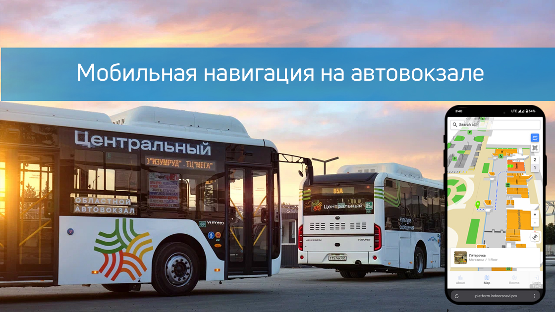
The Indoors Navigation team has implemented smart navigation in the Central Bus Station of Rostov-on-Don!
Now passengers can easily find their bus or the desired area using:
✅ A mobile application with a 3D map and turn-by-turn navigation
✅ Interactive terminals (infomats)
✅ QR codes (works without installing the app)
✅ Augmented reality (AR pointers through the camera) The system is powered by 400 BLE sensors, providing accurate positioning.
Benefit for passengers:
➜ Saving time
➜ Ease of use
➜ Accessibility without downloading the app
Benefits for the bus station:
📊 Movement analytics (heat maps, route history)
📉 Reducing staff workload
🔄 Improving the quality of service
Modern technology is for everyone's comfort! Indoors Navigation is not just a navigation system, but a powerful building management platform that helps make your business more transparent, secure, and efficient.
Discover the future of geographic information systems with the Indoors Navigation Platform. 🌐
📍 What will you see?
• The digital twin of the enterprise in action
• Indoor geolocation services
• Interactive navigation with QR codes and AR
🛠 How to integrate it?
• We create personalized solutions for each client. Contact us for a demo.
👇 Subscribe and keep up to date with innovations! 👇
Learn more about new developments and the geographic information system of the Indoors Navigation Platform: https://indoorsnavi.pro/
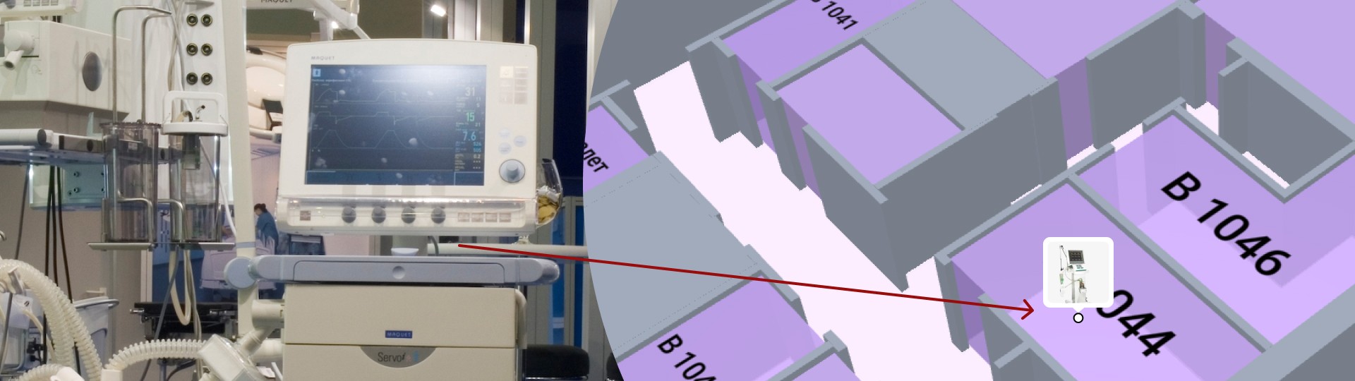
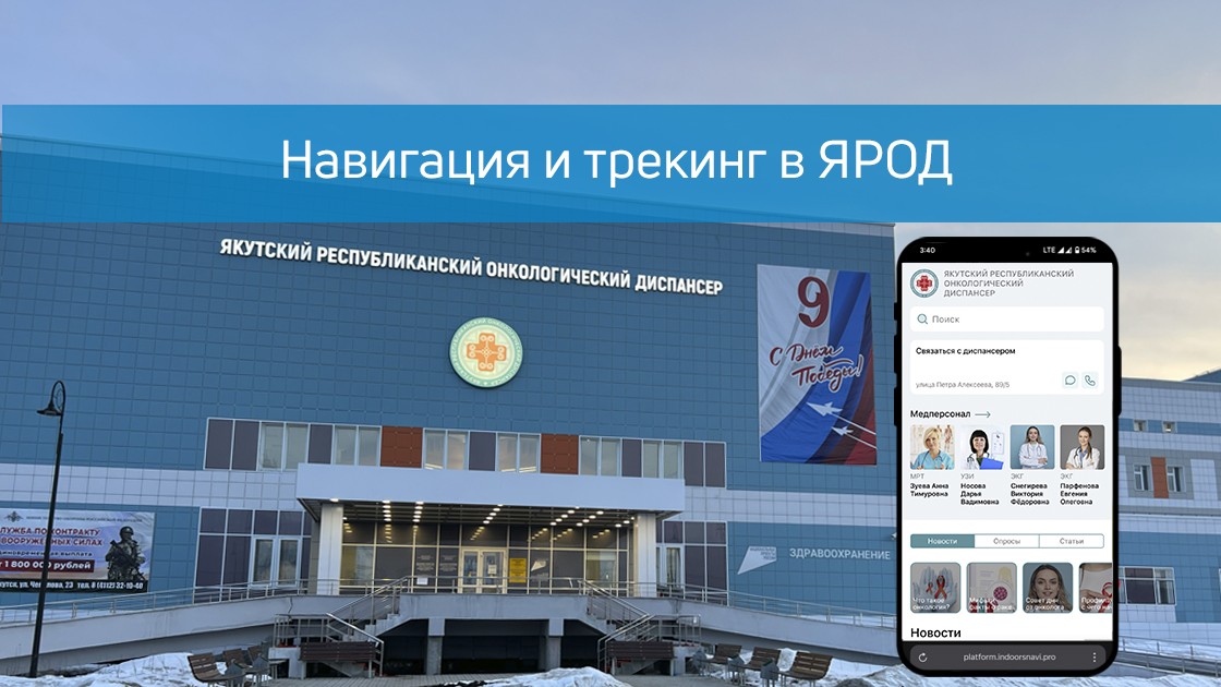
The company Indoors Navigation has implemented a patient navigation and tracking system in the Yakutsk Regional Oncological Dispensary (YAROD), solving the key problems of the medical facility.:
The difficulty of orientation in the hospital building
Search for doctors' offices and medical equipment
Control of patient movements
Implemented solutions:
Hardware search for medical staff
Accurate 3D map buildings with furniture detailing
The mobile app navigator with: — Поиском кабинетов и врачей — Маршрутизацией и позиционированием (+ AR-режимы) — 360° панорамами помещений
QR navigation for guests without an app
Tracking system patients through BLE Navitag bracelets
Implementation results:
✔ Reducing the search time for cabinets ✔ Simplification of patient monitoring ✔ Optimization of visitor flows ✔ Reducing the burden on staff
The technology is available:
In the mobile app
On interactive terminals
Via the web version
To learn more about new developments and the geographic information system of the Indoors Navigation Platform for medical institutions, follow the link: https://indoorsnavi.pro/
👇 Subscribe and keep up to date with innovations! 👇
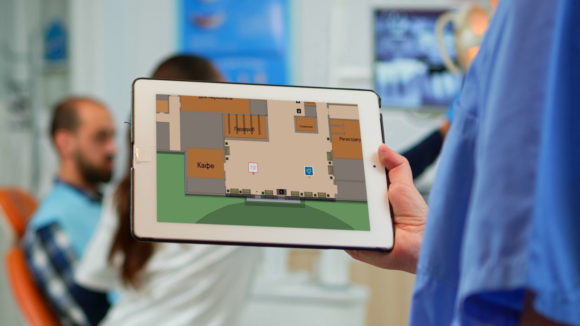
By the age of 2, he had designed the IT landscape for a premium medical clinic. The project includes engineering and IT systems that make the stay of visitors at the clinic as convenient as possible: from smart parking to patient navigation on the territory of the medical institution.
Positioning
The patient positioning system determines the location of a person in the clinic. This system is based on smart bracelets, tags, and an app for mobile devices. Integration with the medical information system allows the application to automatically enroll the patient to the doctors of the chosen specialty, to build the shortest path to them, taking into account the number of people in the electronic queue. The system also optimizes the customer's business processes by analyzing the time spent by doctors on receiving clients.
Monitoring of the patient's condition
The bracelets record the main indicators of the patient's vital functions, have fall monitoring sensors and a doctor's emergency call button. In case of a sudden change in the position of the marker, the nearest video camera turns on, the corresponding image is displayed on the screen of the nurse on duty, and the patient's location is shown on the map. For this purpose, K2TECH experts have designed a video surveillance system covering all possible areas of the clinic's visitors.
POOR
Access control and management systems include both turnstiles at the entrance to the clinic and multimedia reader panels at doctors' offices that display available time slots and the current number of people in the queue. This allows the patient to make an appointment with a doctor on the spot by attaching a wristband or phone to the panel. A complex of security alarms is also responsible for patient safety: volumetric motion sensors, broken glass.
Do you want to implement a modern navigation system in your building? We will offer the optimal solution of the Indoors Navigation Platform.:
🔹 Accuracy up to 1 meter 🔹 Low cost of implementation 🔹 Integration with mobile applications via SDK and third - party systems via API 🔹 SaaS and Op-Premise solution
Leave a request for www.indoorsnavi.pro and make your space convenient for visitors!
👇 Subscribe and keep up to date with innovations! 👇
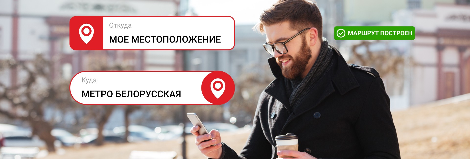
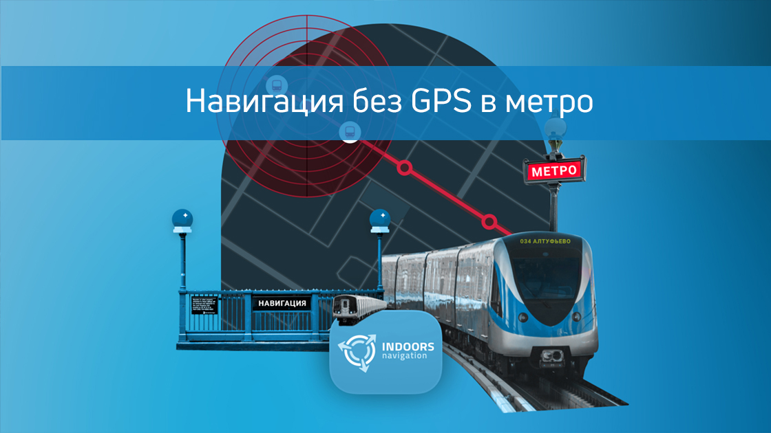
Представьте себя в незнакомом метро — вокруг бетонные стены, нет сигнала GPS, мобильный интернет работает с перебоями, а вам надо быстрой понять где в переходе вы находитесь.
Or how do you define:
Which stations is your train located between?
How much time is left before your stop?
When should I get ready to leave?
Traditional methods like looking out the window for station names or trying to hear announcements have long been outdated. Modern technology offers an elegant solution!
How does this solution work??
The new algorithm determines your location in the underground space by analyzing the characteristic vibrations of your smartphone due to the built-in sensors.
Classification of movement
When the train enters the tunnel:
The smartphone detects vibrations with a frequency of ~5 Hz (train movement)
When walking, the smartphone detects a frequency of ~2 Hz
Escalators and elevators will have their own unique frequency characteristics.
Collection of reference data
It is necessary to conduct a large-scale study and collect data from different stations, crossings and escalators.:
lots of subway rides in different cities
dozens of types of rolling stock
go through all possible scenarios (stops, acceleration, turns)
Neural network training
The algorithm is trained on thousands of trips in different subways around the world
It accurately distinguishes train movement from other passenger activities
Key advantages
It works without internet connection All calculations take place directly on your device.
Complete confidentiality Your data never leaves your smartphone.
Versatility The algorithm can be adapted to any type of subway system.
Но есть один важный недостаток такого решения — не высокая точность определения положения в большом пространстве. Например можно достаточно точно понять на какой станции вы находитесь, но уже в каком месте этой станции вы стоите или около какого вагона, с высокой точностью не получится. Для повышения точности позиционирования это решение модно совмещать с уже ставшей привычной навигацией по маячкам iBeacon.
Why is this important for shopping malls, airports, and hospitals?
The technology developed for the subway may be well suited for indoor navigation on the surface of the earth! After all, the same problems often occur in shopping malls, hospitals, and office centers.:
There is no GPS signal/Glonass
Poor connectivity and insufficient wi-fi coverage
People get lost in large spaces and waste their time.
Indoors Navigation offers similar solutions for a wide range of industries and for a variety of tasks.:
Shopping malls
Shows the way to the desired store
Leads on promotions and discounts
Analyzes the flow of visitors
Airports
Escorts them to the boarding gates
Finds baggage carousels
Shows power points and other POI
Hospitals
It leads to the right doctor's office
Builds routes for hospital visitors
Optimizes the work of staff and the search for medical equipment
How does it work in buildings?
Instead of train vibrations, we use data received over the radio channel, and as a result, navigation appears where GPS and Glonass are powerless. To do this, we use:
Bluetooth beacons
Accelerometer and gyroscope of a mobile device
Digital indoor maps and shortest routes
Try the future of navigation today
Do you want to implement a modern navigation system in your building? Our company offers the Indoors Navigation Platform:
🔹 Accuracy up to 1 meter 🔹 Work without the Internet 🔹 Building movement analytics 🔹 Integration with mobile applications via the SDK
Leave a request for www.indoorsnavi.pro and make your space convenient for visitors!
👇 Subscribe and keep up to date with innovations! 👇
Этот веб-сайт использует файлы cookie для улучшения вашего опыта во время навигации по веб-сайту. Из них файлы cookie, которые классифицируются как необходимые, хранятся в вашем браузере, поскольку они необходимы для работы основных функций веб-сайта. Мы также используем сторонние файлы cookie, которые помогают нам анализировать и понимать, как вы используете этот веб-сайт. Эти файлы cookie будут храниться в вашем браузере только с вашего согласия. У вас также есть возможность отказаться от этих файлов cookie. Но отказ от некоторых из этих файлов cookie может повлиять на ваш опыт просмотра.
Необходимые файлы cookie абсолютно необходимы для правильной работы веб-сайта. В эту категорию входят только файлы cookie, обеспечивающие базовые функции и функции безопасности веб-сайта. Эти файлы cookie не хранят никакой личной информации.
Любые файлы cookie, которые могут не быть особенно необходимыми для функционирования веб-сайта и используются специально для сбора персональных данных пользователей с помощью аналитики, рекламы и другого встроенного содержимого, называются необязательными файлами cookie. Перед запуском этих файлов cookie на вашем веб-сайте обязательно получить согласие пользователя.