2022
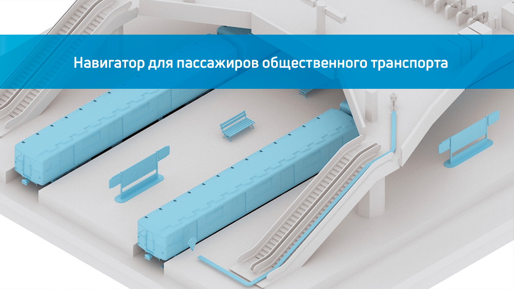
Subway navigation
Positioning at metro stations becomes much more convenient thanks to the mobile navigator for passengers of public transport, which will quickly show the route to the desired point.
The mobile navigator based on the INP platform helps to quickly get acquainted with the TPU map and saves time at the station, helps to increase the level of travel comfort and passenger loyalty. It helps to create a barrier-free environment for the movement of people with disabilities, visually impaired and blind passengers.
by 50%
Increased
passenger comfort
by 60%
The level of passenger loyalty
has increased
by 3 times
Orientation has accelerated
Description
Moscow is a prime example of not only a dynamically developing "smart city", but also a technological transport hub. Public transport is becoming more popular and in demand, and the infrastructure being created for this purpose is constantly expanding, making it more ambitious and difficult to navigate.
The Moscow Metro is the backbone of the capital's transportation system. That is why, as part of the pilot project, the Indoors Navigation team implemented its geographic information system in the Tsaritsyno transport hub, implementing a convenient navigator for passengers.
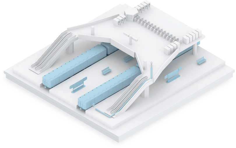
The digital twin of a subway station
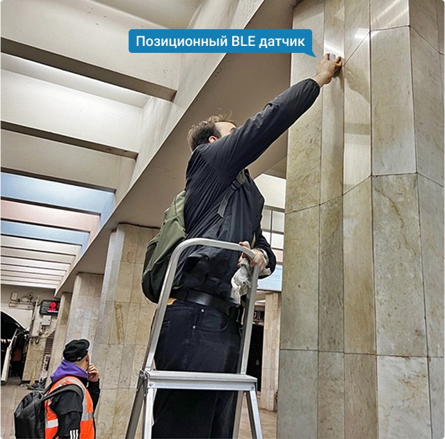
The Indoors Navigation team has created an exact digital copy of the entire Tsaritsyno transit hub with a detailed three-dimensional map of the metro station, MCD, commuter trains, all crossings and stops. More than 100 positional sensors have been installed at the station.

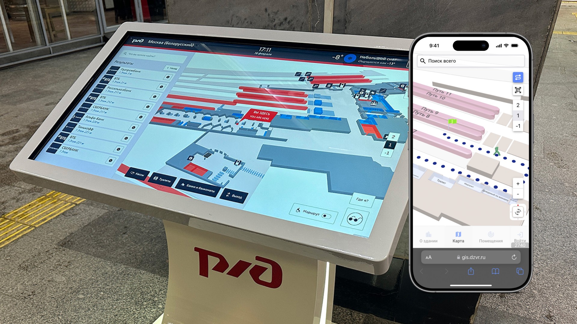
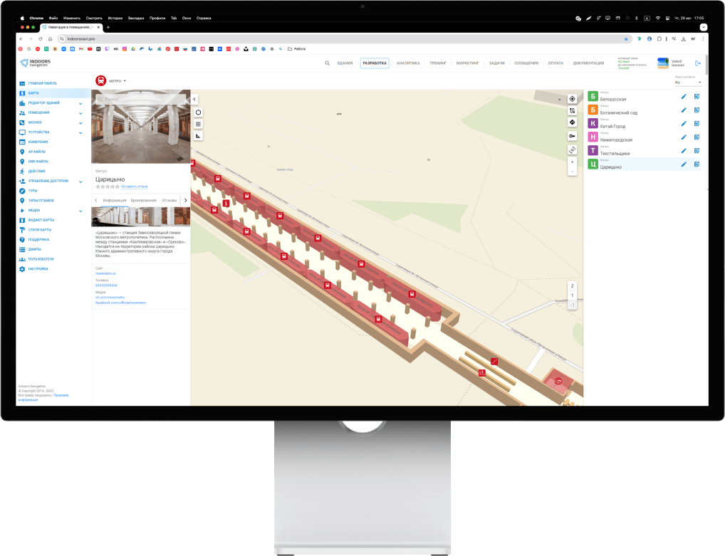
WEB-based control panel
The service is managed from the web-based control panel, where you can quickly change routes, update information about facilities, or inform passengers with an address message. The Indoors Navigation geoinformation system provides seamless navigation both at underground metro stations and at the MCD and MCC street stations, continuously accompanying the user.
AR navigation
The service also has the ability to follow a route in augmented reality mode. By scanning a special marker, the user can see the route through the phone's camera in real space. The augmented reality service can display advertising content with 3D graphics.
Navigator for the visually impaired and blind
The passenger navigator has a special mode for people with limited mobility, including the visually impaired and blind. You can build a special route that will lead through the designated passageways without steps, elevators and ramps. A special interface with voice acting and voice prompts along the route is designed for the visually impaired. At any time, the user can request help by clicking on their location. And specially installed sensors with sound signals will help them accurately determine their location and follow to the end of the route.
Statistics and analytics of movements in the subway
The geographic information system uses visit statistics to determine the object's points of attraction, build a heat map, and visualize popular routes. The metro administration receives time-bound data on crowded areas and congested sections and sees the movement of users online.
Integration of the navigator into other applications
Due to the open API of the platform and the Indoors SDK, the navigator's functionality can be quickly integrated into other mobile applications, such as Metro or Moscow Transport. The system is quickly implemented and easily scaled due to simple installation without damaging the surface and supports a wide range of mobile devices. The use of vertical IoT location in public safety
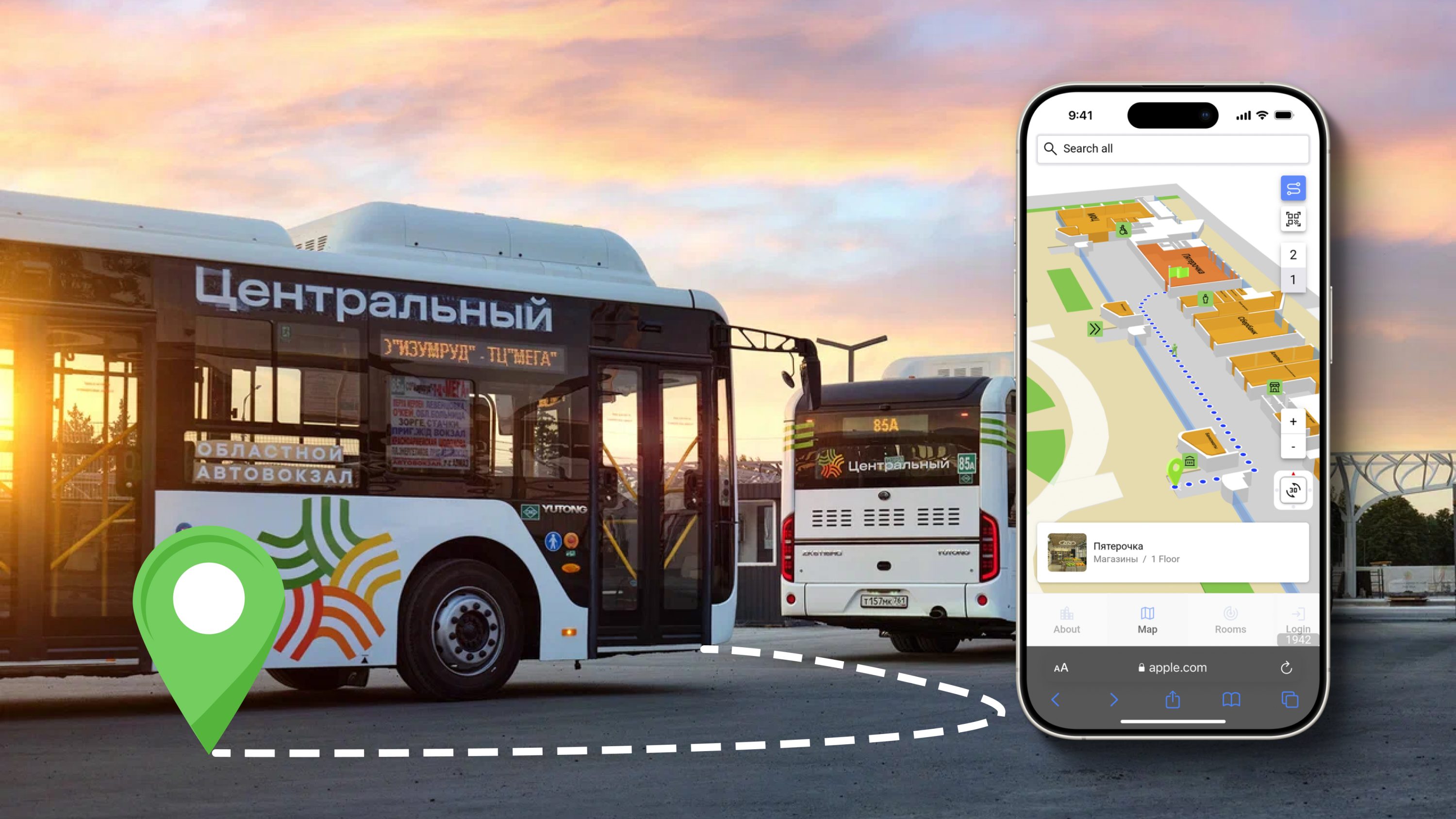
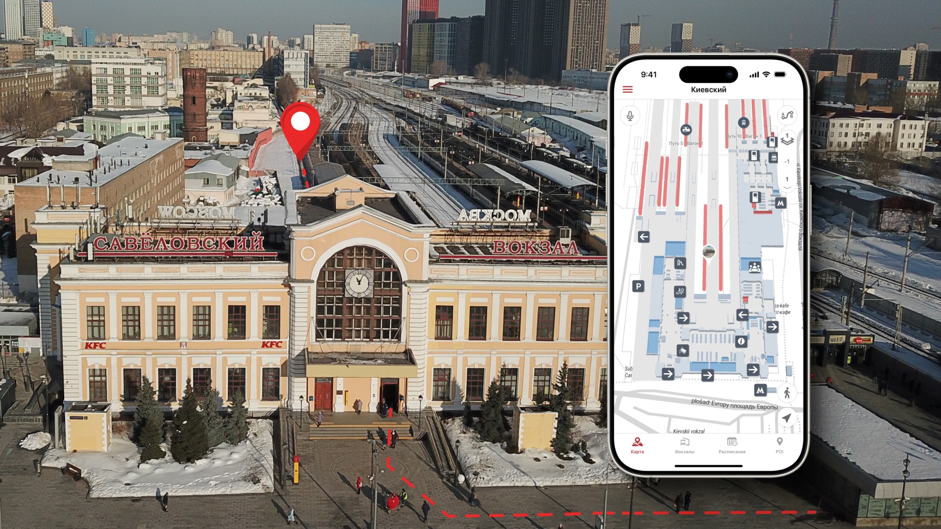
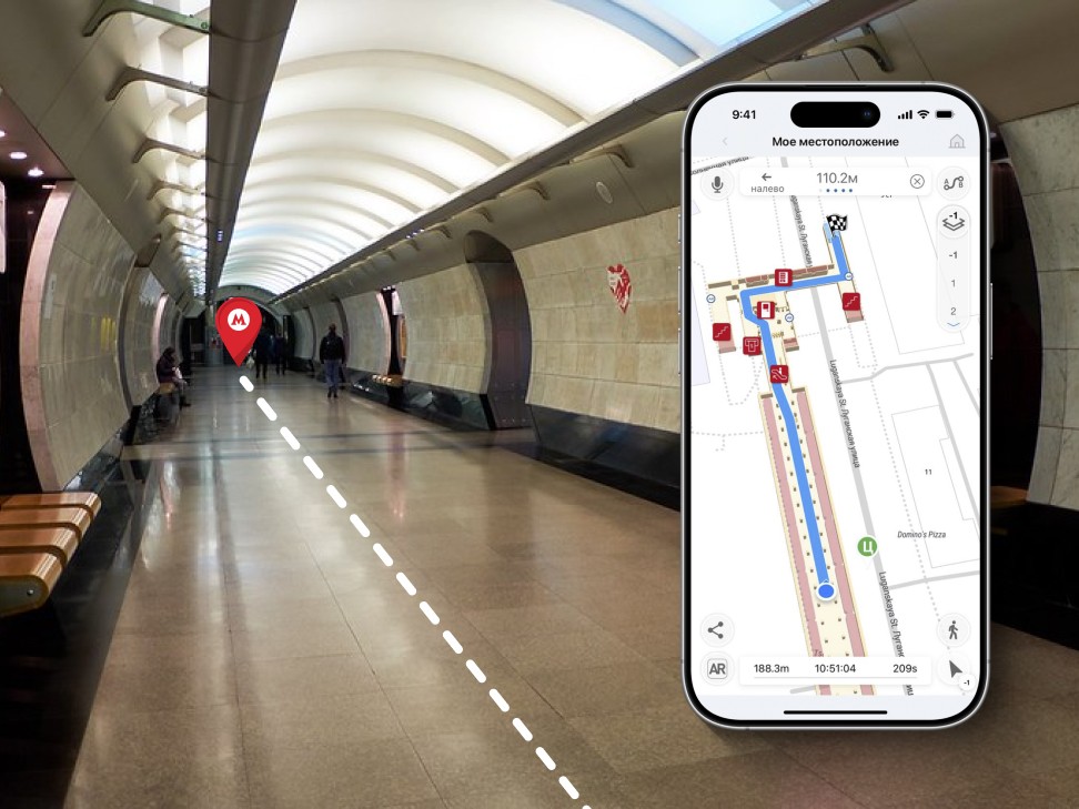
The mobile app
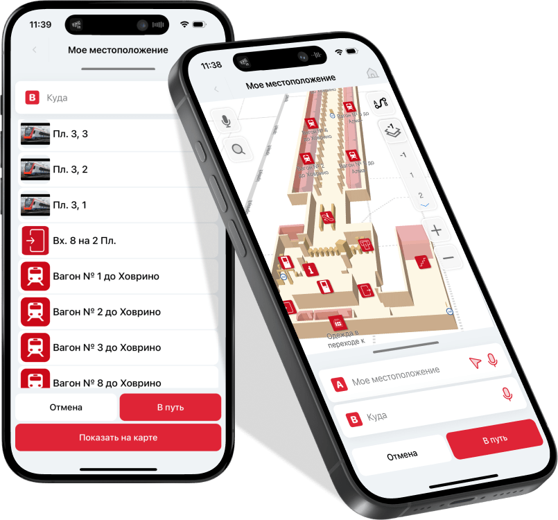
Using the mobile application, passengers can quickly navigate the transport hub, understand where they are and get directions to the desired point: ticket office, platform or carriage.
The navigator app guides him along the shortest route in real time, providing information about infrastructure facilities and points of interest at the station. Passengers can quickly find out which crossings are closed for repairs and how best to get around. Which ticket offices are open and their schedule. Where is the first car, the bus stop, or the store you need.


Subway navigation
The introduction of internal navigation will allow passengers to provide a detailed map of stations on a mobile device with the ability to plot a route to the desired point (exit, crossing, stop) while still in the train carriage, and follow it in navigator mode.
Thematic publications on our blog
Navigator for passengers of public transport and positioning in the subway
Navigation in the subway is becoming more convenient with the use of a mobile navigator for passengers, which was tested in 2022 at Tsaritsyno station. The mobile navigator helps you quickly familiarize yourself with the map and help....
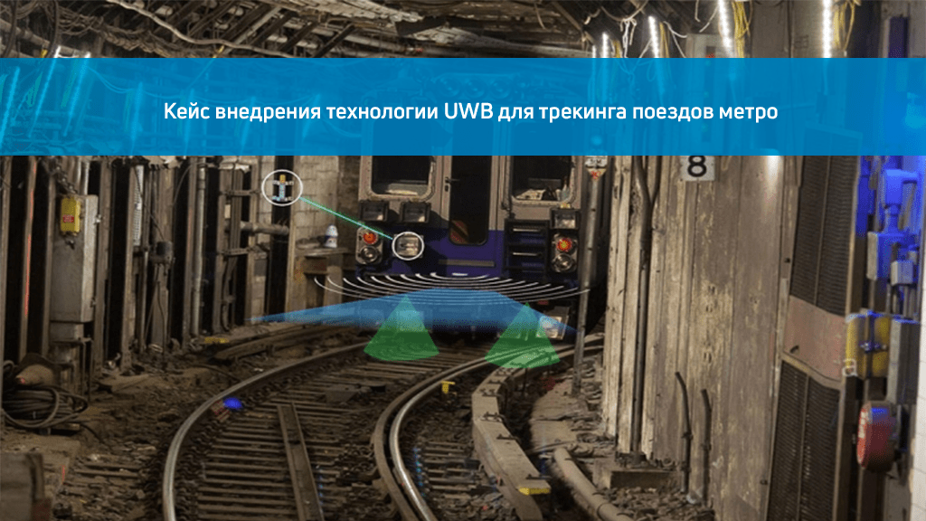
The case of the introduction of UWB technology for tracking metro trains
The New York City Transportation Authority has signed a $14 million contract with Humatics and Siemens to develop an ultra‑broadband radio technology solution within 15 months....