
Stadium navigation
In the modern world, stadiums are no longer just a platform with stands for sporting events. They become part of the show, amaze with new technologies and large-scale cultural events.
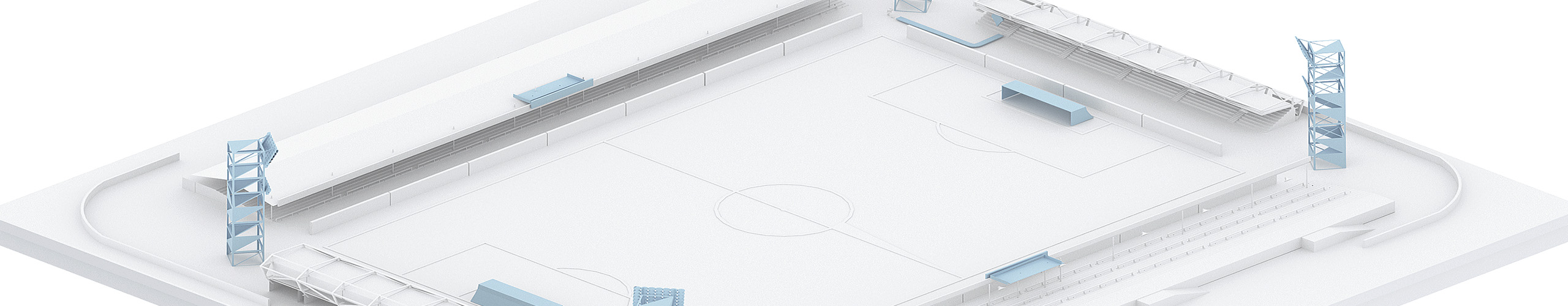
The stadium's digital twin based on GIS Indoors Navigation provides not only a modern navigation service, but also simplifies the operation of the facility with frequent layout changes and provides the administration with the necessary metrics in the web control panel.
For example, which doors are open, which floors have elevators, what temperature is in different rooms, what mode is the fire safety system in, where is the security and other metrics of the stadium's operational processes.
When holding concerts or exhibitions, it is important to quickly transform the space each time and provide visitors with an up-to-date map with a new location of the spectator areas and routes to them.
Advantages for the administration:
The digital twin of the stadium with visualization of operational processes:
Reducing the costs of operating a sports facility and digitalizing it.
Improved service quality and increased stadium capacity:
Consequently, there is an increase in the loyalty of the audience, their number and the prestige of the sports facility.
Increased sales by offering new services:
The new geocontext advertising service generates additional revenue through newsletters and promotional messages to visitors.
Detailed statistics:
Analysis of the behavior and distribution of spectator flows in the stadium, heat maps of the facility.
Staff optimization:
State-of-the-art tracking system for staff movements around the stadium.

Client orientation
The introduction of a geographic information system at the stadium will provide a high level of service to visitors and solve the problem of rapid orientation at the sports facility, ending wandering through sectors and stands once and for all.

Advantages for visitors:
- A detailed map of the stadium is available on your mobile phone, with the ability to plot a route to the desired exit to the podium and navigate it as in the navigator
- Quickly determine your location on the territory of a sports facility
- The ability to find an object of interest in game mode using augmented reality hints — AR navigation in the stadium
- Direct notification of events at the stadium with reference to your geo-location
- Displaying friends on the map of a sports facility
Thematic publications on our blog
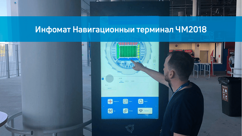
Navigation in the premises of the 2018 World Cup stadium. Infomat.
On the eve of the 2018 FIFA World Cup, we installed a navigation infomat on each floor of football stadiums for indoor navigation, familiarization with the stadium map and its exits. Infomat…
Thematic case studies in our portfolio
Frequently Asked Questions about stadium navigation
What is GIS at stadiums and sports facilities and why is it needed?
The geographic information system (GIS) at stadiums and sports facilities is a technology that helps manage space, track the flow of spectators, ensure their navigation and improve safety at the facility. It allows visitors to navigate faster, and the administration to optimally manage the movement of people.
What are the advantages of GIS implementation in the stadium?
GIS improves navigation for viewers, increases security, allows you to analyze and control the flow of visitors, and helps administrators plan the space more efficiently. This makes visiting the stadium more comfortable and safer.
How will visitors interact with GIS at the stadium?
Visitors can use interactive maps through information terminals, mobile applications or QR codes to obtain information about the location of the stands, toilets, food courts and other areas.
How does GIS help ensure safety at sports facilities?
GIS allows you to track gatherings of people, provides quick access to evacuation plans, and helps you find safe routes in case of an emergency. It also integrates with video surveillance and alarm systems for rapid response.
How does GIS help organizers of sporting events?
GIS provides data on spectator behavior and zone congestion, which makes it possible to optimize the arrangement of services, improve route planning, and minimize possible congestion during major events.
How does GIS improve interaction with fans?
Thanks to navigation applications, fans can easily find their seats, quickly reach amenities and receive important information in real time, which increases the convenience and satisfaction of the audience.
What are the prospects for further GIS development at sports facilities?
In the future, stadium GIS may expand through more accurate analytics, integration with augmented reality technologies, support for interaction via mobile devices, and adaptation to the needs of specific audience groups such as the disabled and the elderly.
Is it possible to integrate GIS with existing stadium systems?
Yes, GIS can integrate with access control systems, video surveillance, ticket management and security systems to create a single integrated infrastructure.