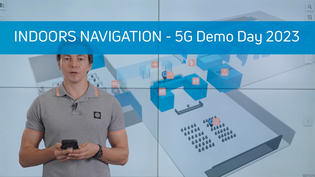
🔥 Indoors Navigation on 5G Demo Day 2023! 🔥
We have developed the most accessible and convenient geographic information system, Indoors Navigation, which allows even an experienced user to create a digital twin of a building with positioning capabilities in the shortest possible time.
The solution is in demand for any large buildings, primarily as a client application for navigation in large transport hubs (airports) and public places such as shopping malls.
Secondly, it is used to track personnel in production and warehouse complexes, and to control dangerous areas.
Metrics:
• Increase labor efficiency by 5-10% due to tracking.
• Increased occupational safety by 10% due to automatic control of access to hazardous areas.
• Increase the safety of tangible assets by 30% due to tracking.
A unified information environment for building and asset management is a geographic information system (GIS) based on a digital twin of the facility and indoor geolocation services, the Indoors Navigation Platform (INP).
Learn more on the website www.indoorsnavi.pro
Discover the future of geographic information systems with the Indoors Navigation Platform. 🌐
📍 What will you see?
• The digital twin of the enterprise in action
• Indoor geolocation services
• Interactive navigation with QR codes and AR
🛠 How to integrate it?
• We create personalized solutions for each client. Contact us for a demo
👇 Subscribe and keep up to date with innovations! 👇
Learn more about solutions based on the geographic information system of the Indoors Navigation Platform
For more information about navigation in public places, follow the link: https://indoorsnavi.pro/


One thought on “Indoors Navigation на 5G Demo Day 2023”
Классное решение! Было бы здорово, если бы все крупные компании взяли себе этот функционал на заметку. Значительно упрощает жизнь!