
Concert Navigation
Digitalization of concert venues ensures a higher quality of concerts, makes attending events more convenient and comfortable for visitors, and also increases the level of security and control on the territory of the concert venue.
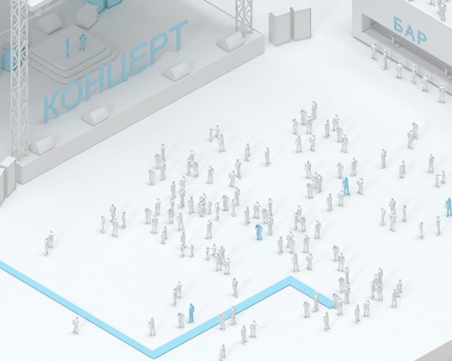
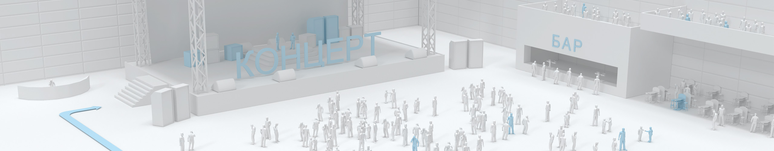
One of the key elements of the digitalization of the concert is the positioning system, which allows visitors to quickly and easily navigate the concert venue, determine their position, and build a route to the bar and a place in the restaurant.
Geographic Information System (GIS) Indoors Navigation Platform. (INP) is based on the use of an interactive event card in your phone, infomat, and computer. инфомате и компьютере
The mobile application will allow visitors to receive an interactive map of the club and their position on it, as well as detailed information about the event and current news.
The use of indoor positioning systems at a concert venue can help in staff control and event security. The INP navigation platform can be used to track the location of staff at an event and monitor their actions.
For example, at an event, you can set positional sensors, which will transmit data about the location of each employee to the server. The event administrator can track the location of the staff at the concert venue, which will allow them to quickly respond to possible problems or delays in work.
The indoor positioning system can also help control staff access to certain areas of the concert venue, such as the engineering area or the equipment warehouse. This will ensure the safety of the event and prevent possible difficulties with the loss.
Advantages for a concert venue:
Convenience for the audience:
The positioning system makes it easier for the audience to find their seats, as well as provide more efficient traffic flow management inside the concert hall. Mobile navigation apps allow visitors to easily navigate the event, find the shortest route, as well as the way to public areas and food outlets.
Safety:
Movement tracking systems help to increase safety at concerts, preventing possible accidents and creating a comfortable environment for visitors.
Improving the consumer experience:
Concert navigation systems help improve the overall experience of the audience by providing better sound, a more spectacular atmosphere, and easier movement inside the concert hall.
Improved sound:
Indoor navigation systems allow you to adjust the sound equipment more precisely and create a better sound at a concert.
More efficient lighting:
Navigation platforms can also help with lighting control, which creates a brighter and more spectacular atmosphere at the concert.


Client orientation
Interactive event maps allow visitors to get information about the venue of the event: the layout of the concert hall, cloakroom, toilets, bars, recreation areas, as well as information about the location of emergency exits and medical centers.

Advantages for visitors:
- Easy navigation of the concert venue: the indoor positioning system can help visitors find the right areas faster and easier, such as ticket offices, toilets, bars, restaurants, etc.
- Improved service: With the help of the indoor navigation system, concert visitors can be offered a personalized service, for example, the opportunity to order drinks and snacks on site, as well as receive personalized promotional offers and recommendations about the nearest recreation and entertainment areas.
- Safety: The positioning system can help in the event of an evacuation by locating visitors and guiding them to exits in case of an emergency. The higher the understanding of the direction of movement, the less panic!
- Better visual and sound perception: Using the positioning system, you can determine the best place to watch and listen to the concert, which improves the quality of perception.

Digitalization of the concert venue
Digitalization of the concert venue with the introduction of an indoor navigation system is a necessity for the administration, as it allows optimizing processes and improving interaction with visitors.
Using such a system, it is possible to increase the efficiency of staff, reduce the time spent searching for the right places and simplify the process of organizing concerts. In addition, the presence of a modern navigation system on the site can attract more visitors who will appreciate the comfort and convenience of attending events.

What does the concert hall administration get?:
- Determining the location of visitors: It allows you to control the movement of visitors at an event, detect problems with the availability of seats and quickly respond to possible threats.
- Access control: It allows you to manage the flow of visitors, control the time spent by the audience at the event and ensure higher security.
- Personnel tracking: The INP geographic information system allows you to track employee movements in real time. For example, you can know the locations of security guards and cleaners in order to manage them more quickly.
- Improved marketing: The positioning system can collect data on visitor behavior and help concert organizers improve marketing strategies and increase ticket sales for future events.

The relevance of the GIS implementation of the Indoors Navigation Platform
Digitalization of concert venues is the process of introducing modern technologies to improve the sound quality, lighting, visual effects and navigation at concerts.
The introduction of indoor navigation at a concert can improve the overall experience of visitors, making it easier for them to find the right place and reducing the number of problems to navigate in a large hall or arena. Also, such a system can help organizers control the flow of visitors and load distribution to various areas of the event, increasing overall safety and comfort at the concert.
Thematic publications on our blog
3 Ways to Improve Food Delivery Services Using Bluetooth Beacons
We live in a world where, most of the time, people are either too busy to cook or too lazy. This is why food delivery services around the world had high revenues (USD 121.848 million) in 2018. Predicted…
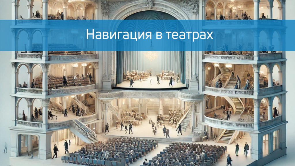
Modern navigation in theaters
A visit to the theater is always a celebration of art and culture. However, in large and modern theaters, visitors often face problems that can make it difficult to fully enjoy the event: finding the right room, confusing routes, long queues at the cloakroom or buffet. Modern…
Frequently Asked questions about concert navigation
What is GIS at a concert venue and why is it needed?
The geographic information system (GIS) at a concert venue is a technology that allows you to track and manage the flow of people, orient visitors, and improve the security and organization of the event. It helps visitors quickly find their seats, exits, recreation areas, and other facilities.
What are the advantages of implementing GIS at a concert venue?
GIS improves navigation, increases security, optimizes visitor flows, and reduces the time needed to find the right areas. It also improves the organization of the event, making it more comfortable and safer for the audience and staff.
How will visitors interact with GIS?
Visitors can use interactive maps on information terminals, mobile applications, or through QR codes that allow them to access the site map and plot routes to the sites of interest.
How does GIS help manage security at a concert venue?
GIS allows you to control crowds of people, quickly find emergency evacuation routes, monitor critical areas and manage the flow of flows in real time, which reduces the risk of emergencies.
Is it possible to integrate GIS with existing security systems?
Yes, GIS can be easily integrated with video surveillance, access control and alarm systems, which allows you to create a unified security infrastructure.
How complicated is the process of installing and configuring GIS on the site?
The process requires careful planning and installation of equipment, including cameras and sensors. After installation, the software is configured and integrated with other systems, which may take some time depending on the size of the site.
How does GIS help organizers plan events better?
Based on data on visitor behavior and zone congestion, GIS allows you to better plan the placement of service areas, determine optimal routes for visitors and improve the organization of future events.
How does GIS affect the user experience?
GIS makes staying at the concert venue more convenient and safer, reduces the time needed to find the right areas, improves navigation and ensures comfortable movement around the territory.