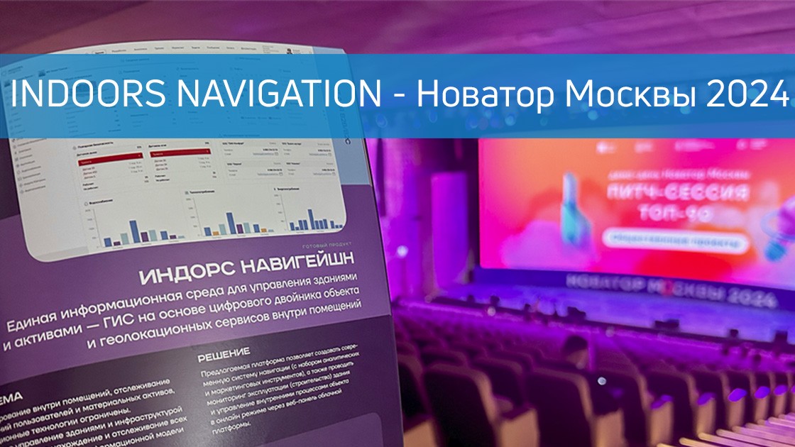
🔥 Indoors Navigation became finalists of the competition for Innovator of Moscow 2024! 🔥
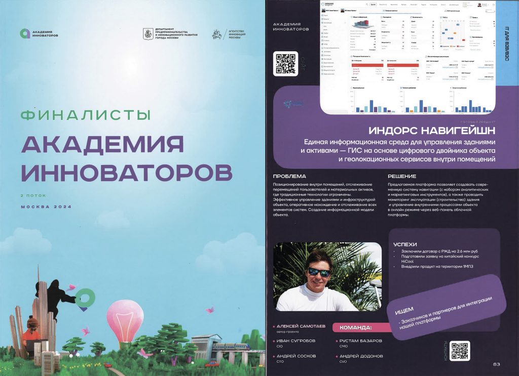
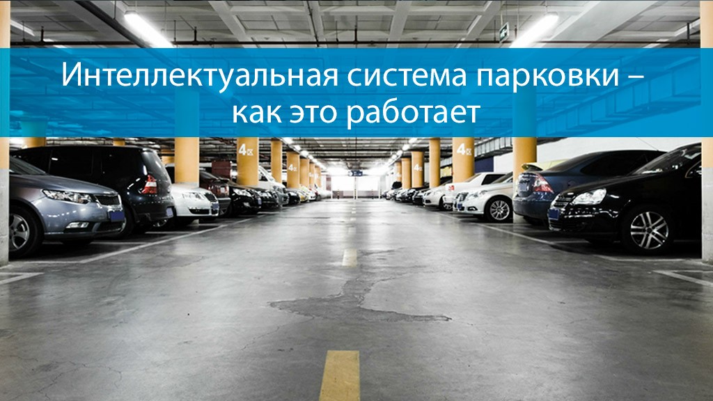
В мире инноваций и передовых технологий конкурсы и премии играют важную роль, мотивируя компании стремиться к новым высотам. Одним из таких престижных мероприятий является конкурс «Новатор Москвы», который привлекает лучшие умы и компании города, работающие в самых разных областях науки и техники. В этом году одной из финалистов стала компания Индорс Навигейшн, которая прошла акселератор «Академия инноваторов» и продемонстрировала свою гео-информационную систему на основе цифрового двойника INP.
The company was founded several years ago with the aim of developing and implementing advanced indoor navigation solutions. Their products help people navigate complex buildings with ease, such as shopping malls, airports, hospitals, and office complexes. In a short period of time, the company has established itself as a reliable and innovative partner capable of offering unique navigation solutions.
One of the key achievements of Indoors Navigation has been the development of a unique algorithm that takes into account the density of the flow of people and optimizes routes in real time. This avoids congestion and ensures comfortable movement around the building. In addition, the system integrates with mobile devices and supports voice commands, making it accessible to a wide range of users, including people with disabilities.
Indoors Navigation is not going to stop there. Our plans include expanding the range of solutions offered, entering the international market and continuing to improve our technologies. Participation and success in the "Innovator of Moscow" competition became an important stage on the way to the realization of these ambitious plans.
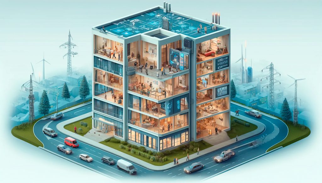
Единая информационная среда для управления зданиями и активами — геоинформационная система (ГИС) на основе цифрового двойника объекта и геолокационных сервисов внутри помещений Indoors Navigation Platform (INP).
Learn more on the website www.indoorsnavi.pro
Discover the future of geographic information systems with the Indoors Navigation Platform. 🌐
📍 What will you see?
• The digital twin of the enterprise in action
• Indoor geolocation services
• Interactive navigation with QR codes and AR
🛠 How to integrate it?
• We create personalized solutions for each client. Contact us for a demo.
👇 Subscribe and keep up to date with innovations! 👇
Подробнее узнать о новых разработках и геоинформационной системе Indoors Navigation Platform
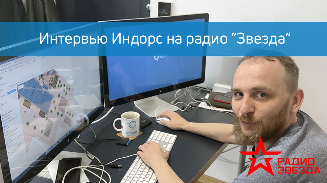
Недавно технический директор компании Индорс Навигейшн, Иван Александрович Сугробов, дал интервью для радио «Звезда». В ходе беседы он поделился ключевыми аспектами работы компании, рассказал о последних достижениях и планах на будущее.
Ivan Alexandrovich spoke about the technologies used in the geographic information system of the Indoors Navigation Platform, patents obtained and areas of work.
The interview was an important event that allowed a wide audience to learn about the company's achievements and plans. Indoors Navigation continues to move forward confidently, making a significant contribution to the development of innovative technologies and improving people's quality of life.
For more information about the company and its products, you can visit the official website.: https://indoorsnavi.pro/
Discover the future of geographic information systems with the Indoors Navigation Platform. 🌐
📍 What will you see?
• The digital twin of the enterprise in action
• Indoor geolocation services
• Interactive navigation with QR codes and AR
🛠 How to integrate it?
• We create personalized solutions for each client. Contact us for a demo.
👇 Subscribe and keep up to date with innovations! 👇
Learn more about new developments and the geographic information system of the Indoors Navigation Platform: https://indoorsnavi.pro/
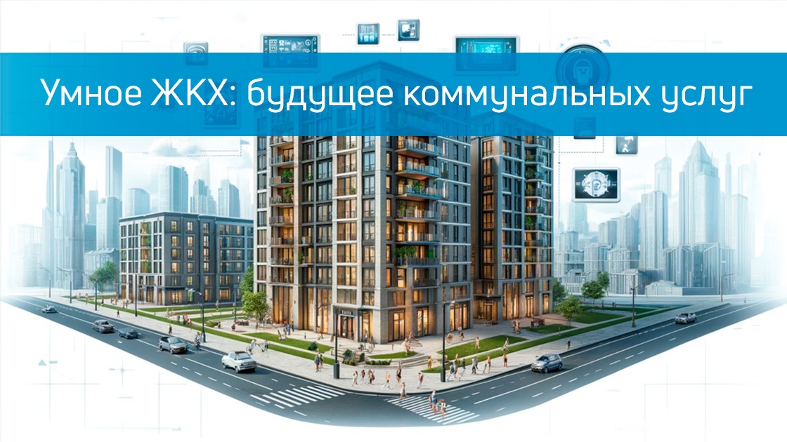
В современном мире технологии стремительно развиваются и проникают во все сферы нашей жизни. Одна из таких областей — жилищно-коммунальное хозяйство (ЖКХ). Концепция «Умного ЖКХ» становится все более популярной и востребованной, предлагая инновационные решения для управления домами и коммунальными услугами. В этой статье мы рассмотрим, что такое «Умное ЖКХ», какие преимущества оно приносит и как его внедрение может улучшить качество жизни.
Что такое «Умное ЖКХ»?
«Умное ЖКХ» — это система управления жилыми зданиями и коммунальными услугами с использованием современных технологий, таких как интернет вещей (IoT), большие данные и искусственный интеллект (AI). Эти технологии позволяют создавать интегрированные и автоматизированные системы, которые могут мониторить, анализировать и управлять различными аспектами жилищно-коммунального хозяйства.
Основные компоненты «Умного ЖКХ» включают:
Smart meters — devices that automatically collect data on water, gas, and electricity consumption and transmit it to a central system for analysis and accounting.
Heating control systems — solutions that allow you to optimize energy consumption for heating and maintain a comfortable temperature in the room.
Smart intercoms and security systems — devices that provide access control and increased security in residential buildings.
Housing Management Platforms — software that integrates all the data and allows residents and management companies to effectively manage homes and utilities.
Преимущества «Умного ЖКХ»
Energy efficiency — Умные системы управления энергопотреблением позволяют существенно снизить расход электроэнергии и тепла. Это не только экономит деньги жильцов, но и способствует охране окружающей среды.
Convenience and comfort — С помощью умных устройств жильцы могут легко контролировать отопление, освещение и другие системы своего дома через мобильные приложения или голосовые команды.
Safety — Умные системы безопасности и видеонаблюдения обеспечивают высокий уровень защиты жилых зданий, снижая риск взломов и краж.
Transparency and control — Автоматический сбор и анализ данных позволяет получать точную информацию о потреблении ресурсов, что упрощает учет и расчет коммунальных платежей.
Quick response to problems — Умные системы могут автоматически обнаруживать неисправности и оперативно уведомлять об этом управляющие компании и жильцов, что позволяет быстрее устранять проблемы.
Как внедрение «Умного ЖКХ» улучшает качество жизни
Внедрение «Умного ЖКХ» может значительно улучшить качество жизни жильцов. Во-первых, оно позволяет экономить на коммунальных платежах за счет оптимизации потребления ресурсов. Во-вторых, умные технологии обеспечивают высокий уровень комфорта и безопасности, создавая удобные условия для проживания. В-третьих, автоматизация процессов управления жильем освобождает время и ресурсы как жильцов, так и управляющих компаний, что повышает общую эффективность и удовлетворенность.
Conclusion
«Умное ЖКХ» — это не просто модное слово, а реальная возможность сделать нашу жизнь лучше и комфортнее. С внедрением умных технологий в жилищно-коммунальное хозяйство мы получаем множество преимуществ: от экономии энергии и ресурсов до повышения безопасности и удобства. Компания Индорс Навигейшн готова предложить передовые решения в области «Умного ЖКХ», помогая сделать ваш дом умнее и современнее.
The future is already here — let's make it better together!
You can learn more about the technologies on our website. on the website Indoors Navigation.
«During a recent trip using my phone to navigate, my Google map showed buildings in 3D, a wonderful tool for showing the relative heights of buildings around me and providing a better understanding of where I am. This feature was introduced back in 2021. I've had enough years to remember the days when paper maps were my main means of navigation, when I had a rented car and had to write down exactly where I needed to go on a separate piece of paper so I wouldn't get lost searching. My path led somewhere in an unfamiliar city. But in the city itself, there were people of certain professions from whom I simply did not expect them to be able to navigate, including taxi drivers, deliverymen, and rapid response services — they all relied on knowledge and understanding of geolocation to get someone or something where they needed to go.», — пишет читатель. Зачастую этим группам людей необходимо найти не только здание, но и определенный этаж внутри здания. В частности, службам быстрого реагирования нужна четкость вертикального местоположения для повышения эффективности служб экстренной помощи и общественной безопасности.
GPS and its disadvantages
GPS — this is an incredible technology that was developed in the 1960s during the Cold War for military purposes. We now use it on our phones for countless applications, from sharing apps to delivery apps; from gaming to finding our way around the city. We are so dependent on it and geolocation services that in many cases we don't even realize all the disadvantages of GPS technology. For example, in urban areas, signals can be reflected and very inaccurate (Have you ever seen a really big blue dot on a map?). Sometimes the map can put you much further away than you actually are, because there is no line of sight with the satellites that make up the GPS signals that your phone should receive. Maps have also historically always been 2D (including many Google and Apple maps so far), but as more and more people live in urban areas (approximately 82% of US residents), it's not enough to get just the coordinates of where an object is located.
Many people don't realize that emergency services and public safety were the driving force that brought GPS to our mobile phones for all the apps we use now. The proliferation of mobile phones (and the emergence of people calling emergency services from these phones) has been the impetus for chips to become small enough to fit into them. As more landlines are "disconnected" over the years, currently more than 80 percent of emergency calls are made from mobile phones. GPS location coordinates from phones can now provide "x" and "y" coordinates in an emergency.
Vertical position of the Z axis
We often think about the need to call 911 when there may be an emergency at home, but it can happen anywhere. Even outside residential buildings, emergency calls come from schools, office buildings, and hotels— multistory buildings where precise location is important, beyond the "x" and "y". Here, vertical positioning can be important to save lives. During a heart attack, acute asthma attack, or other similar emergency, the caller to the emergency service cannot provide his location or address. While our Public Safety Response Points (PSAPs) now have technologies that allow us to determine the "x" and "y" coordinates of the caller and convert them to the actual address. The location of the caller along the vertical axis can be vital for finding a person in need.
Unfortunately, GPS coordinates and even Wi-Fi are quite poor at providing a location at the floor level. The Federal Communications Commission now requires wireless carriers to provide a person's location information "at the floor level" of an emergency caller in 25 major U.S. markets with at least 80 percent accuracy. This will allow emergency service operators and emergency response services to find their callers much faster, which saves thousands of lives every year.
The good news is that vertical Z-axis location technology already exists and can be used in more than just the top 25 U.S. markets. Apart from GPS chips on phones, almost all cell phones, wearables, and IoT devices have barometric pressure sensors. As we were taught in high school in physics, atmospheric pressure can be measured — and it is constantly changing. When you take the elevator, the pressure drops (so your ears may pop). The same thing happens when there is a downpour or even a strong wind – the pressure changes. But by using the pressure readings on the phone and subtracting the immediate weather effects in the area, it is possible to determine the exact location at floor level — even inside buildings.
The importance of accuracy
Digital cards have replaced paper cards. As our maps begin to turn into 3D and we increase our expectations for the functionality of smart buildings, let's not forget the role that accurate geolocation (in particular, floor-level location detection) should play in our future IoT applications and beyond. Accurate real-time location information (including altitude above sea level) will eventually become what makes smart buildings truly smart. As a result, such buildings can actually participate in emergency response, helping emergency services get to people in need faster, as well as tracking first responders, providing enhanced capabilities. Security for them in complex, multi-storey buildings without an accurate vertical location of the 3D map is, in fact, just empty shells. Fortunately, today there are technologies that allow you to use a vertical location at floor level to create mobile applications, etc.
You can learn more about the technologies on our website. on the website Indoors Navigation.
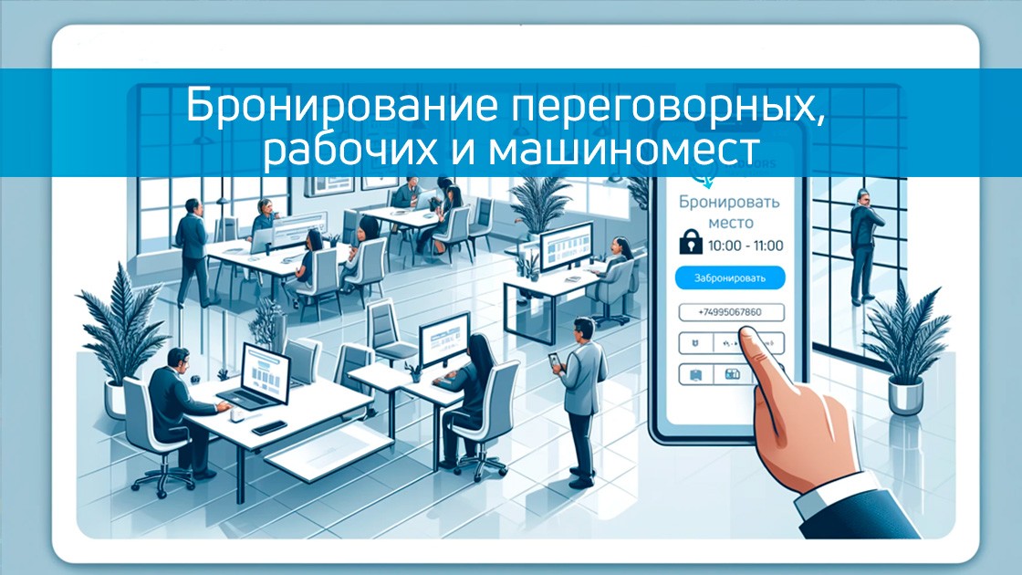
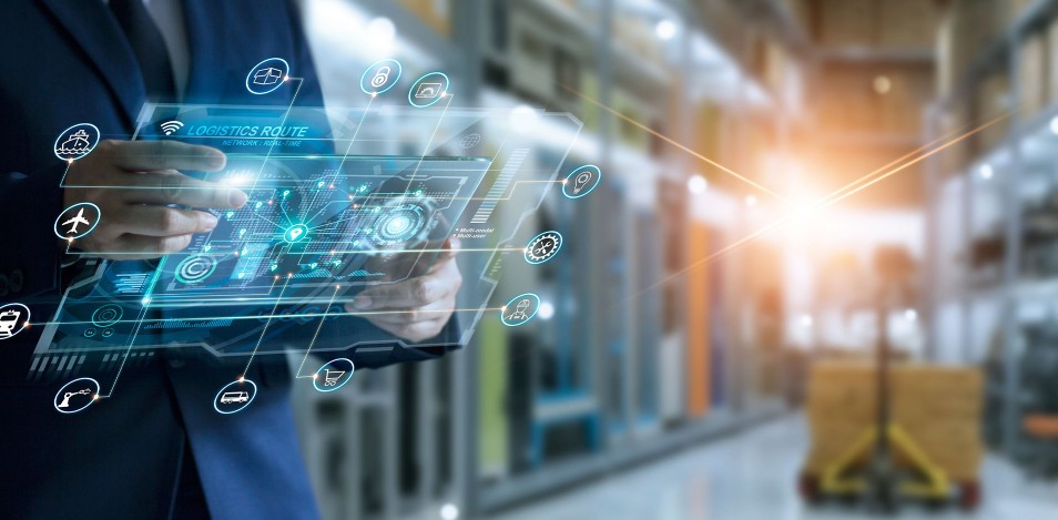
In today's world, where every minute counts, efficient use of office space and resources is becoming a key aspect of a successful business. Modern booking systems for meeting rooms, workplaces and parking spaces can significantly simplify the management of corporate resources and increase the overall productivity of the company.
These innovative technologies provide a higher level of organization and accessibility of office space and resources, which in turn leads to increased productivity and cost optimization. Let's take a closer look at what advantages booking systems provide and what key performance indicators (KPIs) can be improved through their implementation.
Advantages of modern booking systems
Optimizing space usage Booking systems for meeting rooms and workplaces allow you to effectively manage office space, avoiding situations when meeting rooms remain empty, or vice versa, there is not enough space for meetings. Thanks to the centralized booking system, space management becomes flexible and transparent.
Reduced operating costs. Automating the booking process helps to reduce office management costs. Booking systems minimize the need for constant intervention by administrative staff and reduce the risks associated with the human factor, such as errors during reservations.
Increase employee satisfaction and productivity. The convenience of booking workplaces and meeting rooms directly affects the overall satisfaction of employees. Ensuring that the necessary resources are available at the right time allows staff to better plan their workday and be more focused and productive.
Efficient parking space management. Parking reservation systems contribute to a better allocation of available space for cars, prevent overfilling of parking and reduce the time spent searching for an empty space. This is especially important for large business centers with limited parking spaces.
Key KPI that can be improved
The space utilization factor. This indicator reflects how effectively the leased area is being used. Booking systems help to increase this figure by making it more appropriate to allocate meeting rooms and workplaces.
Average booking time. Reducing the time required to book a space improves the overall efficiency of employees and reduces operational costs.
Employee satisfaction level. The convenience and accessibility of booking systems directly affect job satisfaction. A higher level of staff satisfaction can reduce staff turnover and improve corporate culture.
Cost reduction. Optimizing the use of office and parking space can significantly reduce rental and maintenance costs.
Advantages
The introduction of modern booking systems, such as GIS Indoors Navigation, in business centers and offices not only improves corporate resource management, but also creates a more comfortable and productive work environment. This is an important step towards optimizing business processes and increasing the company's competitiveness in the market.
On the website of the indoorsnavi.pro you will find additional information about how our solutions can transform your company for the better. Contact us to discuss how we can help your business become more organized and efficient.
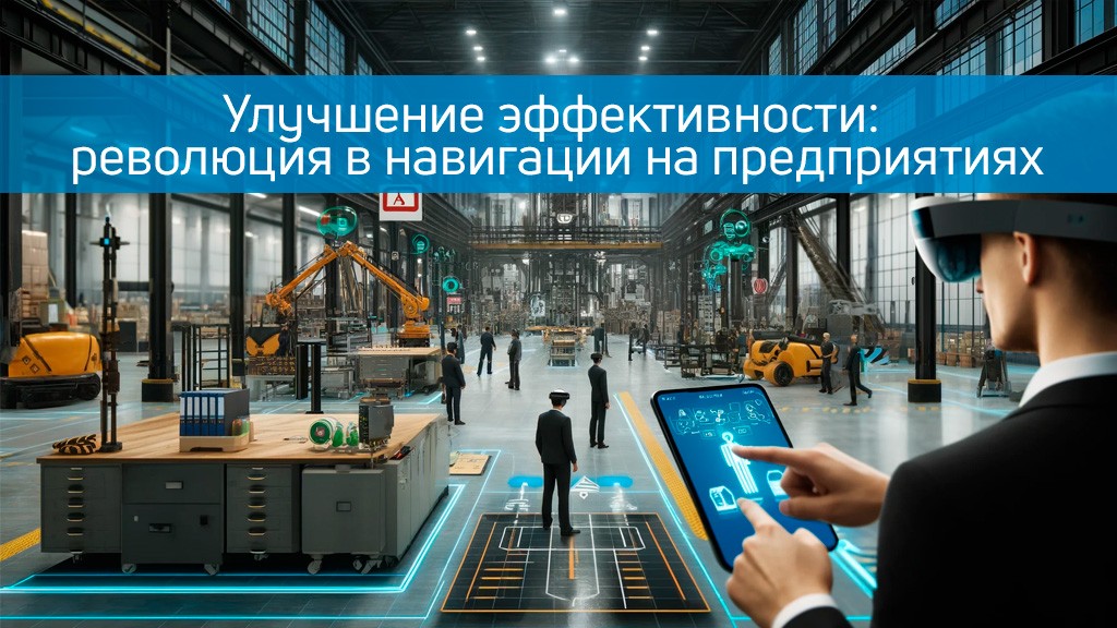
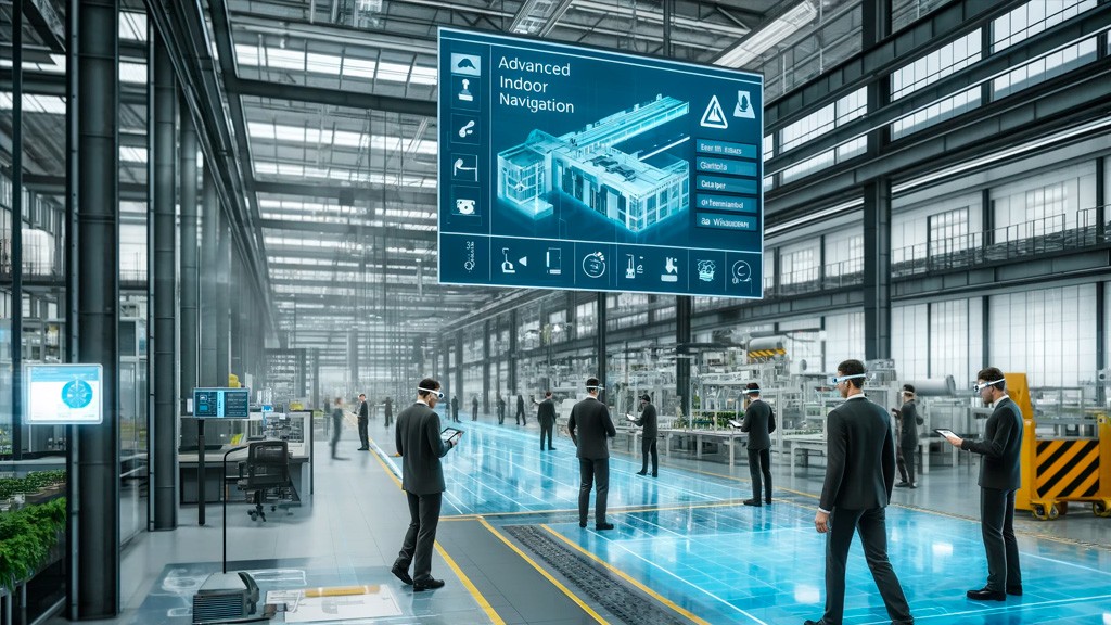
In today's world, where every minute of equipment operation is worth its weight in gold, and every step a worker takes must be aimed at improving productivity, navigation and staff tracking technologies play a key role. Industrial enterprises that face daily challenges in managing large areas and many employees find solutions in innovative systems from the company Indoors Navigation.
Clear understanding of the location
Indoors Navigation systems use advanced technologies such as RTLS (Real-Time Location Systems) to ensure the precise location of each element inside the industrial complex. This makes it possible not only to simplify the orientation of new employees, but also to significantly reduce the time spent searching for the necessary tools and equipment.
Monitoring and security
Tracking personnel movements in real time is not only a matter of efficiency, but also of safety. With the help of Indoors Navigation systems, managers can instantly receive data on the location of employees in case of emergencies, which is crucial for rapid response and minimizing potential risks.
Integration with digital building doubles
One of the most promising areas is the use of digital building doubles in combination with internal navigation systems. This allows you not only to visualize operations in real time, but also to analyze potential improvements in workflows based on the collected data. Managers can view workflow simulations and optimize them, ensuring continuous improvement of production operations.
Advantages for production
The integration of Indoors Navigation systems in production allows not only to improve asset and resource management, but also to significantly increase overall productivity. Optimizing the routes of personnel movement and logistics within the enterprise minimizes downtime and increases overall work efficiency.
On the website of the indoorsnavi.pro you will find additional information about how our solutions can transform your company. Contact us to discuss how we can help your business become more organized, secure, and efficient.
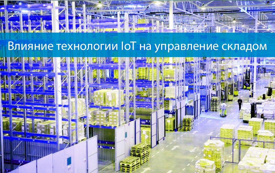
Automation and digitalization are driving the Industrial Revolution 4.0. Industrial revolutions have led to the mass production of goods, which has increased the need for modern warehouses. Every year, the work of warehouses becomes more and more difficult due to the increasing abundance of goods, so the usual warehouse management strategies are no longer suitable. To cope with huge commodity flows, modern innovations should be used more widely to manage these processes. The Internet of Things (IoT) is a technology designed to process large amounts of data with maximum efficiency in real time. The purpose of the technology is to perform administrative work, i.e. effective management of storage data. IoT can facilitate the implementation of intelligent identification, tracking, and control using radio frequency identification (RFID), infrared sensors, global positioning systems (GPS), laser scanners, and other detection tools.
The main function of the warehouse is to ensure sales and customer satisfaction. The introduction of IoT improves financial performance, labor productivity and customer satisfaction. For example, IoT can be used in warehouse management to monitor, track goods, predict demand trends, manage inventory, and other warehouse operations in real time.
Methods and methodologies
The complexity of the supply chain forces logistics companies to improve the flow of information both internally and externally. The Integrated Logistics Information System is a unique business management model that tracks the flow of materials, information, and goods from the point of origin to the point of delivery, where all management actions are interconnected. The possibilities of monitoring and tracking objects in warehouses using LPWAN technologies are being considered. The general idea is to ensure customer satisfaction by reducing the associated costs. The Integrated Logistics system provides a combined warehouse, transportation, and materials management solution, integrating various business process functions including: production function; supply and storage functions; and marketing function.
The positive aspects of integrating IoT into warehouse management using examples
It is believed that IoT in warehouses brings companies a number of advantages. The introduction of the Internet of Things enables intelligent warehousing, brings revolutionary changes, and that is why major industries such as Alibaba, DHL, Amazon, or Bluedart have already implemented it into their inventory, logistics, and warehouse management. Below are also examples of the implementation of IoT solutions to date.
In Korea, a new internal positioning system (IPS) has been developed and integrated with the warehouse management system. The system uses warehouse management tags to exchange data related to product availability, time in stock, delivery time, and inventory control. This flexible system requires the installation of multiple devices such as an LED screen, receiver, transmitter, gateway, and WMS tag. By integrating it with WMS, you can easily track inventory data in warehouses.
Also, one of the approaches presents an innovative solution for warehouse management, which includes the integration of artificial intelligence and an algorithm for planning storage, reception and delivery of orders. This advanced solution requires pallets and shelves with a barcode, as well as the use of GPS and everything related to indoor navigation.: BLE, UWB, Wi-Fi and so on .
The following approach presents an automated warehouse monitoring solution based on IoT, which includes the technology ZigBee, sensors, a situation management system and a wireless intelligent control system. This innovative system instantly controls heating, temperature and humidity in the warehouse. Computers analyze the data collected from the sensors, and in the event of an emergency, the system automatically calls the dispatcher or emergency services.
A study conducted in Malaysia showed that traditional SAP and WMS software packages integrated with IoT are widely used. In warehouses, radio frequency readers are used to manage material flows, plan routes, shipping operations, and dispatch. Intelligent radio frequency devices are used for operational functions in real-time radio communications.
The negative aspects of integrating IoT into warehouse management
Previous discussions have shown that IoT-enabled warehouses are more efficient, faster, and more accurately managed. However, this technology has some drawbacks. According to previous research, this advanced technology has the disadvantages listed in the table below.
The delivery function
The impact of the Internet of Things
The IoT technology used
Operations in WMS
CCTV footage steals the privacy of customers and employees, security vulnerabilities, the complexity of interconnecting thousands of devices, and electronic waste.
Sensors, Cameras, Wi-Fi, GPS, Cloud network
Operations in WMS
Network/system, identity theft, hacking, or streams
Software packages for online transactions, cyber-physical system
Reception activities
The purpose of this section is to show where and how new technologies can be integrated to improve the process and thereby provide real benefits to users of these services. The main functions of the warehouse include the following:
Reception : This process includes receiving the goods. For proper operation, it is necessary to check whether the right amount of goods has been received at the right time. To this end, RFID tags are highly accurate and reduce the likelihood of human error. They document the arrival of the goods. The RFID integrated with the automatic scanner can record the weight and dimensions of the parcel, indicating the correct place to store it. This improves the reception process, allows you to quickly unload the dock and free up space for other shipments.
Discharge . This is the process of moving goods from the receiving dock to the most optimal storage location. Mobile and wearable devices deliver incoming goods to the right location for consistent inventory accounting. The Internet of Things enables the use of intelligent forklifts, which can reduce accidents during this process, thereby reducing the time required to complete tasks and optimizing storage.
Keeping. Storage in a warehouse means placing goods in the most suitable location. Storage facilities require large investments, and optimizing the space can reduce these costs. IoT enables HCL solutions to optimize warehouse space by offering real-time optimization for a specific location and reducing space turnover. RFID tags also store product location data.
Assembly and shipment. This includes customer order processing and shipping. This process requires high efficiency, as mistakes reduce customer satisfaction. Wireless wearable devices can make this process optimal by allowing real-time scanning of the entire warehouse. Smart forklifts with sensors and scanners transmit data related to product handling precautions, as well as outgoing and incoming shipments. GPS allows the trailer tracking system to indicate the location of the cargo in real time. The PoD solution can be used for real-time delivery reports.
Summing up the results
Warehouses have a significant function in modern society, playing an important role in logistics and the entire supply chain. In order for any organization to stay in the market, it is necessary to ensure the smooth movement and operation of the entire chain. Inefficient organizational processes can lead to a loss of time and money. This may also be due to inefficient use of human resources or insufficient automation of business processes. It should be noted that global trends indicate that the complexity of the warehouse process will increase in the future. This means that the need for an efficient system and a customer-oriented approach will prevail in the future.
You can learn more about indoor navigation technologies on the website Indoors Navigation.
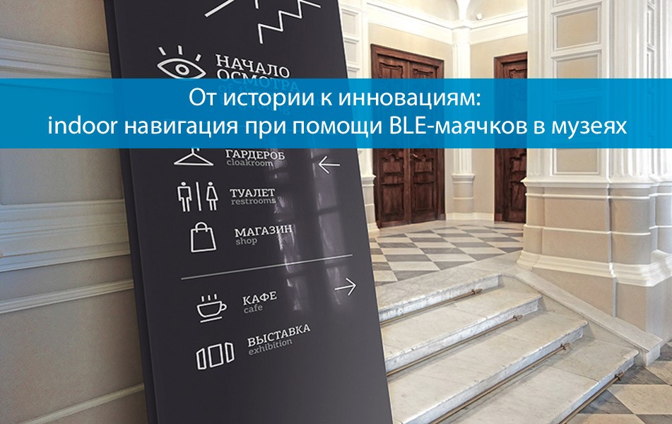
Over the past few years, the ability to implement advanced communication applications and services supported by location information has contributed to the development of systems for locating people and objects indoors, including in museums. In parallel, the evolution of these systems was constantly supported by technological advances in the Internet of Things (IoT), specifically designed for low-cost short-range radio transmission, such as Bluetooth, as well as radio frequency identification technologies (RFID).
The problem of standardization of indoor navigation
Designing navigation systems based on short-range radio communication technologies is not a trivial task. In fact, the propagation of the radio signal inside buildings is influenced by several factors, such as building materials, facilities in the area, the presence of people, etc. All these factors can affect the quality of the received signal, which makes indoor localization very difficult and expensive when it is directly based on measurements of the physical parameters of the received signals from an object. Unlike outdoor navigation, which is mainly based on Global Navigation Satellite System (GNSS) technologies (for example, Global Positioning System, GPS), to date, indoor positioning systems have not yet been defined and standardized. The lack of standardization is mainly due to the very different characteristics of the areas served by the indoor localization system. As a result, this localization system is often developed specifically for a given area. At the same time, heterogeneous and often individual methods and processes for calculating location are used.
Proposed solutions
In this article, we will focus on the localization problem for a typical museum environment. The accessibility of information about the location of visitors in the museum can be used by the museum coordinator to promote communication services aimed at improving the overall “cultural experience.” In particular, location information can be useful to the museum operator for designing art exhibitions, determining individual routes according to the preferences of visitors, permanent or temporary installations, as well as for the care of collections. All these activities can be based on an analysis of visitor flows, for example, by observing the number of visitors stopping in front of a given work of art, or the amount of time spent in some museum rooms. In addition, assessments of the position of visitors can be used to improve their interaction with museum works of art in real time, for example, using augmented reality, which provides information about the works of art. In the latter case, each visitor is equipped with an intelligent device (for example, their own smartphone or tablet), which includes a device for communicating with the indoor localization system and is able to interact with the museum's indoor applications. At the same time, the device provides, for example, additional information about the observed or liked masterpiece, a work of art . The localization system can be deployed not only in the museum, but also in other rooms.
Technologies used
The system uses technology Bluetooth Low Energy (BLE) to collect data transmitted by a device belonging to each visitor. The main advantages of BLE are the availability of a large set of chips on the market and on modern smartphones or tablets, ease of programming and low power consumption. The resulting BLE-based localization system is inexpensive compared to other indoor location detection methods such as those based on (non-standard) RFID devices. In the localization system under consideration, the BLE signals emitted by the visitor's transmitters are received by BLE devices installed on the museum grounds. These devices can measure the received signal strength indicator (RSSI) and the signal-to-noise ratio (SNR) of each received signal, as well as extract the BLE transmitter identifier by extracting the corresponding message. The measured RSSI and SNR and the corresponding BLE message are then transmitted to a central server in the museum. The locator object on the server processes the received data and messages to determine the visitor's location on the object. The localization algorithm for each visitor is based on minimizing the objective function, which includes path loss measurements obtained from the corresponding RSSI and SNR. The optimal solution to the minimization problem corresponding to the expected position of the visitor was obtained by applying the nonlinear least squares algorithm (NLS).
The results show that the BLE transmitter can be localized with an accuracy of less than 1 m (i.e., the Euclidean distance between the true and estimated location is less than 1 m) when the BLE receiver is correctly positioned in the area. After training the neural network, the BLE receiver can better estimate distances based on RSSI and SNR measurements collected as the visitor moves around the artwork.
You can also find out more about the solutions used on the website Indoors Navigation.
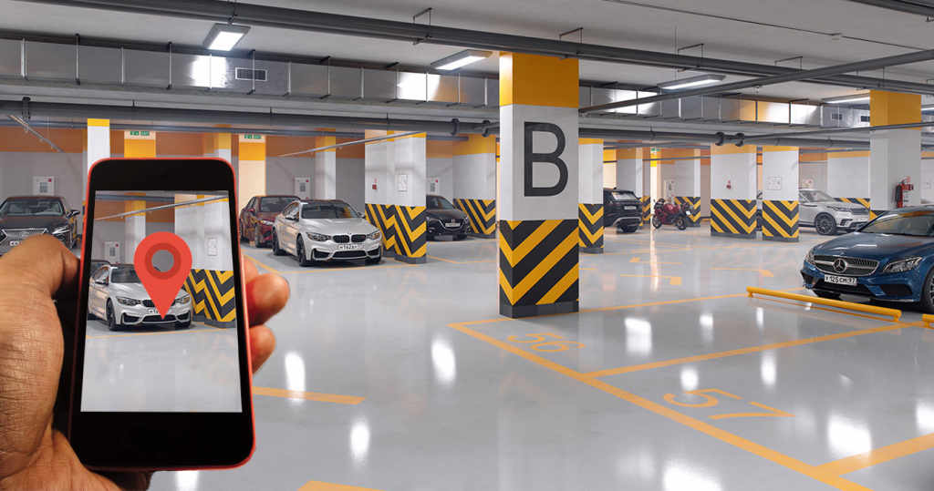
Car parking navigation solutions work for both indoor and outdoor parking systems and can be created to achieve optimal performance. Thus, using a parking navigation solution means that the driver of the car spends less time searching for free parking spaces. The introduction of an intelligent parking system makes life easier for the driver and can even help increase the loyalty of your organization's employees.
Smart Car Parking System – Features
The smart parking system works on a simple principle: detecting obstacles by sending signals and receiving the same reflected signals. It may even be visual feedback. The system consists of sensors and signal interception devices that scan the area and help the driver park the car safely.
However, such smart parking systems can be designed to perform many other additional functions and thus take any business to a whole new level of productivity.
Car navigation in parking lots
Such navigation is facilitated by mobile applications that combine positioning technologies. This helps the car driver to easily navigate large parking lots, especially multi-level ones. The application is designed in such a way as to plot routes to free parking spaces and display them visually to help the driver easily find a place. The functions provided by the parking navigation app include:
Quickly find free parking spaces;
Simplify the search by directing vehicles according to the current occupancy of parking spaces.;
Register the details of all vehicles entering and exiting the slots;
Optimize traffic flow and use bandwidth in an optimal way;
Track the occupancy of parking spaces at different levels in multi-level parking lots.
Tracking the occupancy of a parking space at different levels
When entering a multi-level parking lot, most drivers face difficulties finding free parking spaces. The driver cannot properly search for an empty space, as this takes a long time and may prevent other vehicles from entering the parking space.
Using an internal navigation application specifically designed for this purpose can solve this problem quickly and effectively. The app works to provide car owners with the latest information about available parking spaces. Drivers of vehicles can use this application to reduce fuel consumption and find an empty parking space for their cars in the shortest possible time.
The application works as follows. As soon as the device detects an empty parking space, it sends information to the cloud gateway, where this information is processed and sent to a network server. As the driver approaches the parking entrance, a notification is sent to the driver's phone with information about the nearest available space. The application can also generate a visual map and show the route leading to a closed vacant spot at a certain parking level.
Booking parking spaces
A mobile car parking application can be designed in such a way that vehicle owners can book available spaces in advance, as well as pay for them. The user interface in such an application provides an easy and convenient view of parking spaces available at different levels in a multi-level parking lot. This allows vehicle owners to easily scan parking spaces in search of vacant spaces and book the most profitable ones. The application may include a payment gateway so that users can pay for the facility in advance. Thus, the entire booking process becomes well organized, simple and fast.
The parking management app offers many advantages to parking space owners as well, namely:
The ability to provide reports and analytics;
The owners can change the booking rules or rates at any time.;
Service quality improvement;
Customer loyalty is likely to improve;
It's easy to find any car in the parking lot.;
Optimize the use of parking space in real time.
As is often the case with vast and huge multi-level parking lots, drivers often forget where they parked their cars. Finding a car becomes a problem, and a lot of time is wasted in the process. The use of an intelligent parking system helps such drivers to find their cars quickly. When a driver enters a parking space, an alert is sent to his mobile phone indicating the location of the car with the parking space number and displaying the shortest route. In addition, these applications can be designed for turn-by-turn navigation of the driver to the vehicle, providing the most convenient access.
Technologies used for intelligent parking systems
Smart parking systems using navigation methods use different technologies to implement software applications. Some of them are listed below.
iBeacon
It is a small network device that acts as a transmitter. It helps to detect and track smartphones. The device uses signals BLE. Drivers who have installed the mobile app on their phones receive signals from beacons. They can turn on navigation, which will gradually lead them to a parking spot. This technology, when used, ensures high accuracy and low implementation costs.
Ultra-Broadband (UWB)
UWB — это система, которая обеспечивает точное позиционирование и работает, регистрируя короткие импульсы на небольших расстояниях. Функция навигации использует маломощные метки, которые потребляют меньше энергии. Сверхширокополосные приемники, расположенные на парковочных местах или в районе этих мест, перехватывают радиочастотную модуляцию, посылаемую транспондерами.
Wi-Fi
Technology such as Wi-Fi, can be operated using the existing parking infrastructure. The system works by using tags that send signals to several access points in a parking space at once. The location is determined using the RSSI and MAC address values. There is no need for any additional equipment or infrastructure.
You can learn more about the technologies on the website Indoors Navigation.
By digitizing railway stations, Russian Railways decided to simplify passenger orientation and install navigation touch tables with a map at the stations.
The interactive navigation terminal provides visitors with a three-dimensional map of the station with a search function for services and animated routes to the points of provision of these services, the location of shops and other facilities at the station.
At the terminal, passengers can not only view the station map or plot a route to the desired location, but also save it to their mobile phone by scanning the QR code. Visitors can also send a postcard from the train station by clicking on the corresponding interface button.
In standby mode, the navigation terminal acts as a multimedia screen and displays information or advertising banners in full-screen mode.
Единая информационная среда для управления зданиями и активами — геоинформационная система (ГИС) на основе цифрового двойника объекта и геолокационных сервисов внутри помещений Indoors Navigation Platform (INP).
Открой для себя будущее геоинформационных систем с Indoors Navigation Platform. https://indoorsnavi.pro/ 🌐
📍 What will you see?
• The digital twin of the enterprise in action
• Indoor geolocation services
• Interactive navigation with QR codes and AR
🛠 How to integrate it?
• We create personalized solutions for each client. Contact us for a demo
Этот веб-сайт использует файлы cookie для улучшения вашего опыта во время навигации по веб-сайту. Из них файлы cookie, которые классифицируются как необходимые, хранятся в вашем браузере, поскольку они необходимы для работы основных функций веб-сайта. Мы также используем сторонние файлы cookie, которые помогают нам анализировать и понимать, как вы используете этот веб-сайт. Эти файлы cookie будут храниться в вашем браузере только с вашего согласия. У вас также есть возможность отказаться от этих файлов cookie. Но отказ от некоторых из этих файлов cookie может повлиять на ваш опыт просмотра.
Необходимые файлы cookie абсолютно необходимы для правильной работы веб-сайта. В эту категорию входят только файлы cookie, обеспечивающие базовые функции и функции безопасности веб-сайта. Эти файлы cookie не хранят никакой личной информации.
Любые файлы cookie, которые могут не быть особенно необходимыми для функционирования веб-сайта и используются специально для сбора персональных данных пользователей с помощью аналитики, рекламы и другого встроенного содержимого, называются необязательными файлами cookie. Перед запуском этих файлов cookie на вашем веб-сайте обязательно получить согласие пользователя.