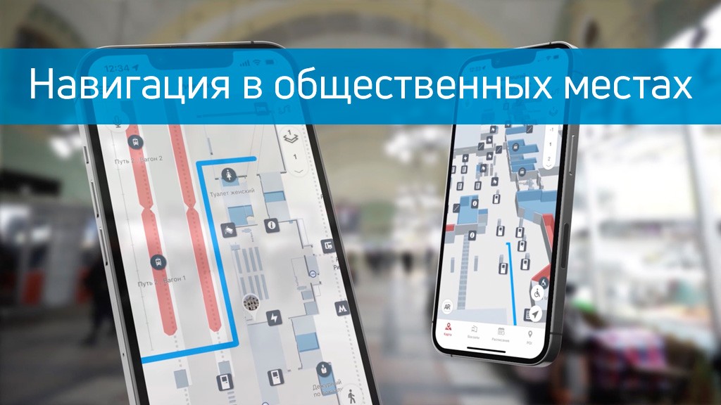
As a rule, it is not convenient for people to navigate in unfamiliar places with a lot of passages and exits. People run the risk of getting confused by navigation signs at train stations, airports, shopping malls and other public places. Now you can quickly determine your position and route, thanks to the 3D map in your mobile device.
The Indoors Navigation platform supports Bluetooth, BLE, Wi-Fi, and Ultra-WideBand technologies for indoor navigation, and GPS for outdoor positioning. Rapid scaling is provided by integrating the Interiors SDK into a mobile application that is installed on users' devices.
In the application, the user finds up-to-date information about each room, which is updated via the web control panel. Indors Navigation actively cooperates with companies from various industries on the basis of exclusive agreements and always supports its products.
Using the application, you significantly save your time and additionally get useful functionality.
Learn more about solutions based on the geographic information system of the Indoors Navigation Platform
For more information about navigation in public places, follow the link: https://indoorsnavi.pro/


3 thoughts on “Навигация в общественных местах”
Теперь навигация станет куда проще, круто, что компания использует множество технологий для определения местоположения!
Классная идея! 3D-навигация в приложении — это настоящее спасение в больших и запутанных местах. Экономия времени и удобство — то, что нужно!
Отличный кейс! Наконец-то навигация в общественных местах становится удобной!
Классно, что компания использует не только примитивное GPS, но и другие технологии для определения местоположения человека!