Navigation in the Management
Improving the comfort of your residents, increasing profitability and reducing costs during the operation of the building is achieved by the introduction of GIS INP
Digitalization of real estate management is a necessary step in the context of modern urban development. It includes the introduction of advanced technologies to optimize management processes and efficient use of resources such as office and residential premises.
Modern real estate management solutions help simplify interaction with tenants and tenants, improve the availability of services and increase the overall efficiency of the management company. Process automation significantly reduces the time required to process applications and book premises, providing a higher quality of service.
Digitalization of office and residential spaces creates an intelligent and convenient environment for all users, where every stage of interaction with the management company — from booking meeting rooms to paying for services — is fully adapted to their needs.

Digitalization
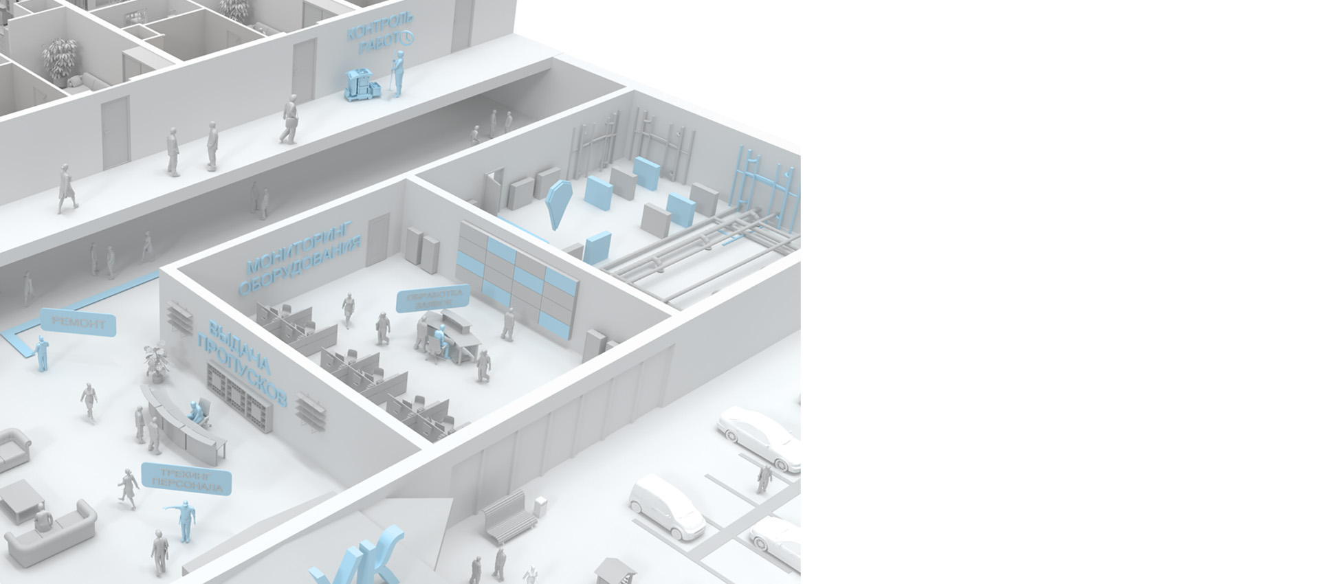
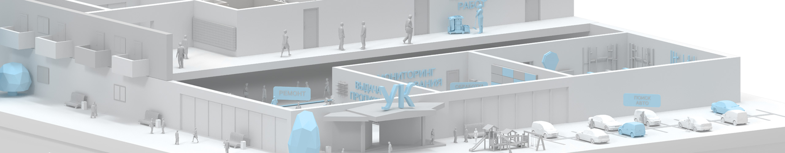
The introduction of a geographic information system (GIS) into the work of a management company significantly increases the efficiency of facility management, improves the quality of service, optimizes costs and strengthens control over all processes. This is an important tool for a modern company that strives to digitalize and automate its processes.

NSP
Indoors Navigation Platform® provides a convenient communication channel with users. Residents and tenants can submit applications and receive notifications about the completion of work through the mobile application. This increases the level of satisfaction, improves the quality of service and strengthens trust in the management company.

Интеграция
GIS can be easily integrated with other digital management systems, including billing systems, energy metering systems, and engineering solutions. This creates a single digital platform for managing all processes at the facility, which simplifies coordination and management.

Safety
GIS helps to increase the level of security on site. The system can be integrated with video surveillance cameras and access control systems, which allows you to track suspicious activity, record events and promptly respond to emergency situations.

Расходы
By automating management processes and using analytics, GIS reduces the cost of operating facilities. The system helps to identify inefficient areas and processes, which helps optimize resources and reduce maintenance costs for buildings and infrastructure.
Advantages of implementing a geographic information system (GIS) for management companies

Effective space management
GIS INP allows management companies to visualize and monitor all real estate properties in real time. Thanks to detailed maps and diagrams, management can quickly obtain information about the condition of buildings, premises and engineering systems, which helps optimize the use of space and resources.

Speeding up application processing and problem solving
With the introduction of GIS, applications from residents and tenants can be processed faster and more efficiently. The system allows you not only to track the status of each application, but also to instantly determine the location of the problem, whether it is a malfunction of engineering systems or the need for maintenance. This reduces the response time and improves the quality of service.

Monitoring the work of staff and resources
Thanks to the automated booking system and fast navigation, employees spend less time searching for available meeting rooms and organizing meetings. This frees up time for more productive work and improves the overall efficiency of the team.

Monitoring and control of engineering systems
GIS INP integrates with the facility's engineering systems, providing complete information about their status in real time. Management companies can not only monitor the current condition, but also predict possible breakdowns or malfunctions, which allows you to plan technical work in advance and avoid emergencies.

Analytics and reporting
GIS provides management companies with powerful analytics and reporting tools. The system collects data on room occupancy, request completion time, resource efficiency, and other key indicators. This allows you to make more informed management decisions and improve overall work efficiency.

Client orientation
Modern standards of service in the field of management of residential and office complexes are aimed at creating maximum comfort for residents and tenants. Digital solutions help simplify interaction with the management company, including filing and processing applications, monitoring the condition of engineering systems, and monitoring maintenance personnel.
Users can easily solve their tasks using digital maps and navigation via mobile devices, which ensures quick application submission and real-time tracking.

What the user gets:
- Convenient access to a digital map of the building with visualization of all necessary facilities and systems.
- Optimal routes for quick solution of your tasks: submitting an application, searching for the right room or service
- Quick access to specialized areas or services, such as technical support or engineers
- A simple and convenient communication channel with the management company via a mobile application, including targeted location-based chats and reviews.
- The interactive process of interaction through augmented reality technology, which makes using the system not only useful, but also fascinating.


Digitalization
The introduction of digital technologies in real estate management includes the automation of processes such as processing residents' applications, monitoring engineering systems and monitoring the work of staff. The digital twin of the object helps to visualize all processes and manage digitalization in real time, improving the efficiency and transparency of management.
The INP system allows management companies to effectively manage all internal processes, from building maintenance to optimizing resource use.

What the management gets:
- A detailed digital map of the facility with information on the status of all engineering systems
- Statistical data and analytical reports that help you make informed decisions
- The ability to manage the work of staff in real time and track their movements on the territory and in the building
- Automation of control and maintenance processes, integration with payment and application management systems
- A single feedback channel with residents and tenants
- Increased security by monitoring the state of the infrastructure and instantly fixing emergency situations
- Reducing maintenance costs and increasing the economic efficiency of facility management

Effectiveness and relevance
The implementation of the INP system and the use of digital tracking and monitoring tools can increase the overall efficiency of real estate by 20%, increase rental income by 15%, improve customer service by 20%, and reduce asset and equipment losses by 15%.
Thus, digitalization of real estate management processes provides not only comfort for residents and tenants, but also increases economic efficiency for management companies.
Thematic publications on our blog
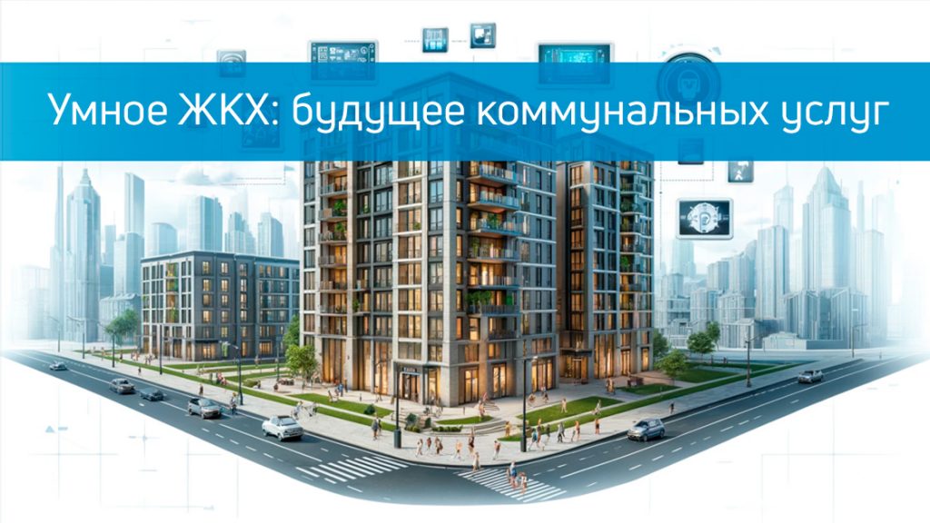
Smart housing and communal services: the future of public utilities.
In the modern world, technology is rapidly developing and penetrating into all areas of our lives. One of these areas is housing and communal services (housing and communal services). The concept of "Smart housing and communal services" is becoming increasingly popular and in demand, offering innovative solutions for managing homes a…
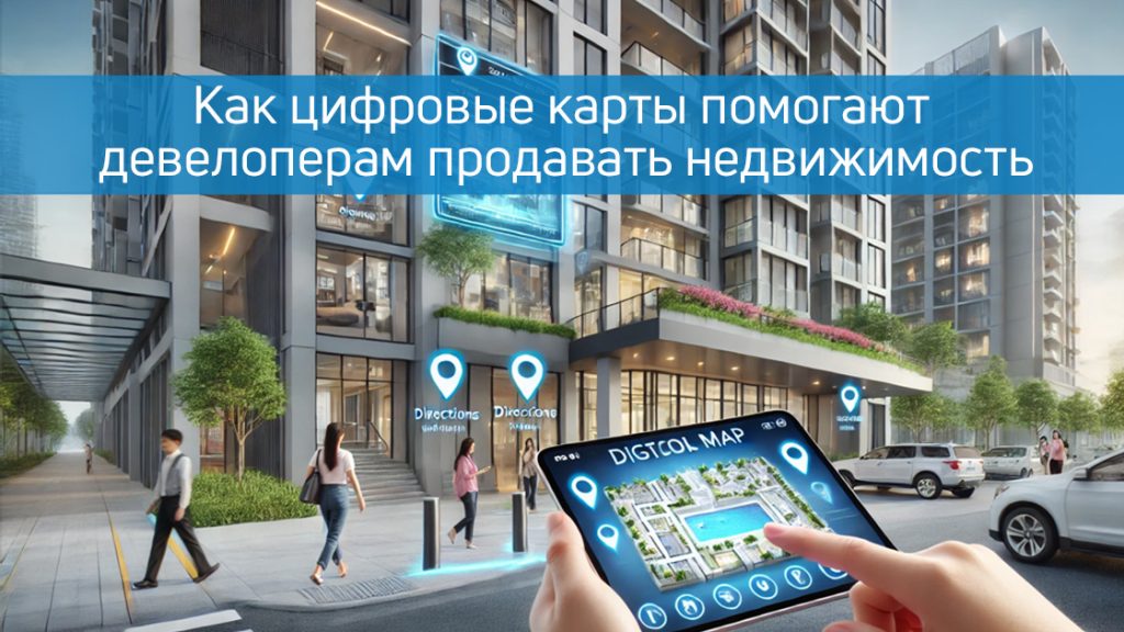
How digital maps help developers sell real estate.
In today's digital world, successful real estate sales require an innovative approach. Digital maps of objects, such as those offered by Indoor Navigation, are becoming an integral part of the developer's strategy.
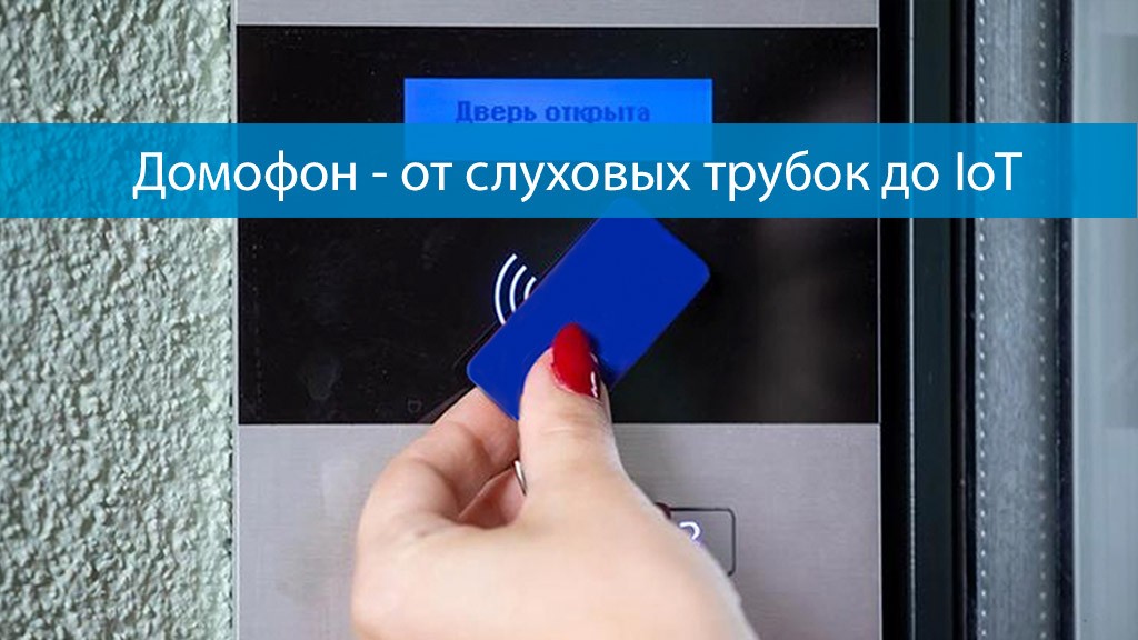
Intercom — from hearing aids to IoT
The world has changed a lot since the first intercom was invented more than 100 years ago. At that time, residents of apartment buildings bought goods at the market within walking distance from their homes, traveled only on special occasions and rarely worried about an unexpected guest visiting them. Today they buy in…
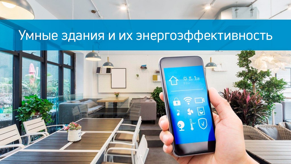
Smart buildings and their energy efficiency
Recently, smart buildings have become very popular all over the world. These are buildings that use connected sensors and Internet of Things (IoT) technology to become more efficient and convenient for residents and business owners. Experts predict that the smart building market will…
Frequently Asked Questions about LCD navigation with Indoors Navigation Platform (INP)
What is digitalization of a residential complex using a geographic information system?
Digitalization of a residential complex with a geographic information system (GIS) is the introduction of technologies for optimal building management and interaction with its residents, improving navigation both indoors and on the territory.
What is modern LCD navigation?
Modern residential complex navigation offers the use of advanced technologies such as geographic information systems (GIS), sensors, cameras and mobile applications to optimize the search and space management of your building.
What are the advantages of modern navigation for an apartment building?
The advantages include the opportunity to earn additional income, optimize the use of public space, reduce the time needed to find the right place, increase security, ease of use, and support various services for residents and guests.
What are the costs of implementing a digital GIS twin in apartment buildings?
The cost varies depending on the size of the residential complex and the technologies used. The main part of the expenses is equipment, software, integration with third-party systems of the Management Company and commissioning work (NDT) directly in the residential complex itself.
What are the possibilities for integration with other systems?
Our interactive map platform is designed to integrate with existing building management and engineering infrastructure engineering systems through an open API.
How do users interact with the GIS system in residential complexes and management companies?
Employees of the management company and other users can use mobile applications based on GIS INP to find the right room or car in the parking lot at the MCD, book parking spaces, as well as order passes, requests for repairs or cleaning. The built-in messenger helps you always stay in touch with the contractor from the Management Company.
What are the possibilities of integrating the existing engineering systems of a residential complex (LCD or IFC) with the INP platform?
Our 3D multimedia map platform is designed to be integrated with existing home Engineering Management Systems (MCS) and other infrastructure through an open API.
Do I need to download an application to use the INP system in ZHU or IFC?
Not obligatory. In the browser, you can use the client solution without installing third-party applications, just scan the QR code or download an interactive map with the location of parking spaces.
To use the full functionality and the ability to navigate a route in real time and track movements, you need to install an iOS or Android mobile application, which can be found in the appropriate stores for your device or integrated into a ready-made application using the Interiors SDK. All detailed and up-to-date documentation on working with the platform is available in the IP control panel.